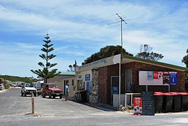
Southend, South Australia
| Southend South Australia | |||||||||||||||
|---|---|---|---|---|---|---|---|---|---|---|---|---|---|---|---|
 Caravan park | |||||||||||||||
 Southend | |||||||||||||||
| Coordinates | 37°34′16″S 140°07′37″E / 37.571066°S 140.126897°ECoordinates: 37°34′16″S 140°07′37″E / 37.571066°S 140.126897°E[1] | ||||||||||||||
| Population | 263 (2016 census)[2] | ||||||||||||||
| Established | 19 March 1846 (town) 23 February 1995 (locality)[1][3][4] | ||||||||||||||
| Postcode(s) | 5280[5] | ||||||||||||||
| Time zone | ACST (UTC+9:30) | ||||||||||||||
| • Summer (DST) | ACST (UTC+10:30) | ||||||||||||||
| Location | 324 km (201 mi) SE of Adelaide | ||||||||||||||
| LGA(s) | Wattle Range Council | ||||||||||||||
| Region | Limestone Coast[1] | ||||||||||||||
| County | Grey[1] | ||||||||||||||
| State electorate(s) | MacKillop[6] | ||||||||||||||
| Federal Division(s) | Barker[7] | ||||||||||||||
| |||||||||||||||
| |||||||||||||||
| Footnotes | Adjoining localities[1] | ||||||||||||||

Southend (formerly known as Grey Town and Grey) is a town and locality in the Australian state of South Australia located in the south-east of the state on the southern shore of Rivoli Bay about 324 kilometres (201 mi) south-east of the state capital of Adelaide.[5]
The site of the town was selected by George Grey, Governor of South Australia before his departure in late 1845 and was approved by his successor, Frederick Robe, on 19 March 1846 with the town being laid out by Thomas Burr, the Deputy Surveyor-General later in 1846.[1][3] The town was originally named Grey Town which changed to Grey in 1912 and then to Southend on 21 October 1971.[1][9][10]
Boundaries for the locality were created on 23 February 1995 for the portion within the local government area of the District Council of Millicent within the portion within the being created on 18 December 1997. The boundaries include land extending from the coastline of the south-eastern end of Rivoli Bay in the west to the Southern Ports Highway in the north and to Lake Frome in the east including the government town of Southend and the former Southend Shack Site.[1][4]
The Southend Caravan Park is in very close proximity to the white beaches of Rivoli Bay. The Bluff, less than a five-minute drive from Southend, is a popular scenic destination for locals and tourists. The Rivoli Bay Sailing Club sails catamarans and monohulls, and is located at the end of Leake Street. The club sails from October to April on weekends.[citation needed]
The locality includes the following protected areas - Canunda National Park which occupies land in its south including the coastline up to Cape Buffon and which overlaps most of Lake Frome.[11]
The 2016 Australian census which was conducted in August 2016 reports that the locality of Southend had a population of 263 people.[2]
Southend is located within the federal division of Barker, the state electoral district of MacKillop and the local government area of the Wattle Range Council.[7][6][1]
References[]
- ^ Jump up to: a b c d e f g h i "Search results for 'Southend, LOCB' with the following datasets being selected - 'Suburbs and Localities', 'Government Towns', 'Counties', 'Local Government Areas', 'SA Government Regions', 'Railways' and 'Gazetteer'". Location SA Map Viewer. Government of South Australia. Retrieved 15 May 2018.
- ^ Jump up to: a b Australian Bureau of Statistics (27 June 2017). "Southend (State Suburb)". 2016 Census QuickStats. Retrieved 5 April 2018.

- ^ Jump up to: a b Robe, Fred. H (19 March 1846). "Minute of 18 March 1846 re establishment of towns at Guichen and Rivoli Bays" (PDF). The South Australian Government Gazette. South Australian Government. pp. 108–109. Retrieved 15 May 2018.
- ^ Jump up to: a b Kentish, P.M. (23 February 1995). "GEOGRAPHICAL NAMES ACT, 1991 Notice to Assign Boundaries to a Place" (PDF). The South Australian Government Gazette. South Australian Government. p. 678. Retrieved 15 May 2018.
- ^ Jump up to: a b "Postcode for Southend, South Australia". postcodes-australia.com. Retrieved 15 May 2018.
- ^ Jump up to: a b "District of MacKillop (map)". Electoral Commission SA. Retrieved 8 April 2019.
- ^ Jump up to: a b "Federal electoral division of Barker" (PDF). Australian Electoral Commission. Retrieved 28 March 2016.
- ^ Jump up to: a b c "Monthly climate statistics: Summary statistics ROBE AIRFIELD (nearest weather station)". Commonwealth of Australia , Bureau of Meteorology. Retrieved 8 April 2019.
- ^ Kneebone, A. F. (21 October 1971). "GEOGRAPHICAL NAMES ACT, 1969" (PDF). The South Australian Government Gazette. South Australian Government. p. 1612. Retrieved 15 May 2018.
- ^ Manning, Geoffrey. "South Australian Names - G" (PDF). Manning Index of South Australian History. State Library of South Australia. Retrieved 15 May 2018.
- ^ "Search results for 'Southend, LOCB' with the following datasets being selected - 'NPW and Conservation Properties', 'Suburbs and Localities' and 'Gazetteer'". Location SA Map Viewer. Government of South Australia. Retrieved 15 May 2018.
- Towns in South Australia
- Limestone Coast