Spring Valley, Minnesota
Spring Valley | |
|---|---|
 Downtown Spring Valley | |
| Nickname(s): The Valley | |
 | |
| Coordinates: 43°41′17″N 92°23′26″W / 43.68806°N 92.39056°W | |
| Country | United States |
| State | Minnesota |
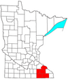
| County | Fillmore |
| Area | |
| • Total | 2.96 sq mi (7.66 km2) |
| • Land | 2.96 sq mi (7.66 km2) |
| • Water | 0.00 sq mi (0.00 km2) |
| Elevation | 1,273 ft (388 m) |
| Population | |
| • Total | 2,479 |
| • Estimate (2019)[5] | 2,410 |
| • Density | 814.74/sq mi (314.61/km2) |
| Time zone | UTC-6 (Central (CST)) |
| • Summer (DST) | UTC-5 (CDT) |
| ZIP code | 55975 |
| Area code(s) | 507 |
| FIPS code | 27-62104[3] |
| GNIS feature ID | 0652485[4] |
| Website | www |

Spring Valley is a city in Fillmore County, Minnesota, United States. The population was 2,479 at the 2010 census.[6]
History[]
Spring Valley was laid out in 1855, and named for a spring near the town site.[7] A post office has been in operation at Spring Valley since 1855.[8] Spring Valley was incorporated in 1872.[7]
Geography[]
According to the United States Census Bureau, the city has an area of 2.53 square miles (6.55 km2), all land.[9] U.S. Route 63 and Minnesota State Highway 16 are two of the town's main routes.
Demographics[]
| Historical population | |||
|---|---|---|---|
| Census | Pop. | %± | |
| 1880 | 1,256 | — | |
| 1890 | 1,381 | 10.0% | |
| 1900 | 1,770 | 28.2% | |
| 1910 | 1,817 | 2.7% | |
| 1920 | 1,871 | 3.0% | |
| 1930 | 1,712 | −8.5% | |
| 1940 | 2,133 | 24.6% | |
| 1950 | 2,467 | 15.7% | |
| 1960 | 2,628 | 6.5% | |
| 1970 | 2,572 | −2.1% | |
| 1980 | 2,616 | 1.7% | |
| 1990 | 2,461 | −5.9% | |
| 2000 | 2,518 | 2.3% | |
| 2010 | 2,479 | −1.5% | |
| 2019 (est.) | 2,410 | [5] | −2.8% |
| U.S. Decennial Census | |||

2010 census[]
As of the census[2] of 2010, there were 2,479 people, 1,074 households, and 651 families living in the city. The population density was 979.8 inhabitants per square mile (378.3/km2). There were 1,172 housing units at an average density of 463.2 per square mile (178.8/km2). The racial makeup of the city was 97.6% White, 0.6% African American, 0.1% Native American, 0.5% Asian, 0.1% from other races, and 1.0% from two or more races. Hispanic or Latino of any race were 0.7% of the population.
There were 1,074 households, of which 31.1% had children under the age of 18 living with them, 45.6% were married couples living together, 10.5% had a female householder with no husband present, 4.5% had a male householder with no wife present, and 39.4% were non-families. 35.2% of all households were made up of individuals, and 16.7% had someone living alone who was 65 years of age or older. The average household size was 2.27 and the average family size was 2.90.
The median age in the city was 39.5 years. 23.8% of residents were under the age of 18; 8.4% were between the ages of 18 and 24; 24.2% were from 25 to 44; 24.8% were from 45 to 64; and 19% were 65 years of age or older. The gender makeup of the city was 48.8% male and 51.2% female.
2000 census[]
As of the census[3] of 2000, there were 2,518 people, 1,026 households, and 662 families living in the city. The population density was 1,003.3 people per square mile (387.3/km2). There were 1,090 housing units at an average density of 434.3 per square mile (167.7/km2). The racial makeup of the city was 98.93% White, 0.08% African American, 0.24% Native American, 0.08% Asian, 0.04% from other races, and 0.64% from two or more races. Hispanic or Latino of any race were 0.44% of the population.
There were 1,026 households, out of which 32.4% had children under the age of 18 living with them, 51.3% were married couples living together, 10.0% had a female householder with no husband present, and 35.4% were non-families. 30.1% of all households were made up of individuals, and 14.7% had someone living alone who was 65 years of age or older. The average household size was 2.40 and the average family size was 3.00.
In the city, the population was spread out, with 26.1% under the age of 18, 8.3% from 18 to 24, 25.9% from 25 to 44, 20.4% from 45 to 64, and 19.4% who were 65 years of age or older. The median age was 38. For every 100 females, there were 89.9 males. For every 100 females age 18 and over, there were 87.1 males.
The median income for a household in the city was $32,688, and the median income for a family was $42,468. Males had a median income of $28,438 versus $22,225 for females. The per capita income for the city was $16,735. About 7.4% of families and 8.6% of the population were below the poverty line, including 10.4% of those under age 18 and 12.6% of those age 65 or over.
Elected officials[10][]
| Commission Serving on | Elected Length of Term | Term Ends | |
|---|---|---|---|
| Jim Struzyk | Mayor, Streets & Utilities | 2 years | 2016 |
| Todd Jones | Park & Recreation & Mayor Pro-Team | 4 years | 2018 |
| Tony Archer | Library | 4 years | 2018 |
| Bill Bires | Public Safety | 4 years | 2016 |
| Jeff Vehrenkemp | Administration | 4 years | 2016 |
Notable people[]
- Richard Sears, founder of Sears, Roebuck and Company, was born in a neighboring town and grew up in Spring Valley.
- Almanzo Wilder, husband of Laura Ingalls Wilder, lived on a farm near Spring Valley.
See also[]
References[]
- ^ "2019 U.S. Gazetteer Files". United States Census Bureau. Retrieved July 26, 2020.
- ^ Jump up to: a b "U.S. Census website". United States Census Bureau. Retrieved 2012-11-13.
- ^ Jump up to: a b "U.S. Census website". United States Census Bureau. Retrieved 2008-01-31.
- ^ "US Board on Geographic Names". United States Geological Survey. 2007-10-25. Retrieved 2008-01-31.
- ^ Jump up to: a b "Population and Housing Unit Estimates". United States Census Bureau. May 24, 2020. Retrieved May 27, 2020.
- ^ "2010 Census Redistricting Data (Public Law 94-171) Summary File". American FactFinder. United States Census Bureau. Retrieved 27 April 2011.[dead link]
- ^ Jump up to: a b Upham, Warren (1920). Minnesota Geographic Names: Their Origin and Historic Significance. Minnesota Historical Society. p. 195.
- ^ "Fillmore County". Jim Forte Postal History. Retrieved 30 May 2015.
- ^ "US Gazetteer files 2010". United States Census Bureau. Archived from the original on 2012-01-25. Retrieved 2012-11-13.
- ^ "City Elected Officials - Spring Valley, MN". Retrieved 2016-06-29.
External links[]
| show Municipalities and communities of Fillmore County, Minnesota, United States |
|---|

Coordinates: 43°41′13″N 92°23′21″W / 43.68694°N 92.38917°W
| show Authority control |
|---|
- Cities in Fillmore County, Minnesota
- Cities in Minnesota