Springdale, Pennsylvania
Springdale, Pennsylvania | |
|---|---|
 | |
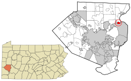 Location in Allegheny County and the U.S. state of Pennsylvania. | |
| Coordinates: 40°32′29″N 79°46′56″W / 40.54139°N 79.78222°WCoordinates: 40°32′29″N 79°46′56″W / 40.54139°N 79.78222°W | |
| Country | United States |
| State | Pennsylvania |
| County | Allegheny |
| Area | |
| • Total | 1.09 sq mi (2.83 km2) |
| • Land | 0.93 sq mi (2.42 km2) |
| • Water | 0.16 sq mi (0.42 km2) |
| Population (2010) | |
| • Total | 3,405 |
| • Estimate (2019)[2] | 3,288 |
| • Density | 3,520.34/sq mi (1,359.75/km2) |
| Time zone | UTC-5 (Eastern (EST)) |
| • Summer (DST) | UTC-4 (EDT) |
| FIPS code | 42-72960 |
| Website | www |

Springdale is a borough in Allegheny County, Pennsylvania, 18 miles (29 km) northeast of Pittsburgh along the Allegheny River. The population was 3,405 at the 2010 census.[3]
Geography[]
Springdale is located at 40°32′29″N 79°46′56″W / 40.54139°N 79.78222°W (40.541491, -79.782124).[4]
According to the United States Census Bureau, the borough has a total area of 1.1 square miles (2.8 km2), of which 0.9 square miles (2.3 km2) is land and 0.2 square miles (0.52 km2), or 13.76%, is water.
Streams[]
Riddle Run joins the Allegheny River at Springdale.[5]
Surrounding and adjacent neighborhoods[]
Springdale has two land borders, including Springdale Township to the north and Cheswick to the west. Adjacent across the Allegheny River to the east and south is Plum.
Demographics[]
| Historical population | |||
|---|---|---|---|
| Census | Pop. | %± | |
| 1880 | 456 | — | |
| 1910 | 1,999 | — | |
| 1920 | 2,929 | 46.5% | |
| 1930 | 4,781 | 63.2% | |
| 1940 | 4,989 | 4.4% | |
| 1950 | 4,939 | −1.0% | |
| 1960 | 5,602 | 13.4% | |
| 1970 | 5,202 | −7.1% | |
| 1980 | 4,418 | −15.1% | |
| 1990 | 3,992 | −9.6% | |
| 2000 | 3,828 | −4.1% | |
| 2010 | 3,405 | −11.1% | |
| 2019 (est.) | 3,288 | [2] | −3.4% |
| Sources:[6][7][8][9][10] | |||
As of the census[9] of 2000, there were 3,828 people, 1,685 households, and 1,034 families residing in the borough. The population density was 4,104.2 people per square mile (1,589.2/km2). There were 1,802 housing units at an average density of 1,932.0 per square mile (748.1/km2). The racial makeup of the borough was 99.03% White, 0.29% African American, 0.08% Native American, 0.13% Asian, 0.18% from other races, and 0.29% from two or more races. Hispanic or Latino of any race were 0.21% of the population.
There were 1,685 households, out of which 25.8% had children under the age of 18 living with them, 46.2% were married couples living together, 11.9% had a female householder with no husband present, and 38.6% were non-families. 34.4% of all households were made up of individuals, and 16.5% had someone living alone who was 65 years of age or older. The average household size was 2.26 and the average family size was 2.93.
In the borough the population was spread out, with 21.9% under the age of 18, 6.0% from 18 to 24, 29.5% from 25 to 44, 22.2% from 45 to 64, and 20.5% who were 65 years of age or older. The median age was 41 years. For every 100 females, there were 89.0 males. For every 100 females age 18 and over, there were 86.7 males.
The median income for a household in the borough was $35,440, and the median income for a family was $43,476. Males had a median income of $36,711 versus $25,920 for females. The per capita income for the borough was $19,798. About 3.5% of families and 7.8% of the population were below the poverty line, including 10.2% of those under age 18 and 8.8% of those age 65 or over.
Government and Politics[]
| Year | Republican | Democratic | Third Parties |
|---|---|---|---|
| 2016 | 55% 834 | 44% 660 | 1% 22 |
| 2012 | 51% 767 | 48% 716 | 1% 24 |
Museums and other points of interest[]
The Springdale Free Public Library serves the borough.[13]
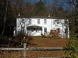
The Rachel Carson Homestead is located in Springdale.
Education[]
The borough is within the Allegheny Valley School District, and is served by Springdale High School.
Notable people[]
- Rachel Carson, a marine biologist who authored Silent Spring
See also[]
- List of crossings of the Allegheny River (coal mine tunnels)
- Logans Ferry Mine Tunnel
References[]
- ^ "2019 U.S. Gazetteer Files". United States Census Bureau. Retrieved July 28, 2020.
- ^ Jump up to: a b "Population and Housing Unit Estimates". United States Census Bureau. May 24, 2020. Retrieved May 27, 2020.
- ^ "Race, Hispanic or Latino, Age, and Housing Occupancy: 2010 Census Redistricting Data (Public Law 94-171) Summary File (QT-PL), Springdale borough, Pennsylvania". United States Census Bureau. Retrieved September 23, 2011.
- ^ "US Gazetteer files: 2010, 2000, and 1990". United States Census Bureau. 2011-02-12. Retrieved 2011-04-23.
- ^ "Riddle Run". Geographic Names Information System. 1979-08-02. Retrieved 2009-12-02.
- ^ "Number and Distribution of Inhabitants:Pennsylvania-Tennessee" (PDF). Fifteenth Census. U.S. Census Bureau.
- ^ "Number of Inhabitants: Pennsylvania" (PDF). 18th Census of the United States. U.S. Census Bureau. Retrieved 22 November 2013.
- ^ "Pennsylvania: Population and Housing Unit Counts" (PDF). U.S. Census Bureau. Retrieved 22 November 2013.
- ^ Jump up to: a b "U.S. Census website". United States Census Bureau. Retrieved 2008-01-31.
- ^ "Annual Estimates of the Resident Population". U.S. Census Bureau. Archived from the original on 19 October 2013. Retrieved 22 November 2013.
- ^ EL. "2012 Allegheny County election". Pittsburgh Tribune-Review. Retrieved 15 October 2017.
- ^ EL. "2016 Pennsylvania general election results". Pittsburgh Post-Gazette. Retrieved 15 October 2017.
- ^ "Springdale Free Public Library". Retrieved 2010-08-11.
External links[]
| show Greater Pittsburgh Region |
|---|

| show Municipalities and communities of Allegheny County, Pennsylvania, United States |
|---|

| Authority control |
|
|---|
- Populated places established in 1820
- 1820 establishments in Pennsylvania
- Pittsburgh metropolitan area
- Boroughs in Allegheny County, Pennsylvania