Swissvale, Pennsylvania
Swissvale, Pennsylvania | |
|---|---|
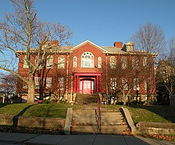 Longfellow School (1902) National Register of Historic Places | |
 Location in Allegheny County and the U.S. state of Pennsylvania. | |
| Coordinates: 40°25′20″N 79°53′10″W / 40.42222°N 79.88611°WCoordinates: 40°25′20″N 79°53′10″W / 40.42222°N 79.88611°W | |
| Country | United States |
| State | Pennsylvania |
| County | Allegheny |
| Government | |
| • Mayor | Deneen Swartzwelder (D) |
| Area | |
| • Total | 1.24 sq mi (3.22 km2) |
| • Land | 1.20 sq mi (3.11 km2) |
| • Water | 0.04 sq mi (0.11 km2) |
| Population (2010) | |
| • Total | 8,983 |
| • Estimate (2019)[2] | 8,647 |
| • Density | 7,193.84/sq mi (2,777.35/km2) |
| Time zone | UTC-5 (Eastern (EST)) |
| • Summer (DST) | UTC-4 (EDT) |
| ZIP codes | 15218 |
| FIPS code | 42-75816 |
| Website | swissvaleborough |


Swissvale is a borough in Allegheny County, Pennsylvania, 9 miles (14 km) east of downtown Pittsburgh. Named for a farmstead owned by James Swisshelm,[3] during the industrial age it was the site of the Union Switch and Signal Company of George Westinghouse. The population was 8,983 at the 2010 census.[4] In 1940, 15,919 people lived there.
Geography[]
Swissvale is located at 40°25′20″N 79°53′10″W / 40.42222°N 79.88611°W (40.422304, -79.886185).[5]
According to the United States Census Bureau, the borough has a total area of 1.3 square miles (3.4 km2), of which 1.2 square miles (3.1 km2) is land and 0.1 square miles (0.26 km2), or 4.76%, is water.
Surrounding and adjacent communities[]
Swissvale has six land borders, including Edgewood to the north, Braddock Hills to the east, North Braddock to the southeast, Rankin to the south, and the Pittsburgh neighborhoods of Regent Square and Swisshelm Park to the west. (The area known as Regent Square also encompasses portions of Pittsburgh, Wilkinsburg, Edgewood, and Swissvale.) Directly across the Monongahela River to the southwest is the borough of Munhall.
Demographics[]
| Historical population | |||
|---|---|---|---|
| Census | Pop. | %± | |
| 1900 | 1,716 | — | |
| 1910 | 7,381 | 330.1% | |
| 1920 | 10,908 | 47.8% | |
| 1930 | 16,029 | 46.9% | |
| 1940 | 15,919 | −0.7% | |
| 1950 | 16,488 | 3.6% | |
| 1960 | 15,089 | −8.5% | |
| 1970 | 13,819 | −8.4% | |
| 1980 | 11,345 | −17.9% | |
| 1990 | 10,637 | −6.2% | |
| 2000 | 9,653 | −9.3% | |
| 2010 | 8,983 | −6.9% | |
| 2019 (est.) | 8,647 | [2] | −3.7% |
| Sources:[6][7][8][9][10] | |||
As of the census[6] of 2000, there were 9,653 people, 4,679 households, and 2,390 families residing in the borough. The population density was 8,052.0 people per square mile (3,105.9/km2). There were 5,097 housing units at an average density of 4,251.6 per square mile (1,640.0/km2). The racial makeup of the borough was 74.45% White, 22.14% African American, 0.11% Native American, 0.91% Asian, 0.06% Pacific Islander, 0.60% from other races, and 1.72% from two or more races. Hispanic or Latino of any race were 1.06% of the population.
There were 4,679 households, out of which 21.2% had children under the age of 18 living with them, 31.0% were married couples living together, 16.5% had a female householder with no husband present, and 48.9% were non-families. 42.0% of all households were made up of individuals, and 14.3% had someone living alone who was 65 years of age or older. The average household size was 2.06 and the average family size was 2.85.
In the borough the population was spread out, with 20.0% under the age of 18, 8.2% from 18 to 24, 31.7% from 25 to 44, 22.7% from 45 to 64, and 17.4% who were 65 years of age or older. The median age was 39 years. For every 100 females, there were 84.4 males. For every 100 females age 18 and over, there were 79.0 males.
The median income for a household in the borough was $31,523, and the median income for a family was $35,929. Males had a median income of $29,333 versus $25,184 for females. The per capita income for the borough was $19,216. About 14.1% of families and 15.3% of the population were below the poverty line, including 26.2% of those under age 18 and 10.4% of those age 65 or over.
Education[]
Swissvale is served by the Woodland Hills School District.
Taxes[]
School tax millage rate- The Woodland Hills School District (shared with Braddock Borough, Braddock Hills Borough, Chalfant Borough, Churchhill Borough, East Pittsburgh, Edgewood Borough, Forest Hills Borough, North Braddock Borough, Rankin Borough, Turtle Creek Borough and Wilkins Township) in 2017 was 25.35. This ranked 7th highest/most expensive out of Allegheny County's 45 school districts [between East Allegheny SD (6th highest) and Upper Saint Clair SD (8th highest)].[11]
Transportation[]
Swissvale is served by the Roslyn and Swissvale stations on the Martin Luther King Jr. East Busway.
Notable people[]
- Billy Gardell, actor
- David Conrad, actor
- Frank Conrad, creator of KDKA Radio; lived In Swissvale borough 1910-15 conducting transmission experiments
- William B. Dickson, steel industry executive and labor policy reformer
- Michael F. Doyle, congressman
- Dick Groat, baseball player for Pittsburgh Pirates and All-American college basketball player
- Agnes Christine Johnston, screenwriter
- Vladimir K. Zworykin, television inventor
- Bobby Epps, NFL player for the New York Giants
Government and Politics[]
| Year | Republican | Democratic | Third Parties |
|---|---|---|---|
| 2016 | 16% 760 | 82% 3,817 | 2% 79 |
| 2012 | 19% 910 | 79% 3,700 | 2% 69 |
History[]
Swissvale is named after the Swisshelm family. John Swisshelm (1752–1838), who owned a farm where the town is located. John Swisshelm served under General George Washington in the Revolutionary War, and camped at Valley Forge. Swisshelm married Mary Elizabeth Miller, and they had many children. Their son, James Swisshelm, married Jane Grey Cannon, noted abolitionist and political activist, Jane Swisshelm named the town Swissvale as the town overlooked the Monongahela River Valley. The Pittsburgh neighborhood of Swisshelm Park, adjacent to Swissvale, is named after John Swisshelm.
Since 1874, the Allegheny Car & Transportation Shops had provided well-paying jobs to local citizens and were later purchased by George Westinghouse, the President of Westinghouse Air Brake Company, who formed the Union Switch & Signal company and maintained that facility in Swissvale.
References[]
- ^ "2019 U.S. Gazetteer Files". United States Census Bureau. Retrieved July 28, 2020.
- ^ Jump up to: a b "Population and Housing Unit Estimates". United States Census Bureau. May 24, 2020. Retrieved May 27, 2020.
- ^ Porter, Thomas J. Jr. (May 10, 1984). "Town names carry a little bit of history". Pittsburgh Post-Gazette. p. 1. Retrieved 26 May 2015.
- ^ "Race, Hispanic or Latino, Age, and Housing Occupancy: 2010 Census Redistricting Data (Public Law 94-171) Summary File (QT-PL), Swissvale borough, Pennsylvania". United States Census Bureau. Retrieved September 23, 2011.
- ^ "US Gazetteer files: 2010, 2000, and 1990". United States Census Bureau. 2011-02-12. Retrieved 2011-04-23.
- ^ Jump up to: a b "U.S. Census website". United States Census Bureau. Retrieved 2008-01-31.
- ^ "Number of Inhabitants: Pennsylvania" (PDF). 18th Census of the United States. U.S. Census Bureau. Retrieved 22 November 2013.
- ^ "Annual Estimates of the Resident Population". U.S. Census Bureau. Archived from the original on 19 October 2013. Retrieved 22 November 2013.
- ^ "Pennsylvania: Population and Housing Unit Counts" (PDF). U.S. Census Bureau. Retrieved 22 November 2013.
- ^ "Number and Distribution of Inhabitants:Pennsylvania-Tennessee" (PDF). Fifteenth Census. U.S. Census Bureau.
- ^ EL. "Allegheny County Treasurer". Retrieved 1 September 2017.
- ^ EL. "2012 Allegheny County election". Pittsburgh Tribune-Review. Retrieved 15 October 2017.
- ^ EL. "2016 Pennsylvania general election results". Pittsburgh Post-Gazette. Retrieved 15 October 2017.
| show Greater Pittsburgh Region |
|---|

| show Municipalities and communities of Allegheny County, Pennsylvania, United States |
|---|

| show Authority control |
|---|
- Populated places established in 1898
- Pittsburgh metropolitan area
- Boroughs in Allegheny County, Pennsylvania
- Pennsylvania populated places on the Monongahela River
- 1898 establishments in Pennsylvania