St. Clair Township, Benton County, Iowa
Saint Clair Township | |
|---|---|
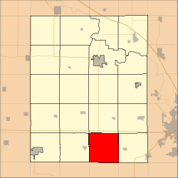 Location in Benton County | |
| Coordinates: 41°54′22″N 92°00′26″W / 41.90611°N 92.00722°WCoordinates: 41°54′22″N 92°00′26″W / 41.90611°N 92.00722°W | |
| Country | |
| State | |
| County | Benton |
| Area | |
| • Total | 92.78 km2 (35.82 sq mi) |
| • Land | 92.78 km2 (35.82 sq mi) |
| • Water | 0 km2 (0 sq mi) 0% |
| Elevation | 256 m (840 ft) |
| Population (2000) | |
| • Total | 461 |
| • Density | 5/km2 (12.9/sq mi) |
| Time zone | UTC-6 (CST) |
| • Summer (DST) | UTC-5 (CDT) |
| ZIP codes | 52209, 52301, 52354 |
| GNIS feature ID | 0468653 |

Saint Clair Township is one of twenty townships in Benton County, Iowa, USA. As of the 2000 census, its population was 461.[1]
Geography[]
According to the United States Census Bureau, Saint Clair Township covers an area of 35.82 square miles (92.78 square kilometers).
Adjacent townships[]
- Eldorado Township (north)
- Fremont Township (northeast)
- Florence Township (east)
- Lenox Township, Iowa County (southeast)
- Washington Township, Iowa County (south)
- Marengo Township, Iowa County (southwest)
- Leroy Township (west)
- Union Township (northwest)
School districts[]
- Benton Community School District
Political districts[]
- Iowa's 1st congressional district
- State House District 75
- State Senate District 38
References[]
- United States Census Bureau 2007 TIGER/Line Shapefiles
- United States Board on Geographic Names (GNIS)
- United States National Atlas
- ^ "U.S. Census website". Retrieved 2009-05-07.
External links[]
| Wikimedia Commons has media related to St. Clair Township, Benton County, Iowa. |
- US-Counties.com
- City-Data.com[permanent dead link]
Municipalities and communities of Benton County, Iowa, United States | ||
|---|---|---|
| Cities | ||
| Townships | ||
| CDP | ||
| Unincorporated communities | ||
| Footnotes | ‡This populated place also has portions in an adjacent county or counties | |
| ||
Categories:
- Townships in Benton County, Iowa
- Cedar Rapids, Iowa metropolitan area
- Townships in Iowa