Benton Township, Benton County, Iowa
Benton Township | |
|---|---|
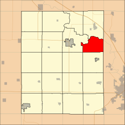 Location in Benton County | |
| Coordinates: 42°09′14″N 91°53′07″W / 42.15389°N 91.88528°WCoordinates: 42°09′14″N 91°53′07″W / 42.15389°N 91.88528°W | |
| Country | |
| State | |
| County | Benton |
| Area | |
| • Total | 58.46 km2 (22.57 sq mi) |
| • Land | 57.99 km2 (22.39 sq mi) |
| • Water | 0.47 km2 (0.18 sq mi) 0.8% |
| Elevation | 283 m (928 ft) |
| Population (2000) | |
| • Total | 900 |
| • Density | 15.5/km2 (40.2/sq mi) |
| Time zone | UTC-6 (CST) |
| • Summer (DST) | UTC-5 (CDT) |
| ZIP codes | 52332, 52349 |
| GNIS feature ID | 0467440 |

Benton Township is one of twenty townships in Benton County, Iowa, USA. As of the 2000 census, its population was 900.[1]
History[]
Benton Township was founded in 1846.[2]
Geography[]
According to the United States Census Bureau, Benton Township covers an area of 22.57 square miles (58.46 square kilometers); of this, 22.39 square miles (57.99 square kilometers, 99.2 percent) is land and 0.18 square miles (0.47 square kilometers, 0.8 percent) is water.
Extinct towns[]
- Benton City at 42°09′30″N 91°56′02″W / 42.158328°N 91.933791°W
(These towns are listed as "historical" by the USGS.)
Adjacent townships[]
- Polk Township (north)
- Washington Township, Linn County (east)
- Fayette Township, Linn County (southeast)
- Canton Township (south)
- Eden Township (southwest)
- Taylor Township (west)
Cemeteries[]
The township contains McBroom Cemetery.
Lakes[]
- Ice House Lake
Landmarks[]
- Pleasant Creek State Par (north edge)
School districts[]
- Center Point-Urbana Community School District
- Vinton-Shellsburg Community School District
Political districts[]
- Iowa's 3rd congressional district
- State House District 39
- State Senate District 20
References[]
- United States Census Bureau 2007 TIGER/Line Shapefiles
- United States Board on Geographic Names (GNIS)
- United States National Atlas
- ^ "U.S. Census website". Retrieved 2009-05-07.
- ^ The History of Benton County, Iowa, Containing a History of the County, Its Cities, Towns, &c. Western Historical. 1878. pp. 312.
External links[]
Municipalities and communities of Benton County, Iowa, United States | ||
|---|---|---|
| Cities | ||
| Townships | ||
| CDP | ||
| Unincorporated communities | ||
| Footnotes | ‡This populated place also has portions in an adjacent county or counties | |
| ||
Categories:
- Townships in Benton County, Iowa
- Cedar Rapids, Iowa metropolitan area
- Townships in Iowa
- 1846 establishments in Iowa Territory
- Populated places established in 1846