Eldorado Township, Benton County, Iowa
Eldorado Township | |
|---|---|
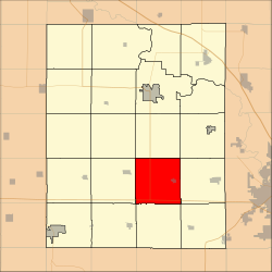 Location in Benton County | |
| Coordinates: 41°59′36″N 92°00′35″W / 41.99333°N 92.00972°WCoordinates: 41°59′36″N 92°00′35″W / 41.99333°N 92.00972°W | |
| Country | |
| State | |
| County | Benton |
| Area | |
| • Total | 92.21 km2 (35.6 sq mi) |
| • Land | 92.21 km2 (35.6 sq mi) |
| • Water | 0 km2 (0 sq mi) 0% |
| Elevation | 287 m (942 ft) |
| Population (2000) | |
| • Total | 1,240 |
| • Density | 13.4/km2 (34.8/sq mi) |
| Time zone | UTC-6 (CST) |
| • Summer (DST) | UTC-5 (CDT) |
| ZIP codes | 52209, 52315, 52346, 52354 |
| GNIS feature ID | 0467771 |

Eldorado Township is one of twenty townships in Benton County, Iowa, USA. As of the 2000 census, its population was 1,240.[1]
Geography[]
According to the United States Census Bureau, Eldorado Township covers an area of 35.6 square miles (92.21 square kilometers).
Cities, towns, villages[]
Adjacent townships[]
- Eden Township (north)
- Canton Township (northeast)
- Fremont Township (east)
- Florence Township (southeast)
- St. Clair Township (south)
- Leroy Township (southwest)
- Union Township (west)
- Big Grove Township (northwest)
Cemeteries[]
The township contains these three cemeteries: Prairie Lutheran, Saint Johns Lutheran and Salem.
Major highways[]
School districts[]
- Benton Community School District
Political districts[]
- Iowa's 3rd congressional district
- State House District 39
- State Senate District 20
References[]
- United States Census Bureau 2007 TIGER/Line Shapefiles
- United States Board on Geographic Names (GNIS)
- United States National Atlas
- ^ "U.S. Census website". Retrieved 2009-05-07.
External links[]
Municipalities and communities of Benton County, Iowa, United States | ||
|---|---|---|
| Cities | ||
| Townships | ||
| CDP | ||
| Unincorporated communities | ||
| Footnotes | ‡This populated place also has portions in an adjacent county or counties | |
| ||
Categories:
- Townships in Benton County, Iowa
- Cedar Rapids, Iowa metropolitan area
- Townships in Iowa