St. Johns, Illinois
St. Johns | |
|---|---|
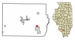 Location of St. Johns in Perry County, Illinois. | |
 Location of Illinois in the United States | |
| Coordinates: 38°1′51″N 89°14′30″W / 38.03083°N 89.24167°WCoordinates: 38°1′51″N 89°14′30″W / 38.03083°N 89.24167°W | |
| Country | United States |
| State | Illinois |
| County | Perry |
| Area | |
| • Total | 0.76 sq mi (1.98 km2) |
| • Land | 0.72 sq mi (1.88 km2) |
| • Water | 0.04 sq mi (0.10 km2) |
| Population (2010) | |
| • Total | 219 |
| • Estimate (2019)[2] | 208 |
| • Density | 286.90/sq mi (110.71/km2) |
| Time zone | UTC-6 (CST) |
| • Summer (DST) | UTC-5 (CDT) |
| ZIP Code(s) | 62832 |
| Area code(s) | 618 |
| FIPS code | 17-66924 |
| Wikimedia Commons | St. Johns, Illinois |

St. Johns is a village in Perry County, Illinois, United States. The population was 218 at the 2000 census.
The village was named in 1856 after St. John's Day.[3]
Geography[]
St. Johns is located at 38°1′51″N 89°14′30″W / 38.03083°N 89.24167°W (38.030740, -89.241671).[4]
According to the 2010 census, St. Johns has a total area of 0.767 square miles (1.99 km2), of which 0.73 square miles (1.89 km2) (or 95.18%) is land and 0.037 square miles (0.10 km2) (or 4.82%) is water.[5]
Although St Johns is an established village, people who reside in St Johns have a Du Quoin street address.
Demographics[]
| Historical population | |||
|---|---|---|---|
| Census | Pop. | %± | |
| 1870 | 356 | — | |
| 1880 | 495 | 39.0% | |
| 1910 | 370 | — | |
| 1920 | 353 | −4.6% | |
| 1930 | 297 | −15.9% | |
| 1940 | 314 | 5.7% | |
| 1950 | 275 | −12.4% | |
| 1960 | 206 | −25.1% | |
| 1970 | 220 | 6.8% | |
| 1980 | 284 | 29.1% | |
| 1990 | 262 | −7.7% | |
| 2000 | 218 | −16.8% | |
| 2010 | 219 | 0.5% | |
| 2019 (est.) | 208 | [2] | −5.0% |
| U.S. Decennial Census[6] | |||
As of the census[7] of 2000, there were 218 people, 96 households, and 62 families residing in the village. The population density was 310.0 people per square mile (120.2/km2). There were 106 housing units at an average density of 150.7 per square mile (58.5/km2). The racial makeup of the village was 92.66% White, 2.75% African American, 0.92% Asian, 0.46% from other races, and 3.21% from two or more races. Hispanic or Latino of any race were 0.46% of the population.
There were 96 households, out of which 29.2% had children under the age of 18 living with them, 47.9% were married couples living together, 10.4% had a female householder with no husband present, and 35.4% were non-families. 30.2% of all households were made up of individuals, and 9.4% had someone living alone who was 65 years of age or older. The average household size was 2.27 and the average family size was 2.79.
In the village, the population was spread out, with 21.6% under the age of 18, 9.2% from 18 to 24, 29.4% from 25 to 44, 30.3% from 45 to 64, and 9.6% who were 65 years of age or older. The median age was 40 years. For every 100 females, there were 118.0 males. For every 100 females age 18 and over, there were 111.1 males.
The median income for a household in the village was $35,455, and the median income for a family was $43,750. Males had a median income of $32,083 versus $14,167 for females. The per capita income for the village was $15,802. About 9.4% of families and 11.4% of the population were below the poverty line, including 7.9% of those under the age of eighteen and none of those 65 or over.
References[]
- ^ "2019 U.S. Gazetteer Files". United States Census Bureau. Retrieved July 14, 2020.
- ^ a b "Population and Housing Unit Estimates". United States Census Bureau. May 24, 2020. Retrieved May 27, 2020.
- ^ Illinois Central Magazine. Illinois Central Railroad Company. 1922. p. 42.
- ^ "US Gazetteer files: 2010, 2000, and 1990". United States Census Bureau. 2011-02-12. Retrieved 2011-04-23.
- ^ "G001 - Geographic Identifiers - 2010 Census Summary File 1". United States Census Bureau. Archived from the original on 2020-02-13. Retrieved 2015-12-25.
- ^ "Census of Population and Housing". Census.gov. Retrieved June 4, 2015.
- ^ "U.S. Census website". United States Census Bureau. Retrieved 2008-01-31.
Municipalities and communities of Perry County, Illinois, United States | ||
|---|---|---|
| Cities | ||
| Villages | ||
| Precincts | ||
| Unincorporated communities | ||
| Footnotes | ‡This populated place also has portions in an adjacent county or counties | |
| ||
- Villages in Perry County, Illinois
- Villages in Illinois