St. Marys Township, Adams County, Indiana
Saint Marys Township | |
|---|---|
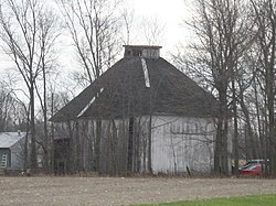 The Ben Colter Polygonal Barn, a historic site in the township | |
 Location within Adams County | |
| Coordinates: 40°47′20″N 84°50′42″W / 40.78889°N 84.84500°WCoordinates: 40°47′20″N 84°50′42″W / 40.78889°N 84.84500°W | |
| Country | United States |
| State | Indiana |
| County | Adams |
| Government | |
| • Type | Indiana township |
| Area | |
| • Total | 24.58 sq mi (63.7 km2) |
| • Land | 24.57 sq mi (63.6 km2) |
| • Water | 0.01 sq mi (0.03 km2) 0.04% |
| Elevation | 784 ft (239 m) |
| Population (2010) | |
| • Total | 1,308 |
| • Density | 53.2/sq mi (20.5/km2) |
| Time zone | UTC-5 (Eastern (EST)) |
| • Summer (DST) | UTC-4 (EDT) |
| ZIP code | 46733 |
| GNIS feature ID | 453821 |

Saint Marys Township is one of twelve townships in Adams County, Indiana.[1] As of the 2010 census, its population was 1,308.[2]
Geography[]
According to the 2010 census, the township has a total area of 24.58 square miles (63.7 km2), of which 24.57 square miles (63.6 km2) (or 99.96%) is land and 0.01 square miles (0.026 km2) (or 0.04%) is water.[3]
Unincorporated towns[]
Major highways[]
Rivers[]
- Saint Mary's River
School districts[]
- Adams Central Community Schools
Political districts[]
- Indiana's 6th congressional district
- State House District 79
- State Senate District 19
References[]
- "St. Marys Township, Adams County, Indiana". Geographic Names Information System. United States Geological Survey. Retrieved 2009-09-24.
- United States Census Bureau 2007 TIGER/Line Shapefiles
- United States National Atlas
- ^ "Saint Marys Township, Adams County, Indiana". Geographic Names Information System. United States Geological Survey. Retrieved February 15, 2020.
- ^ "Geographic Identifiers: 2010 Demographic Profile Data (G001): St. Marys township, Adams County, Indiana". U.S. Census Bureau, American Factfinder. Archived from the original on February 12, 2020. Retrieved May 8, 2013.
- ^ 2002 Census of Governments, Individual State Descriptions (PDF)
External links[]
Places adjacent to St. Marys Township, Adams County, Indiana | |
|---|---|
Municipalities and communities of Adams County, Indiana, United States | ||
|---|---|---|
| Cities | ||
| Towns | ||
| Townships | ||
| Unincorporated communities | ||
| ||
Categories:
- Townships in Adams County, Indiana
- Townships in Indiana