Monroe, Adams County, Indiana
Monroe, Indiana | |
|---|---|
 | |
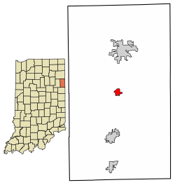 Location of Monroe in Adams County, Indiana. | |
| Coordinates: 40°44′40″N 84°56′26″W / 40.74444°N 84.94056°WCoordinates: 40°44′40″N 84°56′26″W / 40.74444°N 84.94056°W | |
| Country | United States |
| State | Indiana |
| County | Adams |
| Township | Washington and Monroe |
| Area | |
| • Total | 0.68 sq mi (1.76 km2) |
| • Land | 0.68 sq mi (1.76 km2) |
| • Water | 0.00 sq mi (0.00 km2) |
| Elevation | 833 ft (254 m) |
| Population | |
| • Total | 842 |
| • Estimate (2019)[5] | 883 |
| • Density | 1,298.53/sq mi (501.69/km2) |
| Time zone | UTC-5 (EST) |
| • Summer (DST) | UTC-5 (EST) |
| Area code(s) | 260 |
| FIPS code | 18-50202[4] |
| GNIS feature ID | 439338 |

Monroe is a town in Washington and Monroe townships, Adams County, Indiana, United States. The population was 842 at the 2010 census. Adams Central Community Schools is located in Monroe.
History[]
Monroe was platted in 1847.[6] It was named for James Monroe, fifth President of the United States.[7]
Monroe was originally the Adams County seat but this was moved to Decatur after flooding problems in the town.[citation needed]
The Monroe area has consistently been the US region with the highest percentage of people descended from those of Swiss nationality. Most local residents who have Swiss heritage are of Anabaptist faith, or have Swiss Mennonite and Swiss Amish backgrounds, as this area of Indiana was settled by Swiss Anabaptists in the 1800s. Local Amish still speak a Swiss German dialect, which is distinct from most other Amish, who speak a Pennsylvania German dialect.[citation needed]
Geography[]
Monroe is located at 40°44′40″N 84°56′26″W / 40.74444°N 84.94056°W (40.744555, -84.940506).[8]
According to the 2010 census, Monroe has a total area of 0.63 square miles (1.63 km2), all land.[9]
Demographics[]
| Historical population | |||
|---|---|---|---|
| Census | Pop. | %± | |
| 1880 | 97 | — | |
| 1910 | 334 | — | |
| 1920 | 384 | 15.0% | |
| 1930 | 322 | −16.1% | |
| 1940 | 405 | 25.8% | |
| 1950 | 428 | 5.7% | |
| 1960 | 499 | 16.6% | |
| 1970 | 622 | 24.6% | |
| 1980 | 739 | 18.8% | |
| 1990 | 788 | 6.6% | |
| 2000 | 734 | −6.9% | |
| 2010 | 842 | 14.7% | |
| 2019 (est.) | 883 | [5] | 4.9% |
| U.S. Decennial Census[10] | |||
2010 census[]
As of the census[2] of 2010, there were 842 people, 310 households, and 239 families living in the town. The population density was 1,336.5 inhabitants per square mile (516.0/km2). There were 322 housing units at an average density of 511.1 per square mile (197.3/km2). The racial makeup of the town was 99.0% White, 0.2% Asian, 0.1% from other races, and 0.6% from two or more races. Hispanic or Latino of any race were 2.3% of the population.
There were 310 households, of which 41.0% had children under the age of 18 living with them, 60.6% were married couples living together, 11.6% had a female householder with no husband present, 4.8% had a male householder with no wife present, and 22.9% were non-families. 21.9% of all households were made up of individuals, and 11.3% had someone living alone who was 65 years of age or older. The average household size was 2.72 and the average family size was 3.15.
The median age in the town was 34.7 years. 30.4% of residents were under the age of 18; 6.7% were between the ages of 18 and 24; 25% were from 25 to 44; 23.2% were from 45 to 64; and 14.8% were 65 years of age or older. The gender makeup of the town was 47.3% male and 52.7% female.
2000 census[]
As of the census[4] of 2000, there were 734 people, 274 households, and 215 families living in the town. The population density was 1,529.3 people per square mile (590.4/km2). There were 287 housing units at an average density of 598.0 per square mile (230.9/km2). The racial makeup of the town was 97.82% White, 0.14% Native American, 0.41% from other races, and 1.63% from two or more races. Hispanic or Latino of any race were 3.13% of the population. The town holds the distinction of the having the highest percentage of people with Swiss ancestry, followed by nearby Berne, Indiana, according to the 2000 U.S. Census.
There were 274 households, out of which 36.5% had children under the age of 18 living with them, 66.8% were married couples living together, 8.8% had a female householder with no husband present, and 21.5% were non-families. 19.7% of all households were made up of individuals, and 10.2% had someone living alone who was 65 years of age or older. The average household size was 2.68 and the average family size was 3.09.
In the town, the population was spread out, with 27.1% under the age of 18, 9.4% from 18 to 24, 26.4% from 25 to 44, 21.7% from 45 to 64, and 15.4% who were 65 years of age or older. The median age was 35 years. For every 100 females, there were 96.8 males. For every 100 females age 18 and over, there were 96.0 males.
The median income for a household in the town was $42,946, and the median income for a family was $49,821. Males had a median income of $32,308 versus $25,750 for females. The per capita income for the town was $16,682. About 1.4% of families and 4.0% of the population were below the poverty line, including 2.9% of those under age 18 and 11.8% of those age 65 or over.
References[]
- ^ "2019 U.S. Gazetteer Files". United States Census Bureau. Retrieved July 16, 2020.
- ^ Jump up to: a b "U.S. Census website". United States Census Bureau. Retrieved 2012-12-11.
- ^ "US Board on Geographic Names". United States Geological Survey. 2007-10-25. Retrieved 2008-01-31.
- ^ Jump up to: a b "U.S. Census website". United States Census Bureau. Retrieved 2008-01-31.
- ^ Jump up to: a b "Population and Housing Unit Estimates". United States Census Bureau. May 24, 2020. Retrieved May 27, 2020.
- ^ Baker, Ronald L. (October 1995). From Needmore to Prosperity: Hoosier Place Names in Folklore and History. Indiana University Press. p. 224. ISBN 978-0-253-32866-3.
This town was platted in 1847 by John Everhart...
- ^ "Profile for Monroe, IN". ePodunk. Retrieved 26 August 2014.
- ^ "US Gazetteer files: 2010, 2000, and 1990". United States Census Bureau. 2011-02-12. Retrieved 2011-04-23.
- ^ "G001 - Geographic Identifiers - 2010 Census Summary File 1". United States Census Bureau. Archived from the original on 2020-02-13. Retrieved 2015-07-17.
- ^ "Census of Population and Housing". Census.gov. Retrieved June 4, 2015.
External links[]
| show Municipalities and communities of Adams County, Indiana, United States |
|---|
| show Fort Wayne–Huntington–Auburn Combined Statistical Area |
|---|

| show Authority control |
|---|
- Towns in Adams County, Indiana
- Towns in Indiana