Columbia City, Indiana
Columbia City, Indiana | |
|---|---|
City | |
 Downtown Columbia City | |
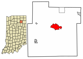 Location of Columbia City in Whitley County, Indiana. | |
| Coordinates: 41°9′31″N 85°29′16″W / 41.15861°N 85.48778°WCoordinates: 41°9′31″N 85°29′16″W / 41.15861°N 85.48778°W | |
| Country | United States |
| State | Indiana |
| County | Whitley |
| Township | Columbia |
| Government | |
| • Mayor | Ryan Daniel (R) |
| Area | |
| • Total | 5.47 sq mi (14.17 km2) |
| • Land | 5.45 sq mi (14.12 km2) |
| • Water | 0.02 sq mi (0.05 km2) |
| Elevation | 860 ft (262 m) |
| Population | |
| • Total | 9,892 |
| • Density | 1,772.76/sq mi (684.47/km2) |
| Time zone | UTC-5 (EST) |
| • Summer (DST) | UTC-4 (EDT) |
| ZIP code | 46725 |
| Area code(s) | 260 |
| FIPS code | 18-14716[3] |
| GNIS feature ID | 432816 |
| Website | http://www.columbiacity.net |

Columbia City is a city in Columbia Township, Whitley County, in the U.S. state of Indiana.[5] The population was 9,892 (2020 Census), growing by 13% since the 2010 Census. The city is the county seat of Whitley County.[6]
History[]

The Whitley County Courthouse was designed (1888–1891) by Brentwood S. Tolan, of Fort Wayne, Indiana. The building was added to the National Register of Historic Places in 1979. The Thomas R. Marshall House was added to the register in 1983 and the Columbia City Historic District was added in 1987.[7]
Geography[]
Columbia City is located at 41°9′31″N 85°29′16″W / 41.15861°N 85.48778°W (41.158569, -85.487784).[8]
According to the 2010 census, Columbia City has a total area of 5.601 square miles (14.51 km2), of which 5.58 square miles (14.45 km2) (or 99.63%) is land and 0.021 square miles (0.05 km2) (or 0.37%) is water.[9]

Demographics[]
| Historical population | |||
|---|---|---|---|
| Census | Pop. | %± | |
| 1860 | 887 | — | |
| 1870 | 1,663 | 87.5% | |
| 1880 | 2,244 | 34.9% | |
| 1890 | 3,027 | 34.9% | |
| 1900 | 2,975 | −1.7% | |
| 1910 | 3,448 | 15.9% | |
| 1920 | 3,499 | 1.5% | |
| 1930 | 3,805 | 8.7% | |
| 1940 | 4,219 | 10.9% | |
| 1950 | 4,745 | 12.5% | |
| 1960 | 4,803 | 1.2% | |
| 1970 | 4,911 | 2.2% | |
| 1980 | 5,091 | 3.7% | |
| 1990 | 5,706 | 12.1% | |
| 2000 | 7,077 | 24.0% | |
| 2010 | 8,750 | 23.6% | |
| 2019 (est.) | 9,234 | [4] | 5.5% |
| U.S. Decennial Census[10] | |||
2010 census[]
As of the census[11] of 2010, there were 8,750 people, 3,658 households, and 2,235 families residing in the city. The population density was 1,568.1 inhabitants per square mile (605.4/km2). There were 3,944 housing units at an average density of 706.8 per square mile (272.9/km2). The racial makeup of the city was 96.7% White, 0.5% African American, 0.3% Native American, 0.5% Asian, 0.6% from other races, and 1.4% from two or more races. Hispanic or Latino of any race were 2.2% of the population.
There were 3,658 households, of which 30.9% had children under the age of 18 living with them, 42.4% were married couples living together, 13.9% had a female householder with no husband present, 4.8% had a male householder with no wife present, and 38.9% were non-families. 33.5% of all households were made up of individuals, and 14.2% had someone living alone who was 65 years of age or older. The average household size was 2.32 and the average family size was 2.93.
The median age in the city was 36.1 years. 24.9% of residents were under the age of 18; 9.1% were between the ages of 18 and 24; 26.7% were from 25 to 44; 23.9% were from 45 to 64; and 15.3% were 65 years of age or older. The gender makeup of the city was 47.6% male and 52.4% female.
2000 census[]
As of the census[3] of 2000, there were 7,077 people, 3,018 households, and 1,874 residing in the city. The population density was 1,359.5 people per square mile (524.5/km2). There were 3,191 housing units at an average density of 613.0 per square mile (236.5/km2). The racial makeup of the city was 98.11% White, 0.32% African American, 0.44% Native American, 0.08% Asian, 0.03% Pacific Islander, 0.34% from other races, and 0.68% from two or more races. Hispanic or Latino of any race were 1.20% of the population.
There were 3,018 households, out of which 30.6% had children under the age of 18 living with them, 45.8% were married couples living together, 12.4% had a female householder with no husband present, and 37.9% were non-families. 33.6% of all households were made up of individuals, and 15.1% had someone living alone who was 65 years of age or older. The average household size was 2.27 and the average family size was 2.89.
In the city, the population was spread out, with 24.4% under the age of 18, 9.9% from 18 to 24, 29.1% from 25 to 44, 18.8% from 45 to 64, and 17.7% who were 65 years of age or older. The median age was 36 years. For every 100 females, there were 89.2 males. For every 100 females age 18 and over, there were 85.8 males.
The median income for a household in the city was $36,112, and the median income for a family was $47,357. Males had a median income of $34,803 versus $21,740 for females. The per capita income for the city was $19,296. About 4.5% of families and 6.4% of the population were below the poverty line, including 5.8% of those under age 18 and 9.8% of those age 65 or over.
Government[]
The city government consists of a mayor and a five-member city council. The mayor is elected in a citywide vote, along with the city councilperson-at-large. The remaining four council members are elected from individual city districts: northeast, southeast, southwest and northwest. There is also a city clerk-treasurer who is elected in a citywide vote.
The Columbia City post office has been in operation since 1854.[12]
Education[]
- Columbia City High School
- Eagle Tech Academy
- Indian Springs Middle School
- Mary Raber Elementary School
- Little Turtle Elementary School
- Northern Heights Elementary School
- Coesse Elementary School
- Faith Christian Academy[13]
The town has a lending library, the Peabody Public Library.[14]
Notable people[]
- Jim Banks, (1980-), US Congressman for Indiana's 3rd District
- Len Barnum (1912–1998), former NFL player with the New York Giants and Philadelphia Eagles, first quarterback ever taken in an NFL draft when the Pittsburgh Pirates chose him in 1936[15]
- Lloyd C. Douglas (1877–1951), author of The Robe and The Magnificent Obsession, born in Columbia City
- Ralph F. Gates (1891–1957), Governor of Indiana (1945–1949), born in Columbia City and lived there throughout his life
- Dave Herman (1984-), retired professional mixed martial artist
- Jill Long Thompson, politician, former U.S. Congresswoman (1989-1995)
- Thomas R. Marshall (1854–1925), Governor of Indiana (1909–1913), Vice President of the United States (1913–1921); a plaque in front of the courthouse honors him, and at one time a middle school bore his name
- General Keller E. Rockey, commanding general of the 5th Marine Division in the Battle of Iwo Jima, awarded the Navy Distinguished Service Medal for inspired combat leadership in this battle. Gen. Rockey served in France in World War I. He was awarded the Navy Cross as a junior officer in the 5th Marines at Chateau-Thierry. A second Navy Cross came later for heroic service in Nicaragua.
- Hannah Schaefer (1996-) a Christian musician
- Oral Swigart, United States Navy admiral
References[]
- ^ http://www.census.gov/quickfacts/fact/table/columbiacitycityindiana/PST045219
- ^ "US Board on Geographic Names". United States Geological Survey. October 25, 2007. Retrieved 2016-07-06.
- ^ Jump up to: a b "U.S. Census website". United States Census Bureau. Retrieved 2008-01-31.
- ^ Jump up to: a b "Population and Housing Unit Estimates". United States Census Bureau. May 24, 2020. Retrieved May 27, 2020.
- ^ "Columbia City, Indiana". Geographic Names Information System. United States Geological Survey. Retrieved 2016-07-06.
- ^ "Find a County". National Association of Counties. Archived from the original on 2011-05-31. Retrieved 2011-06-07.
- ^ "National Register Information System". National Register of Historic Places. National Park Service. July 9, 2010.
- ^ "US Gazetteer files: 2010, 2000, and 1990". United States Census Bureau. 2011-02-12. Retrieved 2011-04-23.
- ^ "G001 - Geographic Identifiers - 2010 Census Summary File 1". United States Census Bureau. Archived from the original on 2020-02-13. Retrieved 2015-07-28.
- ^ "Census of Population and Housing". Census.gov. Retrieved June 4, 2015.
- ^ "U.S. Census website". United States Census Bureau. Retrieved 2012-12-11.
- ^ "Whitley County". Jim Forte Postal History. Retrieved 6 July 2016.
- ^ "Faith Christian Academy of Whitly County". Faith Christian. Retrieved 14 August 2015.
- ^ "Indiana public library directory" (PDF). Indiana State Library. Retrieved 17 March 2018.
- ^ "Page Not Found (404 error) - Pro-Football-Reference.com". Pro-Football-Reference.com. Retrieved 6 July 2017. Cite uses generic title (help)
External links[]
| Wikimedia Commons has media related to Columbia City, Indiana. |
- City of Columbia City, Indiana website
- Columbia City Chamber of Commerce
- Whitley County Official Website
- . New International Encyclopedia. 1905.
| show Municipalities and communities of Whitley County, Indiana, United States |
|---|
| show Fort Wayne–Huntington–Auburn Combined Statistical Area |
|---|

| show Authority control |
|---|
- Cities in Indiana
- Cities in Whitley County, Indiana
- County seats in Indiana
- Fort Wayne, IN Metropolitan Statistical Area