Scottsburg, Indiana
Scottsburg, Indiana | |
|---|---|
| City of Scottsburg | |
 | |
 Location of Scottsburg in Scott County, Indiana. | |
| Coordinates: 38°41′7.3″N 85°46′10.55″W / 38.685361°N 85.7695972°WCoordinates: 38°41′7.3″N 85°46′10.55″W / 38.685361°N 85.7695972°W | |
| Country | United States |
| State | Indiana |
| County | Scott |
| Township | Vienna |
| Government | |
| • Mayor | Terry Amick (D) |
| Area | |
| • Total | 5.56 sq mi (14.39 km2) |
| • Land | 5.53 sq mi (14.33 km2) |
| • Water | 0.02 sq mi (0.06 km2) 0.39% |
| Elevation | 564 ft (172 m) |
| Population | |
| • Total | 6,747 |
| • Estimate (2019)[4] | 6,732 |
| • Density | 1,216.92/sq mi (469.83/km2) |
| Time zone | UTC-5 (EST) |
| • Summer (DST) | UTC-4 (EDT) |
| ZIP code | 47170 |
| Area code(s) | 812 |
| FIPS code | 18-68526[5] |
| GNIS feature ID | 443163 |
| Website | http://www.cityofscottsburg.com/ |

Scottsburg is a city in Vienna Township, Scott County, in the U.S. state of Indiana, about 30 miles (48 km) north of Louisville, Kentucky. The population was 6,747 at the 2010 census. The city is the county seat of Scott County.[6]
History[]
Scottsburg was platted in 1871.[7] The city was named for Horace Scott, a railroad official.[8] A post office has been in operation at Scottsburg since 1873.[9]
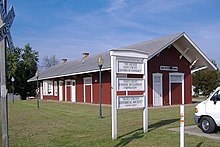
The Scott County Home, Scottsburg Courthouse Square Historic District, and Scottsburg Depot are listed on the National Register of Historic Places.[10]
Geography[]
Scottsburg is located at 38°41′7.3″N 85°46′10.55″W / 38.685361°N 85.7695972°W (38.685361, -85.769597).[11]
According to the 2010 census, Scottsburg has a total area of 5.069 square miles (13.13 km2), of which 5.05 square miles (13.08 km2) (or 99.63%) is land and 0.019 square miles (0.05 km2) (or 0.37%) is water.[12]
Climate[]
The climate in this area is characterized by hot, humid summers and cold Midwest winters. According to the Köppen Climate Classification system, Scottsburg has a humid subtropical climate, abbreviated "Cfa" on climate maps.[13]
| hideClimate data for Scottsburg | |||||||||||||
|---|---|---|---|---|---|---|---|---|---|---|---|---|---|
| Month | Jan | Feb | Mar | Apr | May | Jun | Jul | Aug | Sep | Oct | Nov | Dec | Year |
| Average high °C (°F) | 4 (39) |
6 (43) |
12 (54) |
19 (66) |
24 (75) |
29 (84) |
31 (88) |
30 (86) |
27 (81) |
21 (70) |
12 (54) |
6 (43) |
18 (64) |
| Daily mean °C (°F) | 0 (32) |
1 (34) |
6 (43) |
12 (54) |
17 (63) |
22 (72) |
24 (75) |
23 (73) |
20 (68) |
13 (55) |
6 (43) |
1 (34) |
12 (54) |
| Average low °C (°F) | −5 (23) |
−4 (25) |
0 (32) |
5 (41) |
11 (52) |
16 (61) |
18 (64) |
17 (63) |
13 (55) |
6 (43) |
0 (32) |
−3 (27) |
6 (43) |
| Average precipitation mm (inches) | 90 (3.5) |
72 (2.8) |
111 (4.4) |
104 (4.1) |
107 (4.2) |
106 (4.2) |
102 (4.0) |
95 (3.7) |
75 (3.0) |
72 (2.8) |
83 (3.3) |
83 (3.3) |
1,098 (43.2) |
| Source: [14] | |||||||||||||
Demographics[]
| Historical population | |||
|---|---|---|---|
| Census | Pop. | %± | |
| 1880 | 454 | — | |
| 1890 | 618 | 36.1% | |
| 1900 | 1,274 | 106.1% | |
| 1910 | 1,669 | 31.0% | |
| 1920 | 1,609 | −3.6% | |
| 1930 | 1,702 | 5.8% | |
| 1940 | 2,189 | 28.6% | |
| 1950 | 2,953 | 34.9% | |
| 1960 | 3,810 | 29.0% | |
| 1970 | 4,791 | 25.7% | |
| 1980 | 5,068 | 5.8% | |
| 1990 | 5,334 | 5.2% | |
| 2000 | 6,040 | 13.2% | |
| 2010 | 6,747 | 11.7% | |
| 2019 (est.) | 6,732 | [4] | −0.2% |
| U.S. Decennial Census[15] | |||
In 2003 Scott County was removed from the Louisville-Jefferson County, KY-IN Metropolitan Statistical Area and became the Scottsburg, IN Micropolitan Statistical Area. It is part of the Louisville/Jefferson County–Elizabethtown–Bardstown, KY-IN Combined Statistical Area.
2010 census[]
As of the census[3] of 2010, there were 6,747 people, 2,768 households, and 1,730 families living in the city. The population density was 1,336.0 inhabitants per square mile (515.8/km2). There were 3,117 housing units at an average density of 617.2 per square mile (238.3/km2). The racial makeup of the city was 97.2% White, 0.3% African American, 0.2% Native American, 0.9% Asian, 0.7% from other races, and 0.6% from two or more races. Hispanic or Latino of any race were 1.8% of the population.
There were 2,768 households, of which 32.6% had children under the age of 18 living with them, 40.6% were married couples living together, 16.1% had a female householder with no husband present, 5.8% had a male householder with no wife present, and 37.5% were non-families. 30.9% of all households were made up of individuals, and 12.4% had someone living alone who was 65 years of age or older. The average household size was 2.34 and the average family size was 2.90.
The median age in the city was 37.5 years. 23.3% of residents were under the age of 18; 9.5% were between the ages of 18 and 24; 27% were from 25 to 44; 24.5% were from 45 to 64; and 15.9% were 65 years of age or older. The gender makeup of the city was 47.5% male and 52.5% female.
2000 census[]
As of the census[5] of 2000, there were 6,040 people, 2,539 households, and 1,604 families living in the city. The population density was 1,257.2 people per square mile (485.8/km2). There were 2,823 housing units at an average density of 587.6 per square mile (227.1/km2). The racial makeup of the city was 98.34% White, 0.07% African American, 0.28% Native American, 0.28% Asian, 0.26% from other races, and 0.76% from two or more races. Hispanic or Latino of any race were 0.88% of the population.
There were 2,539 households, out of which 30.6% had children under the age of 18 living with them, 44.5% were married couples living together, 14.1% had a female householder with no husband present, and 36.8% were non-families. 32.4% of all households were made up of individuals, and 13.6% had someone living alone who was 65 years of age or older. The average household size was 2.30 and the average family size was 2.87.
In the city, the population was spread out, with 24.2% under the age of 18, 10.9% from 18 to 24, 29.5% from 25 to 44, 20.3% from 45 to 64, and 15.1% who were 65 years of age or older. The median age was 35 years. For every 100 females, there were 90.4 males. For every 100 females age 18 and over, there were 85.2 males.
The median income for a household in the city was $30,687, and the median income for a family was $37,083. Males had a median income of $31,217 versus $21,321 for females. The per capita income for the city was $16,552. About 12.6% of families and 15.5% of the population were below the poverty line, including 19.7% of those under age 18 and 9.4% of those age 65 or over.
Education[]
The town has a lending library, the Scott County Public Library.[16] The town is in Scott County School District 2. This includes Johnson, Lexington, Scottsburg, and Vienna-Finley Elementary Schools, Scottsburg Middle School, and Scottsburg High School.[17] The elementary schools are kindergarten through fifth grade. Scottsburg Middle School is sixth grade through 8th grade. Scottsburg High School is ninth through twelfth grade with opportunities for a hybrid learning environment through Scottsburg New Tech High School.[18] There are also a variety of early education programs, such as OVO Head Start and Pre-School programs at local churches.[19][20]
Unique events[]
Every year on the fourth weekend in August the Finley Township Volunteer Fire Department holds the Leota Country Frolic, a festival to celebrate the country heritage of the town founded in 1884. Live bluegrass music, antique farm machinery show, watermelon eating contest, arts and crafts, quilt raffle, flea market, pedal pull, euchre tournament, and an abundance of good food.[21][22] This event is held in historic Leota, centered around the infamous covered bridge.
During the second weekend in August the Scottsburg Beautification Committee hosts the Pig Roast in the Park. This is a nonprofit event that raises funds for the city of Scottsburg. There is great food, live music, a slow-pitch softball tournament, arts and crafts booths, and fellowship with fellow community members. At the end of the evening on the last day of the event there is a fireworks display. A winner will also be drawn for the raffle of an Amish built log cabin.[23]
References[]
- ^ "2019 U.S. Gazetteer Files". United States Census Bureau. Retrieved July 16, 2020.
- ^ "US Board on Geographic Names". United States Geological Survey. 2007-10-25. Retrieved 2008-01-31.
- ^ Jump up to: a b "U.S. Census website". United States Census Bureau. Retrieved 2012-12-11.
- ^ Jump up to: a b "Population and Housing Unit Estimates". United States Census Bureau. May 24, 2020. Retrieved May 27, 2020.
- ^ Jump up to: a b "U.S. Census website". United States Census Bureau. Retrieved 2008-01-31.
- ^ "Find a County". National Association of Counties. Retrieved 2011-06-07.
- ^ "LEXINGTON FIRST COUNTY SEAT". Indiana Historical Bureau. Retrieved 4 December 2015.
- ^ Kleber, John E. (2001). The Encyclopedia of Louisville. University Press of Kentucky. p. 793. ISBN 0-8131-2890-0.
- ^ "Scott County". Jim Forte Postal History. Retrieved 4 December 2015.
- ^ "National Register Information System". National Register of Historic Places. National Park Service. July 9, 2010.
- ^ "US Gazetteer files: 2010, 2000, and 1990". United States Census Bureau. 2011-02-12. Retrieved 2011-04-23.
- ^ "G001 - Geographic Identifiers - 2010 Census Summary File 1". United States Census Bureau. Archived from the original on 2020-02-13. Retrieved 2015-07-29.
- ^ Climate Summary for Scottsburg, Indiana
- ^ "Scottsburg, Indiana Temperature Averages". Weatherbase. Retrieved 21 April 2015.
- ^ "Census of Population and Housing". Census.gov. Retrieved June 4, 2015.
- ^ "Indiana public library directory" (PDF). Indiana State Library. Retrieved 15 March 2018.
- ^ www.scsd2.k12.in.us https://www.scsd2.k12.in.us/. Retrieved 2019-02-19. Missing or empty
|title=(help) - ^ "New Tech - Scottsburg High School". shs.scsd2.k12.in.us. Retrieved 2019-02-19.
- ^ "Head Start". Retrieved 2019-02-19.
- ^ "First Christian Church of Scottsburg". First Christian Church of Scottsburg. Retrieved 2019-02-19.
- ^ scottcountyvisitorscommission (2016-08-08). "Leota Frolic!". Scott County Visitors Commission. Retrieved 2019-02-19.
- ^ "Leota Country Frolic". www.facebook.com. Retrieved 2019-02-19.
- ^ "Pig Roast in the Park". www.facebook.com. Retrieved 2019-02-19.
External links[]
 Media related to Scottsburg, Indiana at Wikimedia Commons
 Scottsburg travel guide from Wikivoyage
- http://www.in.gov/dwd/2567.htm
- http://www.hoosierdata.in.gov/docs/state/rank/2012/rankmth05.pdf
| show Municipalities and communities of Scott County, Indiana, United States |
|---|
| Authority control |
|
|---|
- Cities in Indiana
- County seats in Indiana
- Micropolitan areas of Indiana
- Cities in Scott County, Indiana