St Michael's on Wyre
This article needs additional citations for verification. (July 2007) |
| St Michael's on Wyre | |
|---|---|
 St Michael's Church, St. Michael's on Wyre | |
 St Michael's on Wyre Shown within Wyre Borough | |
| OS grid reference | SD462414 |
| Civil parish |
|
| District | |
| Shire county | |
| Region | |
| Country | England |
| Sovereign state | United Kingdom |
| Post town | PRESTON |
| Postcode district | PR3 |
| Dialling code | 01995 |
| Police | Lancashire |
| Fire | Lancashire |
| Ambulance | North West |
| UK Parliament | |
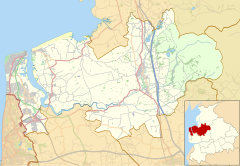
St Michael's on Wyre is a village on the Fylde, in the Borough of Wyre, in Lancashire, England; it lies on the River Wyre. The village is centred on the church of St Michael's which was founded before AD 640. It is in the civil parish of Upper Rawcliffe with Tarnacre, which had a population in 2001 of 604.[1] For later counts see the Civil parish.
History[]
In 1835 the parish of St Michael's contained the townships of Out Rawcliffe, Upper Rawcliffe, Elswick, Great Eccleston, Inskip-with-Sowerby, Newsham and Woodplumpton.
In 1984, 16 people were killed in the Abbeystead disaster, during a visit by a party from St Michael's to a waterworks 10 miles up the River Wyre.
Following severe flooding in 2015 which resulted in the evacuation of the villagers, Prince Harry visited the village to meet with residents affected and reopen the refurbished village hall.[2][3][4][5]
Today[]
Despite its size, the village has its own pub, car garage, school, village hall, tennis club, bowling club and nearby Myerscough College.[6] The parish church of St Michael is the village's most prominent landmark. The nave and chancel date from the 14th century, and the tower from the 16th. It is one of only two Grade I listed buildings in the Borough of Wyre.[7]
Location[]
St Michael's on Wyre is situated between Lancaster, Preston and Blackpool.
Transport[]
St Michael's microlight airfield is located just over a mile to the southeast of the village, south of St Michael's Road. It has three grass runways, and its airport code is GB-0398.[8] It is the home of Northern Microlight School, which was founded in 1982.[9]
See also[]
References[]
- ^ Office for National Statistics : Census 2001 : Parish Headcounts : Wyre Retrieved 2009-08-21
- ^ "Lancashire families are being evacuated as floods caused by Storm Eva threaten havoc again". The Independent. 26 December 2015. Retrieved 22 February 2018.
- ^ "Prince Harry returns to village flooded by 2015 storm". ITV News. Retrieved 22 February 2018.
- ^ "Widespread flood alerts remain in force". BBC News. 13 December 2015. Retrieved 22 February 2018.
- ^ "Prince hears flood victims' stories". BBC News. Retrieved 22 February 2018.
- ^ "Spotlight on - St. Michaels-on-Wyre". www.lep.co.uk. Retrieved 22 February 2018.
- ^ "Listed Buildings". Wyre Borough Council. Archived from the original on 27 September 2011. Retrieved 12 February 2010.
- ^ St Michael's - UK Airfield Guide
- ^ Northern Microlight School's official website
External links[]
| Wikimedia Commons has media related to St Michael's on Wyre. |
- Villages in Lancashire
- Geography of the Borough of Wyre
- The Fylde
- Lancashire geography stubs


