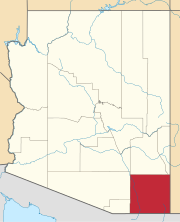
Stark, Arizona
Stark, Arizona | |
|---|---|
 Stark Location within the state of Arizona | |
| Coordinates: 31°22′17″N 110°02′12″W / 31.37139°N 110.03667°WCoordinates: 31°22′17″N 110°02′12″W / 31.37139°N 110.03667°W | |
| Country | United States |
| State | Arizona |
| County | Cochise |
| Elevation | 4,383 ft (1,339 m) |
| Time zone | UTC-7 (Mountain (MST)) |
| • Summer (DST) | UTC-7 (MST) |
| Area code(s) | 520 |
| FIPS code | 04-69430 |
| GNIS feature ID | 24628 |
Stark is a populated place situated in Cochise County, Arizona, United States, adjacent to the international border with Mexico.[2] It has an estimated elevation of 4,393 feet (1,339 m) above sea level.[1]
Initially, Stark was a railroad station named for William Stark, who had a nearby ranch.[3] A post office opened in 1914.[3]
References[]
- ^ a b "Feature Detail Report for: Stark". Geographic Names Information System. United States Geological Survey.
- ^ Stark (in Cochise County, AZ) Populated Place Profile. AZ Hometown Locator. Retrieved April 5, 2017.
- ^ a b Barnes, Will Croft (2016). Arizona Place Names. University of Arizona Press. p. 422. ISBN 9780816534951. Retrieved February 21, 2020.
Categories:
- Populated places in Cochise County, Arizona


