Stewart Manor, New York
Stewart Manor, New York | |
|---|---|
Village | |
| Incorporated Village of Stewart Manor | |
 Stewart Manor Village Hall & Firehouse in 2008. | |
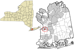 Location in Nassau County and the state of New York. | |
 Location within the state of New York | |
| Coordinates: 40°43′14″N 73°41′7″W / 40.72056°N 73.68528°WCoordinates: 40°43′14″N 73°41′7″W / 40.72056°N 73.68528°W | |
| Country | |
| State | |
| County | |
| Area | |
| • Total | 0.21 sq mi (0.54 km2) |
| • Land | 0.21 sq mi (0.54 km2) |
| • Water | 0.00 sq mi (0.00 km2) |
| Elevation | 85 ft (26 m) |
| Population (2010) | |
| • Total | 1,896 |
| • Estimate (2019)[2] | 1,956 |
| • Density | 9,358.85/sq mi (3,605.62/km2) |
| Time zone | UTC-5 (Eastern (EST)) |
| • Summer (DST) | UTC-4 (EDT) |
| ZIP code | 11530 |
| Area code(s) | 516 |
| FIPS code | 36-71267 |
| GNIS feature ID | 0966409 |
| Website | stewartmanor |

Stewart Manor is a village in Nassau County, New York in the United States. The population was 1,896 at the 2010 census.
The Incorporated Village of Stewart Manor is within the northern part of the Town of Hempstead on Long Island and is a suburb of New York City. The Stewart Manor station, located in adjacent Garden City, serves Stewart Manor.
Geography[]

Stewart Manor is located at 40°43′14″N 73°41′07″W / 40.720578°N 73.685177°W (40.720578, -73.685177).[3]
According to the United States Census Bureau, the village has a total area of 0.2 square miles (0.52 km2), all of it land.
The village is east of the Village of Floral Park, south of the Village of New Hyde Park, and west of Franklin Square, and the Village of Garden City.
Demographics[]
| Historical population | |||
|---|---|---|---|
| Census | Pop. | %± | |
| 1930 | 1,291 | — | |
| 1940 | 1,625 | 25.9% | |
| 1950 | 1,879 | 15.6% | |
| 1960 | 2,422 | 28.9% | |
| 1970 | 2,183 | −9.9% | |
| 1980 | 2,373 | 8.7% | |
| 1990 | 2,002 | −15.6% | |
| 2000 | 1,935 | −3.3% | |
| 2010 | 1,896 | −2.0% | |
| 2019 (est.) | 1,956 | [2] | 3.2% |
| U.S. Decennial Census[4] | |||
This article needs to be updated. (April 2013) |
At the 2000 census there were 1,935 people, 718 households, and 564 families in the village. The population density was 9,784.9 people per square mile (3,735.5/km2). There were 726 housing units at an average density of 3,671.2 per square mile (1,401.6/km2). The racial makeup of the village was 93.28% White, 1.76% African American, 1.91% Asian, 1.45% from other races, and 1.60% from two or more races. Hispanic or Latino of any race were 4.03%.[5]
Of the 718 households 32.2% had children under the age of 18 living with them, 64.1% were married couples living together, 12.0% had a female householder with no husband present, and 21.4% were non-families. 19.4% of households were one person and 10.6% were one person aged 65 or older. The average household size was 2.69 and the average family size was 3.10.
The age distribution was 23.2% under the age of 18, 6.8% from 18 to 24, 28.6% from 25 to 44, 25.4% from 45 to 64, and 16.0% 65 or older. The median age was 40 years. For every 100 females, there were 84.8 males. For every 100 females age 18 and over, there were 81.6 males.
The median household income was $84,913 and the median family income was $97,922. Males had a median income of $67,031 versus $41,042 for females. The per capita income for the village was $35,371. About 1.9% of families and 2.6% of the population were below the poverty line, including 3.2% of those under age 18 and 3.9% of those age 65 or over.
Education[]
Stewart Manor School (Grades K-6, Students: 344)
Sewanhaka High School (Grades 7–12, Students: 1,567) A nationally ranked school in the 2012 U.S. News & World Report Best Schools list.
The Stewart Manor street Fernwood Terrace is split between Garden City UFSD and Sewanhaka/Franklin Square UFSD
Notable people[]
- Sal Paolantonio (born 1956), Philadelphia-based bureau reporter for ESPN, who primarily reports on NFL stories.[6]
See also[]
![]() New York (state) portal
New York (state) portal
References[]
- ^ "2019 U.S. Gazetteer Files". United States Census Bureau. Retrieved July 27, 2020.
- ^ Jump up to: a b "Population and Housing Unit Estimates". United States Census Bureau. May 24, 2020. Retrieved May 27, 2020.
- ^ "US Gazetteer files: 2010, 2000, and 1990". United States Census Bureau. 2011-02-12. Retrieved 2011-04-23.
- ^ "Census of Population and Housing". Census.gov. Retrieved June 4, 2015.
- ^ "U.S. Census website". United States Census Bureau. Retrieved 2008-01-31.
- ^ "ESPN's Sal Paolantonio Earns Suny Honor, Will Deliver Commencement Speech at Suny Oneonta", readMedia.com, April 12, 2013. Accessed January 11, 2018. "Paolantonio grew up in Stewart Manor, Long Island, and attended Sewanhaka High School in Floral Park, N.Y."
External links[]
| Wikimedia Commons has media related to Stewart Manor, New York. |
- History of Stewart Manor in Newsday

| show Authority control |
|---|
- Hempstead, New York
- Villages in New York (state)
- Villages in Nassau County, New York