Stokkelaarsbrug
Stokkelaarsbrug | |
|---|---|
Hamlet | |
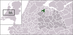 | |
 Stokkelaarsbrug in the municipality of Abcoude. | |
| Coordinates: 52°15′34″N 4°55′36″E / 52.25944°N 4.92667°ECoordinates: 52°15′34″N 4°55′36″E / 52.25944°N 4.92667°E | |
| Country | Netherlands |
| Province | Utrecht |
| Municipality | De Ronde Venen |
| Time zone | UTC+1 (CET) |
| • Summer (DST) | UTC+2 (CEST) |

Stokkelaarsbrug is a hamlet in the Dutch province of Utrecht. It is a part of the municipality of De Ronde Venen, and lies about 12 km south of Amsterdam.[1] It is located on the border with the province North Holland, where the small river joins the .
References[]
- ^ ANWB Topografische Atlas Nederland, Topografische Dienst and ANWB, 2005.
This Utrecht location article is a stub. You can help Wikipedia by . |
Categories:
- Populated places in Utrecht (province)
- De Ronde Venen
- Utrecht (province) geography stubs