Stovall, North Carolina
Stovall, North Carolina | |
|---|---|
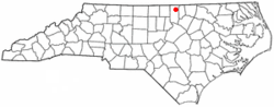 Location of Stovall, North Carolina | |
| Coordinates: 36°26′49″N 78°34′8″W / 36.44694°N 78.56889°WCoordinates: 36°26′49″N 78°34′8″W / 36.44694°N 78.56889°W | |
| Country | United States |
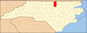
| State | North Carolina |
| County | Granville |
| Area | |
| • Total | 1.05 sq mi (2.71 km2) |
| • Land | 1.05 sq mi (2.71 km2) |
| • Water | 0.00 sq mi (0.00 km2) |
| Elevation | 472 ft (144 m) |
| Population (2010) | |
| • Total | 418 |
| • Estimate (2019)[4] | 420 |
| • Density | 401.15/sq mi (154.94/km2) |
| Time zone | UTC-5 (Eastern (EST)) |
| • Summer (DST) | UTC-4 (EDT) |
| ZIP code | 27582 |
| Area code(s) | 919 |
| FIPS code | 37-65320[2] |
| GNIS feature ID | 0995594[3] |

Stovall is a town in Granville County, North Carolina, United States. The population was 418 as of the 2010 census.[5]
History[]
Abrams Plains, Maurice Hart House, Hill Airy and John W. Stovall Farm are listed on the National Register of Historic Places.[6]
John Penn, one of the original signers of the United States Declaration of Independence, lived just 2 miles east of Stovall. His estate and former grave site are now maintained by the Daughters of the American Revolution.

Geography[]
Stovall is located at 36°26′49″N 78°34′8″W / 36.44694°N 78.56889°W (36.446894, -78.568979).[7]
According to the United States Census Bureau, the town has a total area of 1.0 square mile (2.6 km2): all of it land.
Stovall is located in the Sassafras Fork voting precinct in Granville County.
Demographics[]
| Historical population | |||
|---|---|---|---|
| Census | Pop. | %± | |
| 1910 | 305 | — | |
| 1920 | 414 | 35.7% | |
| 1930 | 415 | 0.2% | |
| 1940 | 415 | 0.0% | |
| 1950 | 410 | −1.2% | |
| 1960 | 570 | 39.0% | |
| 1970 | 405 | −28.9% | |
| 1980 | 417 | 3.0% | |
| 1990 | 409 | −1.9% | |
| 2000 | 376 | −8.1% | |
| 2010 | 418 | 11.2% | |
| 2019 (est.) | 420 | [4] | 0.5% |
| U.S. Decennial Census[8] | |||
As of the 2010 census,[2] there were 418 people and 170 households. The population density was 418.0 people per square mile (154.8/km2). There were 191 housing units at an average density of 191.0 per square mile (70.7/km2). The racial makeup of the town was 54.5% White, 41.4% African American, 4.1% from other races. Hispanic or Latino of any race were 3.8% of the population.
There were 170 households, out of which 25.3% had children under the age of 18 living with them. In the town, the population was spread out, with 24.6% under the age of 18, 9.1% from 18 to 24, 9.3% from 25 to 34, 18.7% from 35 to 49, 18.7% from 50 to 64, and 19.6% who were 65 years of age or older. For every 100 females, there were 96.2 males.
The median income[9] for a household in the town was $35,313, and the mean income for a household was $46,795. The median and mean family incomes were $55,938 and $68,693, respectively. The per capita income for the town was $24,117. About 6.9% of families and 10.9% of the population were below the poverty line, including 12.5% of those under age 18 and 11.3% of those age 65 or over.
Government[]
The Mayor of Stovall is Janet C. Parrott.
The Stovall Town Commissioners are:
- Dale Hughes
- Doug Lunsford, Jr.
- Carl T. Roberts
- Ricky Sneed
- Mike Williford
References[]
- ^ "2019 U.S. Gazetteer Files". United States Census Bureau. Retrieved July 27, 2020.
- ^ Jump up to: a b "U.S. Census website". United States Census Bureau. Retrieved 2008-01-31.
- ^ "US Board on Geographic Names". United States Geological Survey. 2007-10-25. Retrieved 2008-01-31.
- ^ Jump up to: a b "Population and Housing Unit Estimates". United States Census Bureau. May 24, 2020. Retrieved May 27, 2020.
- ^ US Census Interactive Population Search Archived 2012-01-14 at the Wayback Machine, Retrieved 2011-11-11
- ^ "National Register Information System". National Register of Historic Places. National Park Service. July 9, 2010.
- ^ "US Gazetteer files: 2010, 2000, and 1990". United States Census Bureau. 2011-02-12. Retrieved 2011-04-23.
- ^ "Census of Population and Housing". Census.gov. Retrieved June 4, 2015.
- ^ "US Census Fact Finder, United States Census Bureau". Archived from the original on 2020-02-16. Retrieved 2011-11-11.
| show Municipalities and communities of Granville County, North Carolina, United States |
|---|
| show Authority control |
|---|
- Towns in Granville County, North Carolina
- Towns in North Carolina