Strymonian Gulf
| Strymonian Gulf | |
|---|---|
 View of Strymonian Gulf from Paralia Orfiniou | |
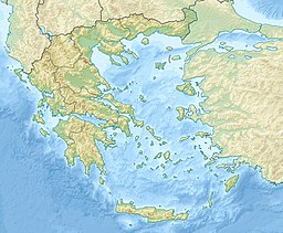 Strymonian Gulf Location of the Strymonian Gulf within Greece | |
| Location | Central Macedonia |
| Coordinates | 40°40′N 23°50′E / 40.667°N 23.833°ECoordinates: 40°40′N 23°50′E / 40.667°N 23.833°E |
| Type | Gulf |
| Native name | Στρυμονικός Κόλπος (Greek) |
| Part of | Aegean Sea |
| River sources | Strymon |
| Basin countries | Greece, Bulgaria |

The Strymonian or Strymonic Gulf (Greek: Στρυμονικός Κόλπος, romanized: Strymonikos Kolpos), also known as the Orfano Gulf (Greek: Κόλπος Ορφανού, romanized: Kolpos Orfanou), is a branch of the Thracian Sea—itself part of the Aegean Sea—lying east of the Chalcidice peninsula and south of the Serres regional unit. It was formerly known as the Gulf of Rendina, in reference to the ancient colony of Eion along the gulf's shores.
The river Strymon empties into the gulf.
The largest towns on the Strymonic Gulf, with their respective administrative divisions, are:
- Asprovalta, Stavros, Nea Vrasna (Thessaloniki regional unit, Central Macedonia);
- Orfani (Kavala regional unit, East Macedonia and Thrace);
- Olympiada, Stratoni (Chalkidiki regional unit, Central Macedonia);
- Nea Kerdylia, Amfipoli (Serres regional unit, Central Macedonia).
Three mountains form the natural border of the Gulf: Pangaio to the north-east, to the north, and Stratoni to the south.
External links[]
| Authority control |
|
|---|
This Central Macedonia location article is a stub. You can help Wikipedia by . |
- Gulfs of Greece
- Gulfs of the Aegean Sea
- Landforms of Thessaloniki (regional unit)
- Landforms of Central Macedonia
- Landforms of Kavala (regional unit)
- Landforms of Eastern Macedonia and Thrace
- Landforms of Chalkidiki
- Landforms of Serres (regional unit)
- Thracian Sea
- Central Macedonia geography stubs