Sulat
This article needs additional citations for verification. (December 2014) |
Sulat | |
|---|---|
| Municipality of Sulat | |
 Flag  Seal | |
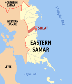 Map of Eastern Samar with Sulat highlighted | |
OpenStreetMap  | |
 Sulat Location within the Philippines | |
| Coordinates: 11°49′N 125°27′E / 11.82°N 125.45°ECoordinates: 11°49′N 125°27′E / 11.82°N 125.45°E | |
| Country | Philippines |
| Region | Eastern Visayas |
| Province | Eastern Samar |
| District | Lone district |
| Barangays | 18 (see Barangays) |
| Government | |
| • Type | Sangguniang Bayan |
| • Mayor | Javier E. Zacate |
| • Vice Mayor | Amado A. Amigo |
| • Representative | Maria Fe R. Abunda |
| • Councilors | List |
| • Electorate | 11,795 voters (2019) |
| Area | |
| • Total | 169.75 km2 (65.54 sq mi) |
| Elevation | 15 m (49 ft) |
| Highest elevation | 182 m (597 ft) |
| Lowest elevation | 0 m (0 ft) |
| Population (2020 census) [3] | |
| • Total | 15,758 |
| • Density | 93/km2 (240/sq mi) |
| • Households | 3,650 |
| Economy | |
| • Income class | 4th municipal income class |
| • Poverty incidence | 38.94% (2015)[4] |
| • Revenue | ₱105,915,257.99 (2020) |
| • Assets | ₱258,132,271.13 (2020) |
| • Expenditure | ₱94,882,358.48 (2020) |
| • Liabilities | ₱84,981,715.16 (2020) |
| Service provider | |
| • Electricity | Eastern Samar Electric Cooperative (ESAMELCO) |
| Time zone | UTC+8 (PST) |
| ZIP code | 6815 |
| PSGC | |
| IDD : area code | +63 (0)55 |
| Native languages | Waray Tagalog |
| Patron saint | Saint Ignatius of Loyola |
| Website | www |

Sulat, officially the Municipality of Sulat (Waray: Bungto han Sulat; Tagalog: Bayan ng Sulat), is a 4th class municipality in the province of Eastern Samar, Philippines. According to the 2020 census, it has a population of 15,758 people. [3]
Barangays[]
Sulat is politically subdivided into 18 barangays. [5]
Demographics[]
| Year | Pop. | ±% p.a. |
|---|---|---|
| 1903 | 5,266 | — |
| 1918 | 6,331 | +1.24% |
| 1939 | 8,004 | +1.12% |
| 1948 | 8,642 | +0.86% |
| 1960 | 9,927 | +1.16% |
| 1970 | 11,535 | +1.51% |
| 1975 | 12,226 | +1.17% |
| 1980 | 12,357 | +0.21% |
| 1990 | 12,738 | +0.30% |
| 1995 | 14,010 | +1.80% |
| 2000 | 14,193 | +0.28% |
| 2007 | 19,322 | +4.35% |
| 2010 | 15,184 | −8.40% |
| 2015 | 15,377 | +0.24% |
| 2020 | 15,758 | +0.48% |
| Source: Philippine Statistics Authority [6] [7] [8][9] | ||
The population of Sulat in the 2020 census was 15,758 people, [3] with a density of 93 inhabitants per square kilometre or 240 inhabitants per square mile.
Climate[]
| Climate data for Sulat, Eastern Samar | |||||||||||||
|---|---|---|---|---|---|---|---|---|---|---|---|---|---|
| Month | Jan | Feb | Mar | Apr | May | Jun | Jul | Aug | Sep | Oct | Nov | Dec | Year |
| Average high °C (°F) | 27 (81) |
28 (82) |
28 (82) |
30 (86) |
30 (86) |
30 (86) |
29 (84) |
29 (84) |
29 (84) |
29 (84) |
28 (82) |
28 (82) |
29 (84) |
| Average low °C (°F) | 22 (72) |
22 (72) |
22 (72) |
23 (73) |
24 (75) |
24 (75) |
24 (75) |
24 (75) |
24 (75) |
24 (75) |
23 (73) |
23 (73) |
23 (74) |
| Average precipitation mm (inches) | 114 (4.5) |
81 (3.2) |
94 (3.7) |
81 (3.2) |
119 (4.7) |
192 (7.6) |
186 (7.3) |
158 (6.2) |
167 (6.6) |
185 (7.3) |
202 (8.0) |
176 (6.9) |
1,755 (69.2) |
| Average rainy days | 18.6 | 14.7 | 16.8 | 17.8 | 22.3 | 25.9 | 27.5 | 26.2 | 26.6 | 27.0 | 24.6 | 22.3 | 270.3 |
| Source: Meteoblue [10] | |||||||||||||
Economy[]
| Poverty Incidence of Sulat | |
| Source: Philippine Statistics Authority[11][12][13][14][15][16] | |
Tourism[]
- Sulat River
- Sulat River possesses beautiful sceneries of the sunrise and sunset with water flowing in from the Pacific Ocean. The river is primarily used by native fishing boats and passenger boats making trips to nearby islands.
- Luyang Beach
- Luyang Beach has patches of corals in ancient underwater limestone formations with a wide variety of tropical aquatic life along the Pacific coast.
- Makate Island
- Makate Island has a pristine white sand beach and seasonal waves for surfers and skimboarders. The island has accommodation for visitors to stay overnight and is being considered by the Department of Tourism for further development.
- Panini-hian Sunrise View Pacific Resort
- Panini-hian Sunrise View Pacific Resort is within walking distance of Luyang Beach. Cottages for rent are available in the resort under the supervision of the Local Government Unit. Further development is ongoing.
- Podpod
- A traditional Waray fishcake dish prevalent in Barangay Santa Vicente. The fishcake is made by first boiling fish with water and salt. Once cooked, the fish meat is separated from the stock and its bones. The meat is then squeezed so take out the liquid. Afterwards, the fish meat is packed into bamboo shapers until the fish meat is flat and in circular shape. The fishmeat is then taken out from the mold and smoked. The podpod can be eaten as it is or used in the od'ong, a traditional Waray soup and noodle dish.[17]
Education[]
Secondary Schools[]
- Sulat National High School
- Santo Niño National High School
- San Vicente Integrated School
- MSH Loyola Academy
Elementary Schools[]
- A-et Elementary School
- San Francisco Elementary School
- Maglipay Elementary School
- Kandalakit Elementary School
- Del Remedio Elementary School
- Mabini Elementary School
- San Juan Elementary School
- San Mateo Elementary School
- San Vicente Elementary School
- Santo Niño Elementary School
- Hamorawon PS
- Sulat CES
- San Isidro Elementary School
- Santo Tomas Elementary School
References[]
- ^ Municipality of Sulat | (DILG)
- ^ "2015 Census of Population, Report No. 3 – Population, Land Area, and Population Density" (PDF). Philippine Statistics Authority. Quezon City, Philippines. August 2016. ISSN 0117-1453. Archived (PDF) from the original on May 25, 2021. Retrieved July 16, 2021.
- ^ a b c Census of Population (2020). "Region VIII (Eastern Visayas)". Total Population by Province, City, Municipality and Barangay. PSA. Retrieved 8 July 2021.
- ^ https://psa.gov.ph/sites/default/files/City%20and%20Municipal-level%20Small%20Area%20Poverty%20Estimates_%202009%2C%202012%20and%202015_0.xlsx; publication date: 10 July 2019; publisher: Philippine Statistics Authority.
- ^ "Province: Eastern Samar". PSGC Interactive. Quezon City, Philippines: Philippine Statistics Authority. Retrieved 12 November 2016.
- ^ Census of Population (2015). "Region VIII (Eastern Visayas)". Total Population by Province, City, Municipality and Barangay. PSA. Retrieved 20 June 2016.
- ^ Census of Population and Housing (2010). "Region VIII (Eastern Visayas)". Total Population by Province, City, Municipality and Barangay. NSO. Retrieved 29 June 2016.
- ^ Censuses of Population (1903–2007). "Region VIII (Eastern Visayas)". Table 1. Population Enumerated in Various Censuses by Province/Highly Urbanized City: 1903 to 2007. NSO.
- ^ "Province of Eastern Samar". Municipality Population Data. Local Water Utilities Administration Research Division. Retrieved 17 December 2016.
- ^ "Sulat, Eastern Samar : Average Temperatures and Rainfall". Meteoblue. Retrieved 31 December 2018.
- ^ "Poverty incidence (PI):". Philippine Statistics Authority. Retrieved 28 December 2020.
- ^ https://psa.gov.ph/sites/default/files/NSCB_LocalPovertyPhilippines_0.pdf; publication date: 29 November 2005; publisher: Philippine Statistics Authority.
- ^ https://psa.gov.ph/sites/default/files/2003%20SAE%20of%20poverty%20%28Full%20Report%29_1.pdf; publication date: 23 March 2009; publisher: Philippine Statistics Authority.
- ^ https://psa.gov.ph/sites/default/files/2006%20and%202009%20City%20and%20Municipal%20Level%20Poverty%20Estimates_0_1.pdf; publication date: 3 August 2012; publisher: Philippine Statistics Authority.
- ^ https://psa.gov.ph/sites/default/files/2012%20Municipal%20and%20City%20Level%20Poverty%20Estima7tes%20Publication%20%281%29.pdf; publication date: 31 May 2016; publisher: Philippine Statistics Authority.
- ^ https://psa.gov.ph/sites/default/files/City%20and%20Municipal-level%20Small%20Area%20Poverty%20Estimates_%202009%2C%202012%20and%202015_0.xlsx; publication date: 10 July 2019; publisher: Philippine Statistics Authority.
- ^ https://www.youtube.com/watch?v=7Hw77F_P7Go
External links[]
- Sulat Profile at PhilAtlas.com
- Philippine Standard Geographic Code
- Philippine Census Information
- Local Governance Performance Management System
Places adjacent to Sulat | ||||||||||||||||
|---|---|---|---|---|---|---|---|---|---|---|---|---|---|---|---|---|
| ||||||||||||||||
Borongan (capital) | |
| Municipalities | |
| Component city | |
This article about a location in Eastern Visayas region is a stub. You can help Wikipedia by . |
Categories:
- Municipalities of Eastern Samar
- Eastern Visayas geography stubs