Suryapet district
Suryapet district | |
|---|---|
District of Telangana | |
 Pillalamarri temple | |
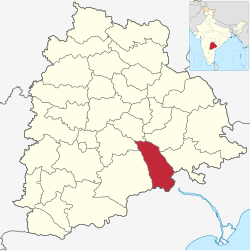 Location of Suryapet district in Telangana | |
| Country | India |
| State | Telangana |
| Established | 2016 |
| Headquarters | Suryapet |
| Tehsils | 23 |
| Government | |
| • District collector | Vinay Krishna Reddy[IAS] |
| • Lok Sabha constituencies | Nalgonda and Bhuvanagiri |
| Area | |
| • Total | 3,607 km2 (1,393 sq mi) |
| Population (2011) | |
| • Total | 1,099,560 |
| • Density | 300/km2 (790/sq mi) |
| • Urban | 15.56% |
| Demographics | |
| • Literacy | 64.11% |
| • Sex ratio | 996 |
| Time zone | UTC+05:30 (IST) |
| Vehicle registration | TS–29[1] |
| Major highways | NH-65, NH-365B, NH-365BB and SH-42 |
| Website | suryapet |

Suryapet district is a district in the Indian state of Telangana.[2] The city of Suryapet is the district headquarters. The district has three revenue divisions Suryapet, Kodad and Huzurnagar. It is sub-divided into 23 mandals. The district shares boundaries with Nalgonda, Khammam, Yadadri, Jangaon and Mahabubabad districts and with Andhra Pradesh state.
Geography[]
The district is spread over an area of 3,374.41 square kilometres (1,302.87 sq mi).[3]
Demographics[]
As of 2011 Census of India, the district has a population of 1,099,560.[3] According to the 2011 census, 83.28% of the population speaks Telugu, 11.24% Lambadi and 4.97% Urdu as their first language.[4]
The Krishna River and Musi River flow through the Suryapet district.
Major city[]
Major towns[]
- Kodad
- Huzurnagar
- Neredcherla
- Thirumalagiri
- Thungathurthy
Culture and Tourism[]
- Lingamanthula Swamy temple - 5 km from Suryapet
- Sri Parvathi Mahadeva Nameshwara Temple and Chennakeshava Swamy temple, Pillalamarri - 6 km from Suryapet
- Dandu Maisamma temple - 12 km from Suryapet
- Sri Undrugonda Lakshmi Narasimha Swamy temple, Undrugonda - 13 km from Suryapet
- Musi Reservoir - 27 km from Suryapet
- Phanigiri Buddhist Site - 42 km from Suryapet
- Ananthagiri Hill - 54 km from Suryapet
- Janapadu Dargah-55 km from Suryapet
- Swayambu Shambhu Lingeshwara Temple, Mellacheruvu - 63 km from Suryapet
- Mattapalli Sri Lakshmi Narasimha Swamy Temple, Mattapalli - 80 km from Suryapet
Administrative divisions[]
The district has three revenue divisions of Suryapet, Kodad and Huzurnagar revenue division. It is sub-divided into 23 mandals.[5] Amoy kumar is the present collector of the district.[6]
Mandals[]
| S.No. | Suryapet revenue division | Kodad revenue division | Huzurnagar revenue division |
|---|---|---|---|
| 1 | Suryapet | Chilkur | Palakeedu |
| 2 | Chivvemla | Ananthagiri | Huzurnagar |
| 3 | Mothey | Kodad | Mellachervu |
| 4 | Jajireddygudem | Munagala | Mallareddygudem |
| 5 | Nuthankal | Nadigudem | Mattampally |
| 6 | Penpahad | Nereducherla | |
| 7 | Athmakur(S) | Garidepally | |
| 8 | Thirumalagiri | ||
| 9 | Thungathurthy | ||
| 10 | Nagaram | ||
| 11 | Maddirala |
Notable personalities[]
Tollywood actors Kanta Rao, Prabhakar Reddy, Venu Madhav were from Suryapet District.
B. Santosh Babu, Army colonel and Maha Vir Chakra awardee killed during Galwan Valley clash
See also[]
- List of districts in Telangana
References[]
- ^ "Telangana New Districts Names 2016 Pdf TS 31 Districts List". Timesalert.com. 11 October 2016. Retrieved 11 October 2016.
- ^ "Suryapet district" (PDF). New Districts Formation Portal. Archived from the original (PDF) on 11 October 2016. Retrieved 11 October 2016.
- ^ Jump up to: a b "New districts". Andhra Jyothy.com. 8 October 2016. Retrieved 8 October 2016.
- ^ 2011 Census of India, Population By Mother Tongue
- ^ "Clipping of Andhra Jyothy Telugu Daily – Hyderabad". Andhra Jyothy. Retrieved 8 October 2016.
- ^ "K Chandrasekhar Rao appoints collectors for new districts". Deccan Chronicle. 11 October 2016. Retrieved 13 October 2016.
External links[]
| Wikimedia Commons has media related to Suryapet district. |
- Suryapet district
- Districts of Telangana
- 2016 establishments in Telangana