Swansboro, North Carolina
Swansboro, North Carolina | |
|---|---|
 | |
| Motto(s): "The Friendly City by the Sea" | |
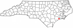 Location of Swansboro, North Carolina shown in North Carolina | |
| Coordinates: 34°41′36″N 77°7′38″W / 34.69333°N 77.12722°WCoordinates: 34°41′36″N 77°7′38″W / 34.69333°N 77.12722°W | |
| Country | United States |
| State | North Carolina |
| County | Onslow |
| Government | |
| • Mayor | John Davis |
| Area | |
| • Total | 2.40 sq mi (6.21 km2) |
| • Land | 2.25 sq mi (5.83 km2) |
| • Water | 0.14 sq mi (0.37 km2) |
| Elevation | 16 ft (5 m) |
| Population (2010) | |
| • Total | 2,663 |
| • Estimate (2019)[4] | 3,344 |
| • Density | 1,484.90/sq mi (573.21/km2) |
| Time zone | UTC-5 (Eastern (EST)) |
| • Summer (DST) | UTC-4 (EDT) |
| ZIP code | 28584 |
| Area code(s) | 910 |
| FIPS code | 37-66360[2] |
| GNIS feature ID | 1022865[3] |
| Website | http://swansboro-nc.org/ |

Swansboro is a town in Onslow County, North Carolina, United States, located along the Atlantic Ocean. In 2010, the population was 2,663.
History[]
Swansboro started as a settlement around the plantation of Theophilus Weeks. In 1783, Swansboro was incorporated as a town, taking its name from Samuel Swann, a Speaker in the North Carolina House of Commons and a resident of Onslow County. In 1818, Otway Burns built the Prometheus, the first river steamboat constructed in North Carolina.
The town, originally spelled Swannsborough, is sometimes called "The Friendly City by the Sea". M.N. Lisk, a popular Swansboro mayor, initiated the annual Mullet Festival,[5] one of the first coastal seafood festivals in North Carolina.
The town is featured as the setting of Nicholas Sparks' novel The Guardian.
The Swansboro Historic District was listed on the National Register of Historic Places in 1990.[6]
In 2018, Swansboro was among the hardest hit cities by Hurricane Florence. A record 30.58 inches (77 cm) of rain fell at Swansboro, North Carolina, breaking the previous state record of 24.06 inches (61 cm).[7]
Geography[]
Swansboro is located at 34°41′36″N 77°7′38″W / 34.69333°N 77.12722°W (34.693327, -77.127327).[8]
According to the United States Census Bureau, the town has a total area of 1.3 square miles (3.4 km2), of which, 1.2 square miles (3.1 km2) of it is land and 0.1 square miles (0.26 km2) of it (8.96%) is water.
Town government[]
The Town of Swansboro is governed by five Board of Commissioner members and the Mayor. The Commissioners are elected for four-year and two-year terms. The Mayor is elected for four-year term. They are elected as Town-wide representatives. The Mayor presides at all meetings as the "Chairman" of the Board of Commissioners. The mayor votes only to break a tie and the Mayor Pro Tem is appointed by the Commissioners and conducts the meetings in the absence of the Mayor.[9]
Demographics[]
| Historical population | |||
|---|---|---|---|
| Census | Pop. | %± | |
| 1850 | 801 | — | |
| 1870 | 141 | — | |
| 1880 | 128 | −9.2% | |
| 1890 | 233 | 82.0% | |
| 1900 | 265 | 13.7% | |
| 1910 | 390 | 47.2% | |
| 1920 | 420 | 7.7% | |
| 1930 | 394 | −6.2% | |
| 1940 | 454 | 15.2% | |
| 1950 | 559 | 23.1% | |
| 1960 | 1,104 | 97.5% | |
| 1970 | 1,207 | 9.3% | |
| 1980 | 976 | −19.1% | |
| 1990 | 1,165 | 19.4% | |
| 2000 | 1,426 | 22.4% | |
| 2010 | 2,663 | 86.7% | |
| 2019 (est.) | 3,344 | [4] | 25.6% |
| U.S. Decennial Census[10] | |||
As of the census of 2000, there were 1,426 people, 655 households, and 419 families residing in the town. The population density was 1,168.2 people per square mile (451.3/km2). There were 770 housing units at an average density of 630.8 per square mile (243.7/km2). The racial makeup of the town was 90.18% White, 4.63% African American, 0.21% Native American, 0.77% Asian, 0.91% from other races, and 3.30% from two or more races. Hispanic or Latino of any race were 2.81% of the population.
There were 655 households, out of which 28.9% had children under the age of 18 living with them, 44.6% were married couples living together, 15.0% had a female householder with no husband present, and 36.0% were non-families. 32.4% of all households were made up of individuals, and 13.1% had someone living alone who was 65 years of age or older. The average household size was 2.18 and the average family size was 2.72.
In the town, the population was spread out, with 24.4% under the age of 18, 7.6% from 18 to 24, 28.1% from 25 to 44, 23.1% from 45 to 64, and 16.8% who were 65 years of age or older. The median age was 38 years. For every 100 females, there were 83.5 males. For every 100 females age 18 and over, there were 81.2 males.
The median income for a household in the town was $37,740, and the median income for a family was $45,357. Males had a median income of $32,188 versus $25,556 for females. The per capita income for the town was $19,625. About 10.3% of families and 11.9% of the population were below the poverty line, including 18.9% of those under age 18 and 7.6% of those age 65 or over.
Education[]
- Queens Creek Elementary School
- Swansboro Elementary School
- Swansboro Middle School
- Swansboro High School
Tourism[]
Swansboro sits across the Intracoastal Waterway from Hammocks Beach State Park and is a popular destination for tourists, outdoor enthusiasts and recreational fishermen.
The city has a diverse selection of restaurants (including Yana's Ye Olde Drug Store diner and Icehouse Waterfront) and shopping much of which is located along the Intracoastal Waterway or White Oak River basin. Residents and visitors alike have multiple boating facilities to choose from (including Casper's Marina and Dudley's Marina) and many restaurants allow for boaters to dock outside their establishments.
The Rotary Club of Swansboro is active in the community and regularly hosts events such as the annual King Mackerel Tournament and numerous fundraising gatherings. During the summers, the Seaside Arts Council hosts weekly concerts aptly named "Swan Fest" on Sunday evenings at the Pavilion in Olde Town Square.
Notable people[]
- Otway Burns, (c. 1775–1850), privateer and North Carolina State Senator, was born at Queen's Creek near Swansboro.
References[]
- ^ "2019 U.S. Gazetteer Files". United States Census Bureau. Retrieved July 27, 2020.
- ^ "U.S. Census website". United States Census Bureau. Retrieved 2008-01-31.
- ^ "US Board on Geographic Names". United States Geological Survey. 2007-10-25. Retrieved 2008-01-31.
- ^ Jump up to: a b "Population and Housing Unit Estimates". United States Census Bureau. May 24, 2020. Retrieved May 27, 2020.
- ^ The Official Town of Swansboro, North Carolina Website
- ^ "National Register Information System". National Register of Historic Places. National Park Service. July 9, 2010.
- ^ [1]
- ^ "US Gazetteer files: 2010, 2000, and 1990". United States Census Bureau. 2011-02-12. Retrieved 2011-04-23.
- ^ The Official Town of Swansboro, North Carolina Website
- ^ "Census of Population and Housing". Census.gov. Retrieved June 4, 2015.
External links[]
- Tourism website
- Town website
- Swansboro Chamber of Commerce
- Swansboro NC InsiderInfo.us Area Guide
 Swansboro travel guide from Wikivoyage
| show Municipalities and communities of Onslow County, North Carolina, United States |
|---|

| show Authority control |
|---|
- Towns in North Carolina
- Towns in Onslow County, North Carolina
- Populated places established in 1783
- Populated coastal places in North Carolina