Syracuse, Kansas
Syracuse, Kansas | |
|---|---|
City and County seat | |
 Downtown Syracuse (2010) | |
 Location within Hamilton County and Kansas | |
 | |
| Coordinates: 37°58′59″N 101°45′4″W / 37.98306°N 101.75111°WCoordinates: 37°58′59″N 101°45′4″W / 37.98306°N 101.75111°W | |
| Country | United States |
| State | Kansas |
| County | Hamilton |
| Founded | 1873 |
| Incorporated | 1887 |
| Named for | Syracuse, New York |
| Area | |
| • Total | 4.10 sq mi (10.62 km2) |
| • Land | 4.10 sq mi (10.62 km2) |
| • Water | 0.00 sq mi (0.00 km2) |
| Elevation | 3,232 ft (985 m) |
| Population | |
| • Total | 1,812 |
| • Estimate (2019)[3] | 1,706 |
| • Density | 416.20/sq mi (160.69/km2) |
| Time zone | UTC-7 (Mountain (MST)) |
| • Summer (DST) | UTC-6 (MDT) |
| ZIP code | 67878 |
| Area code | 620 |
| FIPS code | 20-69850 [4] |
| GNIS ID | 0471583 [5] |
| Website | syracuseks.gov |

Syracuse is a city in and the county seat of Hamilton County, Kansas, United States.[6] As of the 2010 census, the city population was 1,812.[7]
History[]
Syracuse began its existence as a stop on the Atchison, Topeka and Santa Fe Railway. The site was originally called Holidayburg or Holliday in honor of Cyrus K. Holliday, first President of the ATSF railway. In 1873 a group of settlers from Syracuse, New York arrived and the site was renamed to Syracuse.[8][9] In 1886, Syracuse was recognized as the county seat of Hamilton County.[10] Syracuse secured its place in American history on April 5, 1887 by electing an all-woman city council, the first in the nation. The council consisted of Mrs. N. E. Wheeler (mayor), Caroline Johnson Barber, Mrs. W. A. Swartwood, Mrs. S. P. Nott, Mrs. Charles Coe, and Mrs. G. C. Riggles. [11][12]
By 1912, Syracuse was home to more than a thousand souls, 2 banks, a hotel belonging to the Fred Harvey Company, a flour mill, several machine shops, 2 weekly newspapers (Syracuse Journal and the Republican-News), 4 churches, a county high school with 10 teachers, a telegraph and express office, and an international money order post office.[13][14]
Geography[]
Syracuse is located at 37°58′59″N 101°45′04″W / 37.982938°N 101.751224°W (37.982938, -101.751224),[15] along U.S. Route 50 and the Atchison, Topeka and Santa Fe Railway, sixteen miles (twenty-six kilometers) from the Colorado border. The Arkansas River runs just south of the City of Syracuse. The countryside south of the Arkansas River is marked by sandhills. Located within these sandhills is the "Syracuse Sand Dunes," a city park covering 1,300 acres (5.3 km2), including a 40-acre (160,000 m2) fishing pond.
According to the United States Census Bureau, the city has a total area of 4.10 square miles (10.62 km2), all of it land.[16]
Climate[]
According to the Köppen Climate Classification system, Syracuse has a semi-arid climate, abbreviated "BSk" on climate maps.[17]
Demographics[]
| Historical population | |||
|---|---|---|---|
| Census | Pop. | %± | |
| 1890 | 324 | — | |
| 1900 | 460 | 42.0% | |
| 1910 | 1,126 | 144.8% | |
| 1920 | 1,059 | −6.0% | |
| 1930 | 1,383 | 30.6% | |
| 1940 | 1,226 | −11.4% | |
| 1950 | 2,075 | 69.2% | |
| 1960 | 1,888 | −9.0% | |
| 1970 | 1,720 | −8.9% | |
| 1980 | 1,654 | −3.8% | |
| 1990 | 1,606 | −2.9% | |
| 2000 | 1,824 | 13.6% | |
| 2010 | 1,812 | −0.7% | |
| 2019 (est.) | 1,706 | [3] | −5.8% |
| U.S. Decennial Census | |||
2010 census[]
As of the census[2] of 2010, there were 1,812 people, 715 households, and 460 families living in the city. The population density was 442.0 inhabitants per square mile (170.7/km2). There were 832 housing units at an average density of 202.9 per square mile (78.3/km2). The racial makeup of the city was 76.7% White, 0.2% African American, 1.8% Native American, 0.2% Asian, 0.1% Pacific Islander, 19.4% from other races, and 1.6% from two or more races. Hispanic or Latino of any race were 32.7% of the population.
There were 715 households, of which 37.1% had children under the age of 18 living with them, 51.6% were married couples living together, 9.0% had a female householder with no husband present, 3.8% had a male householder with no wife present, and 35.7% were non-families. 31.5% of all households were made up of individuals, and 14.3% had someone living alone who was 65 years of age or older. The average household size was 2.53 and the average family size was 3.23.
The median age in the city was 32.1 years. 28.7% of residents were under the age of 18; 9.8% were between the ages of 18 and 24; 25.5% were from 25 to 44; 22.4% were from 45 to 64; and 13.5% were 65 years of age or older. The gender makeup of the city was 50.6% male and 49.4% female.
2000 census[]
As of the census[4] of 2000, there were 1,824 people, 742 households, and 483 families living in the city. The population density was 1,374.0 people per square mile (529.5/km2). There were 830 housing units at an average density of 625.2 per square mile (241.0/km2). The racial makeup of the city was 79.22% White, 0.71% African American, 0.27% Native American, 0.82% Asian, 17.65% from other races, and 1.32% from two or more races. Hispanic or Latino of any race were 22.42% of the population.
There were 742 households, out of which 33.7% had children under the age of 18 living with them, 53.5% were married couples living together, 7.7% had a female householder with no husband present, and 34.9% were non-families. 32.6% of all households were made up of individuals, and 17.7% had someone living alone who was 65 years of age or older. The average household size was 2.46 and the average family size was 3.13.
In the city, the population was spread out, with 29.2% under the age of 18, 7.6% from 18 to 24, 25.5% from 25 to 44, 20.4% from 45 to 64, and 17.2% who were 65 years of age or older. The median age was 36 years. For every 100 females, there were 95.9 males. For every 100 females age 18 and over, there were 90.7 males.
The median income for a household in the city was $31,250, and the median income for a family was $37,976. Males had a median income of $29,000 versus $23,482 for females. The per capita income for the city was $15,531. About 10.7% of families and 15.0% of the population were below the poverty line, including 20.0% of those under age 18 and 11.6% of those age 65 or over.
Education[]
is the unified high school for Hamilton County USD 494.[18] The Syracuse school mascot is Bulldogs.[19]
Gallery[]
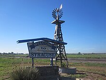
Syracuse welcome sign.

Northrup Theater in downtown Syracuse.

Syracuse High School Bulldog mascot.

Hamilton County courthouse.


See also[]
References[]
- ^ "2019 U.S. Gazetteer Files". United States Census Bureau. Retrieved July 24, 2020.
- ^ Jump up to: a b "U.S. Census website". United States Census Bureau. Retrieved 2012-07-06.
- ^ Jump up to: a b "Population and Housing Unit Estimates". United States Census Bureau. May 24, 2020. Retrieved May 27, 2020.
- ^ Jump up to: a b "U.S. Census website". United States Census Bureau. Retrieved 2008-01-31.
- ^ "US Board on Geographic Names". United States Geological Survey. 2007-10-25. Retrieved 2008-01-31.
- ^ "Find a County". National Association of Counties. Retrieved 2011-06-07.
- ^ "2010 City Population and Housing Occupancy Status". U.S. Census Bureau. Retrieved March 27, 2011.[dead link]
- ^ Kansas State Historical Society (1916). Biennial Report of the Board of Directors of the Kansas State Historical Society. Kansas State Printing Plant. pp. 201.
- ^ "Profile for Syracuse, Kansas". ePodunk. Retrieved 11 June 2014.
- ^ "County Overview and History in Hamilton County, KS".
- ^ "Hamilton County, Kansas - Kansapedia - Kansas Historical Society".
- ^ "Clarissa Nichols, Susanna Salter, N.E. Wheeler, Minnie D. Morgan, Mary D. Lowman". 25 November 2020.
- ^ "Syracuse - KS-Cyclopedia - 1912".
- ^ https://thesyracusejournal.com/
- ^ "US Gazetteer files: 2010, 2000, and 1990". United States Census Bureau. 2011-02-12. Retrieved 2011-04-23.
- ^ "US Gazetteer files 2010". United States Census Bureau. Archived from the original on 2012-01-25. Retrieved 2012-07-06.
- ^ Climate Summary for Syracuse, Kansas
- ^ "USD 494 Syracuse". USD 494. Retrieved 8 January 2017.
- ^ maxpreps.com
Further reading[]
External links[]
| Wikimedia Commons has media related to Syracuse, Kansas. |
- City of Syracuse
- Syracuse - Directory of Public Officials
- USD 494, local school district
- Syracuse City Map, KDOT
| hide Municipalities and communities of Hamilton County, Kansas, United States | ||
|---|---|---|
| Cities |  | |
| Unincorporated community | ||
| Townships | ||
| ||
| show Authority control |
|---|
- Cities in Kansas
- County seats in Kansas
- Cities in Hamilton County, Kansas
- Kansas populated places on the Arkansas River
- 1873 establishments in Kansas
- Populated places established in 1873