Taipower Building metro station
Taipower Building 台電大樓 | |||||||||||
|---|---|---|---|---|---|---|---|---|---|---|---|
 Platform | |||||||||||
| Chinese name | |||||||||||
| Traditional Chinese | 台電大樓 | ||||||||||
| |||||||||||
| General information | |||||||||||
| Location | B1F 63-3 Sec. 3 Roosevelt Rd. Zhongzheng and Da'an, Taipei Taiwan | ||||||||||
| Operated by |
| ||||||||||
| Line(s) |
| ||||||||||
| Connections | Bus stop | ||||||||||
| Construction | |||||||||||
| Structure type | Underground | ||||||||||
| Other information | |||||||||||
| Station code | G08 | ||||||||||
| History | |||||||||||
| Opened | 11 November 1999 | ||||||||||
| Passengers | |||||||||||
| daily (December 2020)[1] | |||||||||||
| Rank | 71 out of 109 and 5 others | ||||||||||
| Services | |||||||||||
| |||||||||||
The Taipei Metro Taipower Building station is a station on the Xindian Line located on the border in Taipei, Taiwan.
Station overview[]

Taipower Building station exit 2

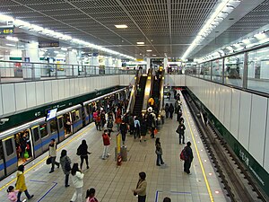
Taipower Building station platform
The two-level, underground station has an island platform and five exits.[2][3] Some trains from Songshan terminate here and reenter service by utilizing the pocket track south of the station.
History[]
During initial planning in 1980, the station was to be named Sanzong (三總), after the Tri-Service General Hospital which has since relocated to Neihu.
Station layout[]
| Street Level | Entrance/Exit | Entrance/Exit |
| B1 | Concourse | Lobby, information counter, automatic ticket-dispensing machines, one-way faregates |
| Restrooms(North side outside fare zone, near exit 2) | ||
| B2 | Platform 1 | ← |
| Island platform, doors will open on the left | ||
| Platform 2 | → → | |
Songshan–Xindian Line trains terminate here during non-rush hours.
Around the station[]
- Taipei Cultural Mosque
- Shida Park
See also[]
- List of railway stations in Taiwan
References[]
| Wikimedia Commons has media related to Taipower Building Station. |
- ^ "Passenger Volume at Taipei Rapid Transit Stations". Taipei Mass Rapid Transit Co., Ltd. 2021-01-15.
- ^ "Route Map: Taipower Building". Taipei Rapid Transit Corporation. Archived from the original on 2010-08-08. Retrieved 2010-06-14.
- ^ "第二章 站場規劃". Department of Rapid Transit Systems. Retrieved 2011-05-15.
| Stations |
| ||||||||
|---|---|---|---|---|---|---|---|---|---|
| Rolling stock |
| ||||||||
Coordinates: 25°01′14″N 121°31′42″E / 25.020522°N 121.528325°E

This Taiwanese rapid transit article is a stub. You can help Wikipedia by . |
Categories:
- 1999 establishments in Taiwan
- Railway stations opened in 1999
- Songshan–Xindian line stations
- Taiwan rapid transit stubs