Tama, Tokyo
Tama
多摩市 | |
|---|---|
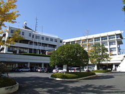 Tama City Hall | |
 Flag  Seal | |
 Location of Tama in Tokyo | |
 Tama | |
| Coordinates: 35°38′13″N 139°26′46.6″E / 35.63694°N 139.446278°ECoordinates: 35°38′13″N 139°26′46.6″E / 35.63694°N 139.446278°E | |
| Country | Japan |
| Region | Kantō |
| Prefecture | Tokyo |
| Area | |
| • Total | 21.01 km2 (8.11 sq mi) |
| Population (March 2021) | |
| • Total | 148,285 |
| • Density | 7,100/km2 (18,000/sq mi) |
| Time zone | UTC+9 (Japan Standard Time) |
| Symbols | |
| • Tree | Ginkgo biloba |
| • Flower | Prunus serrulata |
| • Bird | Oriental turtle dove |
| Phone number | 042-375-8111 |
| Address | 6-12-1 Sekido, Tama-shi, Tokyo 206-8666 |
| Website | Official website |


Tama (多摩市, Tama-shi) is a city located in the western portion of Tokyo Metropolis, Japan. As of 11 March 2021, the city had an estimated population of 148,285 in 73,167 households, and a population density of 7,100 inhabitants per square kilometre (18,000/sq mi).[1] The total area of the city was 21.01 square kilometres (8.11 sq mi).
Geography[]
Tama is located in the foothills of the Okutama Mountains of southwestern Tokyo, known as Tama Hills, which spans Tokyo and Kanagawa Prefecture. The entire region is historically referred to as Tama; therefore there are many place names scattered throughout the area with references to the name "Tama" which are not within the city limits. The Tama River marks the city's northern boundary, and Kanagawa Prefecture is to the south. Its southern half forms part of the Tama New Town project, Japan's largest residential development, constructed in the 1970s.
Surrounding municipalities[]
Tokyo Metropolis
Climate[]
Tama has a Humid subtropical climate (Köppen Cfa) characterized by warm summers and cool winters with light to no snowfall. The average annual temperature in Tama is 14.0 °C. The average annual rainfall is 1647 mm with September as the wettest month. The temperatures are highest on average in August, at around 25.3 °C, and lowest in January, at around 2.8 °C.[2]
Demographics[]
Per Japanese census data,[3] the population of Tama increased very rapidly in the 1970s and 1980s.
| Year | Pop. | ±% |
|---|---|---|
| 1920 | 4,111 | — |
| 1930 | 4,497 | +9.4% |
| 1940 | 5,158 | +14.7% |
| 1950 | 7,394 | +43.4% |
| 1960 | 9,746 | +31.8% |
| 1970 | 30,672 | +214.7% |
| 1980 | 95,248 | +210.5% |
| 1990 | 144,489 | +51.7% |
| 2000 | 145,862 | +1.0% |
| 2010 | 147,541 | +1.2% |
History[]
- The area of present-day Tama was part of ancient Musashi Province. In the post-Meiji Restoration cadastral reform of July 22, 1878, the area became part of Minamitama District in Kanagawa Prefecture.
- Tama Village was founded on April 1, 1889 from the merger of 11 pre-Meiji period hamlets with the establishment of the modern municipalities system.
- Minamitama District was transferred to the administrative control of Tokyo Metropolis on April 1, 1893.
- Tama was elevated to town status on April 1, 1964. Construction of Tama New Town began in 1966, and the first occupants started moving in 1971.
- On November 1, 1971, Tama Town was reclassified as Tama City, dissolving Minamitama District. Tama was the last town in the former Minamitama District.
Government[]
Tama has a mayor-council form of government with a directly elected mayor and a unicameral city council of 26 members. Tama, together with the city of Inagi, contributes two members to the Tokyo Metropolitan Assembly. In terms of national politics, the city is divided between and of the lower house of the Diet of Japan.
Economy[]
Several companies have their headquarters in the city:
Education[]
Universities and colleges[]
- Keisen University Tama Campus
- Kokushikan University Tama Campus
- Otsuma Women's University Tama Campus
- Tama University Tama Campus
- Teikyo University Hachioji Campus
- University of Tokyo Health Sciences
- National Farmer's Academy
Elementary and secondary schools[]
- The Tama city government operates 17 public elementary and nine public middle schools. There is also one private elementary school and one private middle school.
- The Tokyo Metropolitan Government Board of Education operates Nagayama High School,[6] the one public high school. There are also two private combined middle/high schools.
Transportation[]
Railway[]
- Seiseki-Sakuragaoka
![]() Keio Corporation - Keiō Sagamihara Line
Keio Corporation - Keiō Sagamihara Line
![]() Odakyu Electric Railway - Odakyū Tama Line
Odakyu Electric Railway - Odakyū Tama Line
- Tama Center
Highway[]
Tama is not served by any national expressways or national highways
Military facilities[]
- Tama Hills, a recreational facility of the U.S. Air Force, intended for use by United States service members and their families, as well as Japan Maritime Self-Defense Force service members and their families.
Local attractions[]
- Sanrio Puroland Amusement Park
- Thirteen Buddhas of Tama
Sister cities[]
 Japan - Fujimi, Nagano in Japan.[citation needed]
References[]
- ^ "Tama city official statistics" (in Japanese). Japan.
- ^ Tama climate data
- ^ Musashino population statistics
- ^ "Company Information." Mitsumi Electric Retrieved on June 16, 2015.
- ^ "Corporate Outline." JUKI Retrieved on August 4, 2015.
- ^ [1]
External links[]
| Wikimedia Commons has media related to Tama, Tokyo. |
| Wikivoyage has a travel guide for Tama. |
- Tama City Official Website (in Japanese)
| show Authority control |
|---|
- Tama, Tokyo
- Cities in Tokyo
- Western Tokyo