Tandora County

From Wikipedia, the free encyclopedia

Map all coordinates using: OpenStreetMap 
Download coordinates as: KML
Tandora
New South Wales
Tandora NSW.PNG
Location in New South Wales
Lands administrative divisions around Tandora:
Mootwingee Mootwingee Young
Yancowinna Tandora Livingstone
Menindee Menindee Livingstone

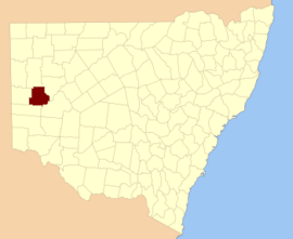
Tandora County is one of the 141 Cadastral divisions of New South Wales. It is located to the north west of the Darling River, to the area to the north (but not including) Menindee.

The name Tandora is of unknown origin.[1][failed verification]

Parishes within this county[]

A full list of parishes found within this county; their current LGA and mapping coordinates to the approximate centre of each location is as follows:

Parish LGA Coordinates
Unincorporated 32°08′34″S 142°16′15″E / 32.14278°S 142.27083°E / -32.14278; 142.27083 (Bellar)
Unincorporated 31°56′18″S 142°24′03″E / 31.93833°S 142.40083°E / -31.93833; 142.40083 (Burke)
Unincorporated 31°44′00″S 142°13′48″E / 31.73333°S 142.23000°E / -31.73333; 142.23000 (Burnayto)
Unincorporated 31°34′55″S 142°24′09″E / 31.58194°S 142.40250°E / -31.58194; 142.40250 (Eckerboon)
Unincorporated 32°17′21″S 142°05′46″E / 32.28917°S 142.09611°E / -32.28917; 142.09611 (Hartung)
Unincorporated 32°00′56″S 142°24′28″E / 32.01556°S 142.40778°E / -32.01556; 142.40778 (Herbert)
Hume Central Darling Shire 32°18′43″S 142°22′37″E / 32.31194°S 142.37694°E / -32.31194; 142.37694 (Hume)
Unincorporated 32°15′05″S 142°13′34″E / 32.25139°S 142.22611°E / -32.25139; 142.22611 (Kars)
Central Darling Shire 32°08′50″S 142°26′36″E / 32.14722°S 142.44333°E / -32.14722; 142.44333 (Maiden)
Unincorporated 31°52′42″S 142°35′02″E / 31.87833°S 142.58389°E / -31.87833; 142.58389 (Malakoff)
Unincorporated 31°56′28″S 142°03′24″E / 31.94111°S 142.05667°E / -31.94111; 142.05667 (Malta)
Mulga Gaari Central Darling Shire 31°57′37″S 142°41′32″E / 31.96028°S 142.69222°E / -31.96028; 142.69222 (Mulga Gaari)
Unincorporated 32°03′22″S 142°16′15″E / 32.05611°S 142.27083°E / -32.05611; 142.27083 (Mulga)
Unincorporated 31°34′59″S 142°33′08″E / 31.58306°S 142.55222°E / -31.58306; 142.55222 (Mutlow)
Unincorporated 31°34′53″S 142°13′53″E / 31.58139°S 142.23139°E / -31.58139; 142.23139 (Nadbuck)
Nelia Gaari Central Darling Shire
Central Darling Shire 32°05′29″S 142°35′06″E / 32.09139°S 142.58500°E / -32.09139; 142.58500 (Pamamaroo)
Patterson Unincorporated 31°56′36″S 142°13′40″E / 31.94333°S 142.22778°E / -31.94333; 142.22778 (Patterson)
Quondong Unincorporated 32°16′02″S 141°58′40″E / 32.26722°S 141.97778°E / -32.26722; 141.97778 (Quondong)
Unincorporated 32°08′46″S 142°05′15″E / 32.14611°S 142.08750°E / -32.14611; 142.08750 (Silistria)
Sturt Unincorporated 31°43′56″S 142°24′07″E / 31.73222°S 142.40194°E / -31.73222; 142.40194 (Sturt)
Tandore Central Darling Shire 32°15′43″S 142°36′27″E / 32.26194°S 142.60750°E / -32.26194; 142.60750 (Tandore)
Titabaira Central Darling Shire 32°15′01″S 142°28′48″E / 32.25028°S 142.48000°E / -32.25028; 142.48000 (Titabaira)
Topar Unincorporated 31°44′57″S 142°03′07″E / 31.74917°S 142.05194°E / -31.74917; 142.05194 (Topar)
Weinteriga Central Darling Shire 32°10′01″S 142°39′54″E / 32.16694°S 142.66500°E / -32.16694; 142.66500 (Weinteriga)
Unincorporated 31°36′18″S 142°03′32″E / 31.60500°S 142.05889°E / -31.60500; 142.05889 (Wills)
Worungil Unincorporated 31°43′42″S 142°32′56″E / 31.72833°S 142.54889°E / -31.72833; 142.54889 (Worungil)

References[]

  1. ^ "Tandora". Geographical Names Register (GNR) of NSW. Geographical Names Board of New South Wales. Retrieved 4 August 2013. Edit this at Wikidata
Retrieved from ""