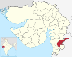
Tapi district
This article needs additional citations for verification. (January 2016) |
Tapi district | |
|---|---|
 Location of district in Gujarat | |
| Country | |
| State | Gujarat |
| Headquarters | Vyara |
| Government | |
| • Body | Nagar Palika |
| Area | |
| • Total | 3,139 km2 (1,212 sq mi) |
| Population (2011) | |
| • Total | 807,022 |
| • Density | 260/km2 (670/sq mi) |
| Languages | |
| • Official | Gujarati, Hindi, English |
| Time zone | UTC+5:30 (IST) |
| Area code(s) | 02624, 02625, 02626, 02628 |
| Vehicle registration | GJ 26 |
| Website | tapi |
Tapi district is one of the 33 districts of Gujarat state in western India. It has seven talukas Vyara, Songadh, Nizar, Valod, Uchhal, Dolavan, Kukarmunda. Vyara town is the district headquarters. Tapi has 523 villages and two municipalitites. The district was formed in 2007 out of some talukas that were separated from Surat district.[1] As of 2011, 90.15% of the district's population is rural and 84.2% of its population is Scheduled Tribes.[2]
Demographics[]
According to the 2011 census, Tapi district has a population of 807,022,[3] roughly equal to the nation of Comoros[4] or the US state of South Dakota.[5] This gives it a ranking of 484th in India (out of a total of 640).[3] The district has a population density of 234 inhabitants per square kilometre (610/sq mi) .[3] Its population growth rate over the decade 2001-2011 was 12.07%.[3] Tapi has a sex ratio of 1004 females for every 1000 males,[3] and a literacy rate of 69.23%.[3]
At the time of the 2011 Census of India, 49.09% of the population in the district spoke Gujarati, 14.53% Gamit, 9.96% Bhili, 8.02% Vasava, 5.96% Chodri, 4.39% Hindi, 2.86% Marathi and 1.81% Kukna as their first language.[6]
| Year | Pop. | ±% p.a. |
|---|---|---|
| 1901 | 155,894 | — |
| 1911 | 166,720 | +0.67% |
| 1921 | 167,361 | +0.04% |
| 1931 | 183,989 | +0.95% |
| 1941 | 221,965 | +1.89% |
| 1951 | 263,380 | +1.73% |
| 1961 | 329,134 | +2.25% |
| 1971 | 457,502 | +3.35% |
| 1981 | 527,971 | +1.44% |
| 1991 | 626,979 | +1.73% |
| 2001 | 719,634 | +1.39% |
| 2011 | 807,022 | +1.15% |
| source:[7] | ||
Notable persons[]
- Suresh Joshi (1921–1986) Writer and academic. Born in Valod.[8]
- Amarsinh Bhilabhai Chaudhary, Former Chief Minister of Gujarat (July 1985 to December 1989)
Tourism[]
The District shares Purna Wildlife Sanctuary with the Districts of Dang and Nandurbar, the latter of which is in Maharashtra. The sanctuary is a part of the Dangs' Forest.[9][10]
References[]
- ^ "About Tapi". Government of Gujarat.
- ^ "Tapi District Population, Caste, Religion Data (Gujarat) - Census 2011". Census 2011.
- ^ Jump up to: a b c d e f "District Census 2011". Census2011.co.in. 2011. Retrieved 30 September 2011.
- ^ US Directorate of Intelligence. "Country Comparison:Population". Retrieved 1 October 2011.
Comoros 794,683 July 2011 est.
- ^ "2010 Resident Population Data". U. S. Census Bureau. Retrieved 30 September 2011.
South Dakota 814,180
- ^ 2011 Census of India, Population By Mother Tongue
- ^ Decadal Variation In Population Since 1901
- ^ Mohan, Sarala Jag, Chapter 4: "Twentieth-Century Gujarati Literature" (Google books link), in Natarajan, Nalini, and Emanuel Sampath Nelson, editors, Handbook of Twentieth-century Literatures of India, Westport, Connecticut: Greenwood Publishing Group, 1996, ISBN 978-0-313-28778-7, retrieved December 10, 2008
- ^ "Mahal Eco Campsite". Gujarat Tourism. Retrieved 25 January 2017.
- ^ Significant bird records and local extinctions in Purna and Ratanmahal Wildlife Sanctuaries, Gujarat, India-PRANAV TRIVEDI and V. C. SONI
External links[]
| Wikimedia Commons has media related to Tapi district. |
Coordinates: 21°07′N 73°24′E / 21.12°N 73.4°E
- Tapi district
- 2007 establishments in Gujarat
- Districts of Gujarat
- Gujarat geography stubs

