Jamnagar district
Jamnagar District | |
|---|---|
| Nickname(s): Paris of Saurashtra, Choti Kashi | |
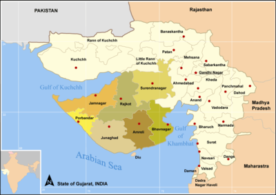
 Location of district in Gujarat | |
| Coordinates: 22°13′N 69°42′E / 22.217°N 69.700°ECoordinates: 22°13′N 69°42′E / 22.217°N 69.700°E | |
| Country | |
| State | Gujarat |
| Region | Saurashtra |
| Nawanagar | 1540 A.D. |
| Founded by | Jam Rawalji Jadeja |
| Named for | Jam, The title of Jadeja rulers. |
| Headquarters | Jamnagar |
| Area | |
| • Total | 14,184 km2 (5,476 sq mi) |
| Population (2011) | |
| • Total | 2,160,119 |
| • Density | 150/km2 (390/sq mi) |
| Demonym(s) | Halaree |
| Languages | |
| • Official | kutchi, Gujarati, Sanskrit, Sindhi, Hindi |
| Time zone | UTC+5:30 (IST) |
| Vehicle registration | GJ-10 |
| Website | gujaratindia |

Jamnagar District is a district of India located on the southern coast of the Gulf of Kutch in the state of Gujarat. Its headquarters are located in the eponymous city of Jamnagar. It hosts the production facilities of large Indian companies[1] such as Reliance. Among its attractions are several palaces,[1] a Marine National Park at Narara and a Bird Sanctuary, known as Khijadiya Bird Sanctuary.[2]

Talukas (administrative divisions)[]
Total 444 Villages In Jamnagar District
- Jam Jodhpur
- Jodiya
- Dhrol
- Jamnagar
- Lalpur
- Kalavad Taluka
Demographics[]
According to the 2011 census Jamnagar district has a population of 2,160,119,[3] roughly equal to the nation of Namibia[4] or the US state of New Mexico.[5] This gives it a district population ranking of 212th in India (out of a total of 640).[3] The district has a population density of 153 inhabitants per square kilometre (400/sq mi) .[3] Its population growth rate over the decade 2001-2011 was 13.38%.[3] Jamnagar has a sex ratio of 938 females for every 1000 males.[3] It had literacy rate of 66.4% in 2001 which rose impressively in a decade to literacy rate of 74.4% by 2011.[3]
At the time of the 2011 Census of India, 87.78% of the population in the district spoke Gujarati, 6.28% Sindhi and 2.53% Hindi as their first language.[6]
Geography[]
Geography. Jamnagar is located at 22°28′N 70°04′E / 22.47°N 70.07°E / 22.47; 70.07 It has an average elevation of 20 meters (65 ft). Jamnagar has a lake called Lakhota lake which is very popular in the world.
Climate[]
In Jamnagar, the wet season is oppressive and mostly cloudy, the dry season is humid and mostly clear, and it is hot and windy year round. Over the course of the year, the temperature typically varies from 15°c to 35°c and is rarely below 10°c or above 40°c. Average Annual Rainfall Near about 70 cm.
Historical Populations[]
| Year | Pop. | ±% p.a. |
|---|---|---|
| 1901 | 352,150 | — |
| 1911 | 359,604 | +0.21% |
| 1921 | 359,631 | +0.00% |
| 1931 | 425,463 | +1.70% |
| 1941 | 517,833 | +1.98% |
| 1951 | 616,896 | +1.77% |
| 1961 | 828,419 | +2.99% |
| 1971 | 1,111,343 | +2.98% |
| 1981 | 1,393,076 | +2.29% |
| 1991 | 1,563,558 | +1.16% |
| 2001 | 1,904,278 | +1.99% |
| 2011 | 2,160,119 | +1.27% |
| source:[7] | ||
See also[]
References[]
- ^ Jump up to: a b "Jamnagar District Map". Mapsofindia.com. 12 September 2011. Retrieved 12 March 2014.
- ^ Mustak Amin Mepani. "Jamnagar the beautiful - Tourist information". Jamnagar.org. Retrieved 12 March 2014.
- ^ Jump up to: a b c d e f "District Census 2011". Census2011.co.in. 2011. Retrieved 30 September 2011.
- ^ US Directorate of Intelligence. "Country Comparison:Population". Retrieved 1 October 2011.
Namibia 2,147,585
- ^ "2010 Resident Population Data". U. S. Census Bureau. Archived from the original on 19 October 2013. Retrieved 30 September 2011.
New Mexico - 2,059,179
- ^ 2011 Census of India, Population By Mother Tongue
- ^ Decadal Variation In Population Since 1901
External links[]
| Wikimedia Commons has media related to Jamnagar district. |
| show Places adjacent to Jamnagar district |
|---|

| show Authority control |
|---|
This article about a location in Jamnagar district, Gujarat, India is a stub. You can help Wikipedia by . |
- Jamnagar district
- Districts of Gujarat
- Gujarat geography stubs