Valsad
Valsad
Bulsar | |
|---|---|
City | |
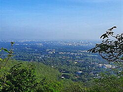 Valsad City View from Parnera Hill | |
| Nickname(s): City of Peace | |
 Valsad | |
| Coordinates: 20°36′36″N 72°55′34″E / 20.610°N 72.926°ECoordinates: 20°36′36″N 72°55′34″E / 20.610°N 72.926°E | |
| Country | |
| District | Valsad |
| Elevation | 13 m (43 ft) |
| Population (2011)[1] | |
| • Total | 170,060 |
| Demonym(s) | Valsadians, Valsadis |
| Languages | |
| • Official | Gujarati |
| Time zone | UTC+5:30 (IST) |
| PIN | 396001 |
| Telephone code | 912632 |
| Vehicle registration | GJ-15 |
| Sex ratio | 926/1000 ♂/♀ |
| Literacy | 80.94 % |


Valsad (Pronunciation: [ʋalsɑɖ]), historically known as Bulsar, is a city and a municipality in Valsad district of the Indian state of Gujarat. It is the district headquarters of Valsad district.[2]
Etymology[]
The name "Valsad" derives from vad-saal, a Gujarati language compound meaning "hampered (saal) by banyan trees (vad)" (the area was naturally rich in banyan trees). During British Raj, it was historically known as "Bulsar".
Geography[]
Valsad is located at 20°38′N 72°56′E / 20.63°N 72.93°E.[3] It has an average elevation of 13 metres (42 feet). The old city is about 4 km inland from the Arabian sea.
| Geography of Valsad City:[4] | |
|---|---|
| Average rainfall | 1500 mm |
| Average temperature | 26.9 °C |
| Seismic Zone | Zone III |
| Major rivers | Auranga, Wanki |
| Beaches | Tithal Beach |
Climate[]
Valsad has a tropical savanna climate (Aw) with little to no rainfall from October to May and very heavy to extremely heavy rainfall from June to September when it is under the direct influence of Arabian Sea branch of the South-west monsoon.
| hideClimate data for Valsad, India (1981-2010, extremes 1974–2012) | |||||||||||||
|---|---|---|---|---|---|---|---|---|---|---|---|---|---|
| Month | Jan | Feb | Mar | Apr | May | Jun | Jul | Aug | Sep | Oct | Nov | Dec | Year |
| Record high °C (��F) | 36.9 (98.4) |
38.8 (101.8) |
42.3 (108.1) |
43.1 (109.6) |
41.9 (107.4) |
38.1 (100.6) |
36.8 (98.2) |
33.4 (92.1) |
36.4 (97.5) |
38.9 (102.0) |
38.1 (100.6) |
36.7 (98.1) |
43.1 (109.6) |
| Average high °C (°F) | 29.6 (85.3) |
29.7 (85.5) |
32.4 (90.3) |
33.8 (92.8) |
33.8 (92.8) |
32.5 (90.5) |
30.1 (86.2) |
29.3 (84.7) |
30.4 (86.7) |
32.9 (91.2) |
32.4 (90.3) |
31.4 (88.5) |
31.5 (88.7) |
| Average low °C (°F) | 14.6 (58.3) |
15.8 (60.4) |
19.1 (66.4) |
22.8 (73.0) |
26.0 (78.8) |
26.2 (79.2) |
24.9 (76.8) |
24.5 (76.1) |
23.9 (75.0) |
22.2 (72.0) |
18.7 (65.7) |
15.6 (60.1) |
21.2 (70.2) |
| Record low °C (°F) | 7.1 (44.8) |
5.6 (42.1) |
10.6 (51.1) |
17.1 (62.8) |
19.8 (67.6) |
17.0 (62.6) |
16.8 (62.2) |
15.6 (60.1) |
16.8 (62.2) |
12.6 (54.7) |
10.4 (50.7) |
7.0 (44.6) |
5.6 (42.1) |
| Average rainfall mm (inches) | 0.3 (0.01) |
0.0 (0.0) |
0.1 (0.00) |
0.0 (0.0) |
3.0 (0.12) |
274.6 (10.81) |
576.0 (22.68) |
381.4 (15.02) |
218.4 (8.60) |
32.6 (1.28) |
13.3 (0.52) |
0.6 (0.02) |
1,500.3 (59.07) |
| Average rainy days | 0.0 | 0.0 | 0.0 | 0.0 | 0.4 | 7.9 | 15.5 | 15.5 | 9.0 | 1.4 | 0.5 | 0.1 | 50.3 |
| Average relative humidity (%) (at 17:30 IST) | 54 | 53 | 50 | 58 | 66 | 75 | 82 | 84 | 79 | 67 | 56 | 55 | 65 |
| Source: India Meteorological Department[5][6] | |||||||||||||
Demographics[]
As of the 2011 India census,[7] Valsad (metropolitan area) has a population of 170,060. Males constitute 51% of the population and females 49%. Valsad has an average literacy rate of 91.66%, higher than the national average of 74.04%: male literacy is 94.62%, and female literacy is 88.58%.
The major language spoken is Gujarati. Other languages spoken are Hindi, Marathi and English.
The major religion followed in Valsad is Hinduism. Other religions followed are Islam, Christianity, Jainism, Zoroastrianism and Buddhism.
Transport[]

Valsad lies on NH 48. Valsad is connected to many cities in Gujarat by the Gujarat State Road Transport Corporation bus service. Valsad is one of the 16 divisions of GSRTC referred as Daman Ganga. Following bus depots come under Valsad division: Valsad, Vapi, Navsari, Bilimora, Dharampur and Ahwa.
Valsad railway station is managed by the Mumbai WR railway division of the Western Railway and it is a Sub-Division under Western Railway. It lies on the New Delhi–Mumbai main line. The present railway station building was established in 1925. Adjacent to the railway station is the Valsad Electric Loco Shed which houses over 100 electric locomotives.
The nearest airport is Surat Airport in Surat.
Economy[]
Valsad is an industrial base for sectors such as chemicals, textiles, and paper & pulp industries. Since the 1980s, textile and chemicals have been the major sectors of investments and employment in the district. Valsad is emerging as a horticulture hub of the state, witnessing significant production in food grains and crops.
Valsad has 7 Industrial Estates located in Dungra, Pardi, Dharampur, Bhilad, Valsad, Umbergaon, Sarigam, Vapi (the chemical hub of Gujarat) and 1 Industrial park in Kalgam.[8] With over 300 medium and large scale industries, Vapi is a major industrial center in Valsad. One of Asia's largest Common Effluent Treatment Plant (CETP) is present in Vapi, owned by Vapi Waste & Effluent Management Company and promoted by Vapi Industrial Association.[9]
Over 10,716 units of small and medium enterprises (SMEs), involved in different sectors, such as chemicals, textiles, engineering, and paper industry, are present in the district. Several private conglomerates are present in Valsad, such as Alok Industries Ltd., Wyeth, Welspun India Ltd. Hubergroup India Private Limited (formerly Micro Inks Ltd.), Meril Group of companies (Meril Life Sciences Pvt. Ltd., Meril Healthcare Pvt. Ltd., Meril Endo Surgery Pvt. Ltd. and Meril Diagnostics Pvt. Ltd.), Aarti Industries, Atul Limited, Gujarat Heavy Chemicals Ltd. (GHCL), Raymond, Sun Pharmaceuticals, United Phosphorus, Pidilite, Polyols & Polymers and Vadilal, Unique Polymers.
Education[]
Colleges[]
- GMERS Medical College, est 2014
- Government Engineering College, est 2004
- Government Polytechnic, est 1965
- Smt. J.P. Shroff Arts College
- Shah N.H. Commerce College
- Dhiru-Sarla Institute of Management and Commerce
- B.K.M. Science College
- Dolat-Usha Institute of Applied Sciences
- Shah K.M. Law College
Schools[]
- Affiliated with ICSE
- Atul Vidyalaya School
- Affiliated with the CBSE
- Saraswati International School
- Shree Vallabh Ashram's MGM Amin & V N Savani International School
- Shree Vallabh Sanskar Dham's Smt. Shobhaben Pratapbhai Patel Day Boarding School
- Shree Vallabh Ashram's MCM Kothari Girl's Residential School
- Western Railway English Medium Secondary School
- Affiliated with the GSHSEB
- D.M.D.G. Municipal High School
- Jamnabai Sarvajanik Kanya Vidyalaya
- Maniba Sarvajanik Vidyalaya
- Shah Khimchand Mulji Sarvajanik High School
- St. Joseph's English Teaching High School
- St Mary's High school.
- Bai Ava Bai High School
- BAPS Swaminarayan Vidhyamandir
- G.V.D. Sarvajanik High School
- Sett Rustomjee Jamsetjee Jejeebhoy or Sett R.J.J High School
- R.M. & V.M. Desai Vidyalaya
- Swaminarayan High School
- Gayatri High School
- Kusum Vidyalaya
- C.B High school
Tourist Attraction[]

Tithal Beach is located near Tithal town. The sand of the beach is black sand. Tithal Beach Festival and International Kite Festival are also organized on the shore of the beach.
Shree Shirdi Saibaba Sansthapan is located on the shore of the beach in Tithal town of Valsad district. The temple was established in 1982.

Shri Swaminarayan Mandir is located on the shore of the beach in Tithal town of Valsad district. This is a temple of Lord Swami Narayan.
Shantidham Aradhana Kendra in Tithal is a meditation centre.[10]
Tadkeshwar Mahadev Temple is a temple of Lord Shiva located in Abrama. This temple is more than 800 years old.
Morarji Desai Museum is built to dedicate former 5th Prime Minister of India, Morarji Desai in Valsad. The museum was developed by Valsad municipality at a cost of Rs. 4 crore. The museum was inaugurated by former Chief Minister of Gujarat, Anandiben Patel.[11]
Callian Baug is an urban park in Valsad. In 1929, Mr. Motilal Callianji presented donation for park to Valsad Municipality in memory of his father. In 1931, Callian Baug was opened by J.H.Garrett.[12]
Notable people[]
- Bhavesh Baria - first-class cricketer playing for Gujarat cricket team.
- Bhulabhai Desai - freedom fighter and acclaimed lawyer.
- Bindu Desai - Hindi film actress.
- Dadabhoy Havewala - first-class cricketer, who played for Bombay cricket team and Parsees cricket team.
- Freddie Mercury (born Farrokh Bulsara) - singer and songwriter for the British rock band Queen, whose family originated from Valsad.
- Hemin Desai - Indian-born cricketer, who has represented Oman at the List A cricket.
- Makarand Dave - Gujarati poet.
- Manilal Desai - Gujarati poet.
- Morarji Desai - former Prime Minister of India.
- Nagindas Parekh - literary critic, editor and translator.
- Nanubhai Vakil - a Hindi and Gujarati film director.
- Narayan Desai - Gujarati author.
- Nirupa Roy - Hindi film actress.
- Pooja Jhaveri - Telugu, Tamil and Kannada film actress.
- Pramodkumar Patel - literary critic.
- Pratap Save - a social activist.
- Ravindra Parekh - a writer, novelist, poet, critic and translator.
- Rex Sellers - a former Indian-Australian cricketer.
- Sam Manekshaw - First Field Marshal of India and former chief of army staff, India. His family hailed from Valsad, later moved to Bombay and then Amritsar
- Sangeita Chauhan - South Indian film & Hindi television actress.
- Sheela Sharma - Hindi and Gujarati film actress.
- Ushnas - Gujarati poet.
See also[]
References[]
- ^ [1]
- ^ https://www.valsad.nic.in
- ^ "redirect to /world/IN/09/Valsad.html". www.fallingrain.com.
- ^ "Geography of Valsad". Valsadonline.
- ^ "Climatological Normals 1981–2010" (PDF). India Meteorological Department. July 2020. pp. 75–76. Archived from the original (PDF) on 8 July 2020. Retrieved 28 September 2020.
- ^ "Extremes of Temperature & Rainfall for Indian Stations (Up to 2012)" (PDF). India Meteorological Department. December 2016. p. M51. Archived from the original (PDF) on 5 February 2020. Retrieved 28 September 2020.
- ^ "Census of India 2001: Data from the 2001 Census, including cities, villages and towns (Provisional)". Census Commission of India. Archived from the original on 16 June 2004. Retrieved 1 November 2008.
- ^ "District Profile: Valsad" (PDF). Global Gujarat.
- ^ "DISTIRCT INDUSTRIAL POTENTIALITY SURVEY REPORT" (PDF). Dcmsme.
- ^ "Shantidham Aradhana Kendra". Jinjimaharaj.
- ^ "Museum on Morarji Desai likely to open in February 2015 in Gujarat". DeshGujarat.
- ^ "Valsad Tourism". Valsad Tourism.
External links[]
| Wikimedia Commons has media related to Valsad. |
| Wikivoyage has a travel guide for Valsad. |
- Official website of the Valsad Nagarpalika.
- Official website of the Valsad Collectorate (in Gujarati).

| show Authority control |
|---|
- Valsad
- Cities and towns in Valsad district