Te Puru
Te Puru | |
|---|---|
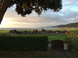 View from a bach at Te Puru | |
 | |
| Coordinates: 37°2′48″S 175°31′18″E / 37.04667°S 175.52167°E | |
| Country | New Zealand |
| Region | Waikato |
| District | Thames-Coromandel District |
| Population (2013) | |
| • Total | 846 |


Te Puru is a locality on the western side of the Coromandel Peninsula of New Zealand. State Highway 25 runs through it. Tapu lies about 7 km to the north, and Thames is about 12 km to the south.[1][2] The Te Puru Stream and about 18 tributaries drain a steep hilly 23 km² area of the Coromandel Range, almost entirely covered by native forest. It runs through the settlement and into the Firth of Thames to the west. Flooding has been a problem.[3]
Demographics[]
| Year | Pop. | ±% p.a. |
|---|---|---|
| 2006 | 1,710 | — |
| 2013 | 1,533 | −1.55% |
| 2018 | 1,704 | +2.14% |
| Source: [4] | ||
The statistical area of Thames Coast, which at 116 square kilometres is much larger than the locality, covers the west coast of the Coromandel between Waikawau River and . It had a population of 1,704 at the 2018 New Zealand census, an increase of 171 people (11.2%) since the 2013 census, and a decrease of 6 people (-0.4%) since the 2006 census. There were 717 households. There were 846 males and 858 females, giving a sex ratio of 0.99 males per female. The median age was 58.1 years, with 198 people (11.6%) aged under 15 years, 162 (9.5%) aged 15 to 29, 735 (43.1%) aged 30 to 64, and 606 (35.6%) aged 65 or older.
Ethnicities were 89.6% European/Pākehā, 19.0% Māori, 1.8% Pacific peoples, 1.8% Asian, and 2.1% other ethnicities (totals add to more than 100% since people could identify with multiple ethnicities).
The proportion of people born overseas was 14.4%, compared with 27.1% nationally.
Although some people objected to giving their religion, 53.0% had no religion, 34.0% were Christian, 0.2% were Hindu, 0.2% were Muslim, 0.7% were Buddhist and 3.0% had other religions.
Of those at least 15 years old, 234 (15.5%) people had a bachelor or higher degree, and 372 (24.7%) people had no formal qualifications. The median income was $22,900. The employment status of those at least 15 was that 471 (31.3%) people were employed full-time, 258 (17.1%) were part-time, and 60 (4.0%) were unemployed.[4]
Education[]
Te Puru School is a coeducational full primary (years 1-8) school with a roll of 192 students as of November 2021.[5][6]
History[]
Te Puru suffered severe flooding in 2002, when a low-pressure system led to extensive flooding on the Coromandel Peninsula and the south-west Waikato region.[7] Te Puru and Waiomu were included in the ‘high impact’ area of the storm.[8] Private and public property was damaged during the flood.
References[]
- ^ Peter Dowling (editor) (2004). Reed New Zealand Atlas. Reed Books. pp. map 16. ISBN 0-7900-0952-8.
{{cite book}}:|author=has generic name (help) - ^ Roger Smith, GeographX (2005). The Geographic Atlas of New Zealand. Robbie Burton. pp. map 40. ISBN 1-877333-20-4.
- ^ "Proposals for Te Puru" (PDF). Environment Waikato.
- ^ a b "Statistical area 1 dataset for 2018 Census". Statistics New Zealand. March 2020. Thames Coast (167200). 2018 Census place summary: Thames Coast
- ^ "New Zealand Schools Directory". New Zealand Ministry of Education. Retrieved 22 December 2021.
- ^ Education Counts: Te Puru School
- ^ NIWA - June 2002 Upper North Island Weather Bomb.
- ^ Ministry for the Environment - The Waikato Weather Bomb: Understanding the impact.
External links[]
Coordinates: 37°02′48″S 175°31′18″E / 37.04667°S 175.52167°E
- Thames-Coromandel District
- Populated places in Waikato
- Populated places around the Firth of Thames