Thames-Coromandel District
Thames-Coromandel District | |
|---|---|
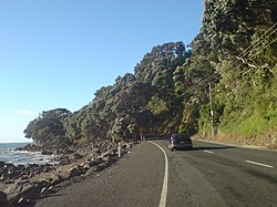 The road northwards from Thames. Somewhere south of Te Mata. | |
 | |
| Country | New Zealand |
| Region | Waikato |
| Wards | Coromandel-Colville Mercury Bay Tairua/Pauanui Whangamata Thames |
| Formed | 1975 |
| Seat | Thames |
| Government | |
| • Mayor | Sandra Goudie |
| • Deputy Mayor | Murray McLean |
| Area | |
| • Total | 2,297 km2 (887 sq mi) |
| Population (33,000 (June 2021))[1] | |
| • Total | 33,000 |
| • Density | 14/km2 (37/sq mi) |
| Time zone | UTC+12 (NZST) |
| • Summer (DST) | UTC+13 (NZDT) |
| Postcode(s) | |
| Website | Thames-Coromandel District Council |
The Thames-Coromandel District is a territorial authority district in the North Island of New Zealand, covering all the Coromandel Peninsula and extending south to Hikutaia.
It is administered by the Thames-Coromandel District Council, which has its seat in the town of Thames. It was the first district council to be formed in New Zealand, being constituted in 1975. The district lies within the Waikato Regional Council area. Its only land boundary is with Hauraki District.
Population[]
The district had a population of 33,000 in June 2021.[1] 7,480 live in Thames, 6,330 in Whitianga, 4,450 in Whangamatā, and 1,890 in Coromandel.
Demographics[]
| Year | Pop. | ±% p.a. |
|---|---|---|
| 2006 | 25,938 | — |
| 2013 | 26,178 | +0.13% |
| 2018 | 29,895 | +2.69% |
| Source: [2] | ||
Thames-Coromandel District had a population of 29,895 at the 2018 New Zealand census, an increase of 3,717 people (14.2%) since the 2013 census, and an increase of 3,957 people (15.3%) since the 2006 census. There were 12,471 households. There were 14,625 males and 15,273 females, giving a sex ratio of 0.96 males per female. The median age was 53.6 years, the oldest of all territorial authorities in New Zealand, with 4,488 people (15.0%) were aged under 15 years, 3,537 (11.8%) aged 15 to 29, 12,600 (42.1%) aged 30 to 64, and 9,273 (31.0%) aged 65 or older.
Ethnicities were 87.9% European/Pākehā, 18.3% Māori, 2.1% Pacific peoples, 3.4% Asian, and 1.7% other ethnicities (totals add to more than 100% since people could identify with multiple ethnicities).
The proportion of people born overseas was 16.4%, compared with 27.1% nationally.
Although some people objected to giving their religion, 54.4% had no religion, 33.0% were Christian, and 4.7% had other religions.
Of those at least 15 years old, 3,591 (14.1%) people had a bachelor or higher degree, and 5,874 (23.1%) people had no formal qualifications. The median income was $24,900. The employment status of those at least 15 was that 9,414 (37.1%) people were employed full-time, 4,359 (17.2%) were part-time, and 633 (2.5%) were unemployed.[2]
Local government[]
The Thames-Coromandel District Council was formed from the amalgamation of the Thames Borough, Thames County and Coromandel County councils in 1975,[3] and is led by the Mayor of Thames-Coromandel.
History[]
In 1923 the constituent counties included -[4]
| area | population | gravel roads | mud roads | tracks | |
|---|---|---|---|---|---|
| Coromandel County | 440 sq mi (1,100 km2) | 2,120 | 42 mi (68 km) | 74 mi (119 km) | 189 mi (304 km) |
| Thames County | 413 sq mi (1,070 km2) | 5,373 | 52 mi (84 km) | 26 mi (42 km) | 155 mi (249 km) |
| Thames Borough | 3,670 acres (14.9 km2)[5] | 4,765[6] | |||
| Totals | 2,185 km2 (844 sq mi) | 12,258 |
References[]
- ^ a b "Population estimate tables - NZ.Stat". Statistics New Zealand. Retrieved 22 October 2021.
- ^ a b "Statistical area 1 dataset for 2018 Census". Statistics New Zealand. March 2020. Thames-Coromandel District (011). 2018 Census place summary: Thames-Coromandel District
- ^ Monin, Paul (14 April 2016). "Hauraki–Coromandel region - Government and politics". Te Ara – the Encyclopedia of New Zealand. Retrieved 10 July 2019.
- ^ "KAWHIA SETTLER AND RAGLAN ADVERTISER Main Highways - Conference at Hamilton". paperspast.natlib.govt.nz. 3 August 1923. Retrieved 16 October 2021.
{{cite web}}: CS1 maint: url-status (link) - ^ "Thames Valley Power Board. TE AROHA NEWS". paperspast.natlib.govt.nz. 6 July 1922. Retrieved 16 October 2021.
{{cite web}}: CS1 maint: url-status (link) - ^ "Official Year Book 1921-22".
{{cite web}}: CS1 maint: url-status (link)
External links[]
![]() Coromandel Peninsula travel guide from Wikivoyage
Coromandel Peninsula travel guide from Wikivoyage

- Thames-Coromandel District
- 1975 establishments in New Zealand