Hauraki District
Hauraki District | |
|---|---|
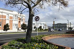 Paeroa Post Office | |
 | |
| Country | New Zealand |
| Region | Hauraki |
| District | Hauraki District Council |
| Wards | Paeroa Plains Waihi |
| Seat | Paeroa |
| Government | |
| • Ancestor | Marutuahu |
| • Ancestor | Hotunui |
| Area | |
| • Total | 1,144 km2 (442 sq mi) |
| Population (June 2021)[1] | |
| • Total | 21,800 |
| • Density | 19/km2 (49/sq mi) |
| Time zone | UTC+12 (NZST) |
| • Summer (DST) | UTC+13 (NZDT) |
| Postcode(s) | |
| Website | Hauraki District Council |
Hauraki District is a territorial authority within the Hauraki region of New Zealand. The seat of the council is at Paeroa.
The area covered by the district extends from the southwest coast of the Firth of Thames southeast towards Te Aroha, although that town lies beyond its boundaries. It extends eastwards to the Bay of Plenty coast, taking in the southernmost part of the Coromandel Peninsula. The rest of the peninsula is part of Thames-Coromandel District.
Features of the district include the Karangahake Gorge, Whiritoa, the Hauraki Plains, Ngatea and the gold mining town of Waihi.
Population[]
The district covers 1,144 square kilometres (442 sq mi), and has a population of approximately 21,800 residents in June 2021, of whom 4,600 live in Paeroa and 5,790 in Waihi.[1]
Demographics[]
| Year | Pop. | ±% p.a. |
|---|---|---|
| 2006 | 17,856 | — |
| 2013 | 17,808 | −0.04% |
| 2018 | 20,022 | +2.37% |
| Source: [2] | ||
Hauraki District had a population of 20,022 at the 2018 New Zealand census, an increase of 2,214 people (12.4%) since the 2013 census, and an increase of 2,166 people (12.1%) since the 2006 census. There were 7,869 households. There were 9,885 males and 10,137 females, giving a sex ratio of 0.98 males per female. Of the total population, 3,741 people (18.7%) were aged up to 15 years, 2,958 (14.8%) were 15 to 29, 8,595 (42.9%) were 30 to 64, and 4,728 (23.6%) were 65 or older. Figures may not add up to the total due to rounding.
Ethnicities were 84.1% European/Pākehā, 22.9% Māori, 3.0% Pacific peoples, 3.6% Asian, and 1.5% other ethnicities. People may identify with more than one ethnicity.
The percentage of people born overseas was 13.1, compared with 27.1% nationally.
Although some people objected to giving their religion, 54.9% had no religion, 31.4% were Christian, and 4.9% had other religions.
Of those at least 15 years old, 1,629 (10.0%) people had a bachelor or higher degree, and 4,551 (28.0%) people had no formal qualifications. The median income was $24,600. The employment status of those at least 15 was that 6,708 (41.2%) people were employed full-time, 2,532 (15.6%) were part-time, and 660 (4.1%) were unemployed.[2]
Local government[]
In 2010, the neighbouring Franklin District was abolished during the creation of the Auckland Council, and a stretch of the southwest coast of the Firth of Thames, around Kaiaua, was added to the Hauraki District.
The current mayor is Toby Adams.[3]
Populated places[]
Hauraki District consists of the following towns, localities, settlements and communities:
|
|
|
Notes:
1 - partly shared with Thames-Coromandel District
2 - formerly part of the defunct Franklin District
3 - also known as Pukorokoro
References[]
- ^ a b "Population estimate tables - NZ.Stat". Statistics New Zealand. Retrieved 22 October 2021.
- ^ a b "Statistical area 1 dataset for 2018 Census". Statistics New Zealand. March 2020. Hauraki District (012). 2018 Census place summary: Hauraki District
- ^ "Mayor & Councillors » Hauraki District Council". www.hauraki-dc.govt.nz. Retrieved 24 April 2020.
External links[]

- Hauraki District
- Waikato