Waipa District
Waipa District | |
|---|---|
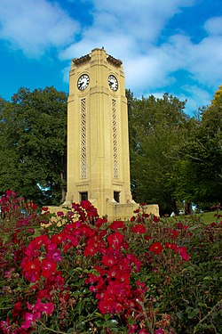 Cambridge clock tower | |
 | |
| Country | New Zealand |
| Region | Waikato |
| District | Waipa District |
| Wards | Te Awamutu Cambridge Pirongia Maungatautari Kakepuku |
| Seat | Te Awamutu |
| Government | |
| • Mayor | Jim Mylchreest |
| Area | |
| • Territorial | 1,473.47 km2 (568.91 sq mi) |
| Population (June 2021)[1] | |
| • Territorial | 59,500 |
| • Density | 40/km2 (100/sq mi) |
| Postcode(s) | |
| Area code(s) | 07 |
| Website | Waipa District Council |
Waipa District is a municipality in the Waikato region of New Zealand that is administered by the Waipa District Council. Its most populous town is Cambridge. The seat of the council is at the second most populous town, Te Awamutu. The district is south and south-east of the city of Hamilton. It has five wards: Te Awamutu, Cambridge, Pirongia, Maungatautari and Kakepuku.
Although the official name remains Waipa District,[2] the council sought in 2020 a simpler means of changing to Waipā District, which is the orthographic form it uses.[3]
History[]
The District was formed from Waipa County Council and its town boroughs in 1989.[4] The county boundaries had varied since five ridings were formed in Waipa county in 1876: Newcastle, Hamilton, Mangapiko North and South,[5] Rangiaowhia,[6] and Pukekura.[7] In 1902 it covered 282 sq mi (730 km2) and had an additional riding, Tuhikaramea.[8]
In 1923 Waipa County covered 429 sq mi (1,110 km2) and had a population of 9,275, with 283 mi (455 km) of gravel roads, 506 mi (814 km) of mud roads and 153 mi (246 km) of tracks.[9]
Geography[]
The district has a land area of 1,473.47 km² (568.91 sq mi). Its population in June 2021 was 59,500,[1] of whom approximately 35% lived in each of the two main towns.
The Waikato River forms much of the eastern boundary of the district, before it flows north-westward through the district, past Cambridge. The Waipa River, the Waikato River's main tributary, flows northwards through the western part of the district;[10] the two rivers meet outside the district. The highest mountains are Mount Pirongia in the west and Maungatautari in the east.
The region's economy is based largely on dairy farming and cereal production. The southeastern corner of the district includes the hydroelectric project at Karapiro.
Demographics[]
| Year | Pop. | ±% p.a. |
|---|---|---|
| 2006 | 42,501 | — |
| 2013 | 46,668 | +1.35% |
| 2018 | 53,241 | +2.67% |
| Source: [11] | ||
Waipa District had a population of 53,241 at the 2018 New Zealand census, an increase of 6,573 people (14.1%) since the 2013 census, and an increase of 10,740 people (25.3%) since the 2006 census. There were 19,518 households. There were 26,067 males and 27,171 females, giving a sex ratio of 0.96 males per female. Of the total population, 10,995 people (20.7%) were aged up to 15 years, 9,252 (17.4%) were 15 to 29, 23,535 (44.2%) were 30 to 64, and 9,456 (17.8%) were 65 or older. Figures may not add up to the total due to rounding.
Ethnicities were 87.7% European/Pākehā, 14.9% Māori, 1.8% Pacific peoples, 4.3% Asian, and 1.9% other ethnicities. People may identify with more than one ethnicity.
The percentage of people born overseas was 18.5, compared with 27.1% nationally.
Although some people objected to giving their religion, 51.6% had no religion, 36.9% were Christian, and 3.9% had other religions.
Of those at least 15 years old, 8,175 (19.4%) people had a bachelor or higher degree, and 8,130 (19.2%) people had no formal qualifications. The median income was $35,500. The employment status of those at least 15 was that 21,927 (51.9%) people were employed full-time, 6,345 (15.0%) were part-time, and 1,269 (3.0%) were unemployed.[11]
References[]
- ^ a b "Population estimate tables - NZ.Stat". Statistics New Zealand. Retrieved 22 October 2021.
- ^ "NZGB Gazetteer". gazetteer.linz.govt.nz. Retrieved 15 June 2021.
{{cite web}}: CS1 maint: url-status (link) - ^ "Waipā wins support for te reo - Waipa District Council". www.waipadc.govt.nz. Retrieved 15 June 2021.
{{cite web}}: CS1 maint: url-status (link) - ^ "Te Awamutu Borough Council". thecommunityarchive.org.nz. Retrieved 30 April 2017.
- ^ "Counties ridings". The New Zealand Herald. 27 November 1876. Retrieved 30 April 2017.
- ^ "Rangiaohia". nzetc.victoria.ac.nz. 1902. Retrieved 30 April 2017.
- ^ "Pukekura". nzetc.victoria.ac.nz. 1902. Retrieved 30 April 2017.
- ^ "Te Awamutu". nzetc.victoria.ac.nz. 1902. Retrieved 30 April 2017.
- ^ "KAWHIA SETTLER AND RAGLAN ADVERTISER Main Highways - Conference at Hamilton". paperspast.natlib.govt.nz. 3 August 1923. Retrieved 16 October 2021.
{{cite web}}: CS1 maint: url-status (link) - ^ "Waipa River, Waikato". NZ Topo Map. Retrieved 30 April 2017.
- ^ a b "Statistical area 1 dataset for 2018 Census". Statistics New Zealand. March 2020. Waipa District (017). 2018 Census place summary: Waipa District
External links[]

- Waipa District