Telêmaco Borba Airport
Telêmaco Borba Airport Aeroporto de Telêmaco Borba | |||||||||||
|---|---|---|---|---|---|---|---|---|---|---|---|
 Monte Alegre Airport | |||||||||||
| Summary | |||||||||||
| Airport type | Public | ||||||||||
| Operator | Indústrias Klabin S/A SEIL | ||||||||||
| Serves | Telêmaco Borba | ||||||||||
| Time zone | Time in Brazil (UTC−03:00) | ||||||||||
| Elevation AMSL | 796 m / 2,610 ft | ||||||||||
| Coordinates | 24°18′59″S 050°39′08″W / 24.31639°S 50.65222°WCoordinates: 24°18′59″S 050°39′08″W / 24.31639°S 50.65222°W | ||||||||||
| Map | |||||||||||
 TEC Location in Brazil | |||||||||||
| Runways | |||||||||||
| |||||||||||
| Statistics (2011) | |||||||||||
| |||||||||||


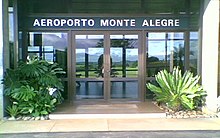
Telêmaco Borba Airport - Monte Alegre Airport (IATA: TEC, ICAO: SSVL), formerly SBTL is the airport serving Telêmaco Borba, Brazil.
It is operated by Indústrias Klabin S/A under the supervision of Aeroportos do Paraná (SEIL).
Airlines and destinations[]
| Airlines | Destinations |
|---|---|
| Azul Brazilian Airlines | Curitiba |
Access[]
The airport is located 3 km (2 mi) northwest from downtown Telêmaco Borba.
See also[]
References[]
- ^ "Estatística de passageiros" (PDF). SEIL (in Portuguese). March 2012. Retrieved 18 July 2020.
- ^ "Movimentação de aeronaves" (PDF). SEIL (in Portuguese). March 2012. Retrieved 18 July 2020.
- ^ "Aeródromos". ANAC (in Portuguese). 26 June 2020. Retrieved 15 February 2021.
External links[]
- Airport information for SBTL at Great Circle Mapper. Source: DAFIF (effective October 2006).
- Current weather for SBTL at NOAA/NWS
- Accident history for TEC at Aviation Safety Network
Airports in Paraná | |
|---|---|
Categories:
- Airports in Paraná (state)
- Telêmaco Borba