Thompson and Meserve's Purchase, New Hampshire
Thompson and Meserve's Purchase, New Hampshire | |
|---|---|
Township | |
 A large portion of the Mount Washington Auto Road passes through the township. | |
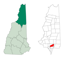 Location in Coös County, New Hampshire | |
| Coordinates: 44°17′54″N 71°18′42″W / 44.29833°N 71.31167°WCoordinates: 44°17′54″N 71°18′42″W / 44.29833°N 71.31167°W | |
| Country | United States |
| State | New Hampshire |
| County | Coös |
| Area | |
| • Total | 18.5 sq mi (48 km2) |
| • Land | 18.5 sq mi (48 km2) |
| • Water | 0 sq mi (0 km2) 0% |
| Elevation | 6,000 ft (2,000 m) |
| Population (2010) | |
| • Total | 0 |
| Time zone | UTC-5 (Eastern) |
| • Summer (DST) | UTC-4 (Eastern) |
| Area code(s) | 603 |

Thompson and Meserve's Purchase is a township located in Coös County, New Hampshire, United States. The purchase lies entirely within the White Mountain National Forest. As of the 2010 census, the purchase had a population of zero.[1]
In New Hampshire, locations, grants, townships (which are different from towns), and purchases are unincorporated portions of a county which are not part of any town and have limited self-government (if any, as many are uninhabited).
Thompson and Meserve's Purchase is notable for encompassing the northern slope of Mount Washington, including a large portion of the Mount Washington Auto Road and the Cog Railway.
History[]
Thompson and Meserve's Purchase was sold by Commissioner Willey to Samuel W. Thompson of Conway and George P. Meserve of Jackson, New Hampshire, in 1855 for $500.[citation needed]
Geography[]
According to the United States Census Bureau, the purchase has a total area of 18.5 square miles (48 km2), all of it land. The highest point in the purchase is 6,000 feet (1,800 m) above sea level on the slope of Chandler Ridge, just north of the summit of Mount Washington. Thompson and Meserve's Purchase contains a northern portion of the Presidential Range, including Mount Adams, the second highest mountain in New Hampshire at 5,774 feet (1,760 m), and Mount Jefferson, the third highest peak at 5,712 feet (1,741 m). To the east of the Presidential peaks lies the Great Gulf, a deep glacial cirque.
Demographics[]
| Historical population | |||
|---|---|---|---|
| Census | Pop. | %± | |
| 1860 | 32 | — | |
| 1900 | 18 | — | |
| 1910 | 4 | −77.8% | |
| 1930 | 2 | — | |
| 1940 | 0 | −100.0% | |
| 1950 | 2 | — | |
| 1960 | 1 | −50.0% | |
| 1970 | 0 | −100.0% | |
| 1980 | 2 | — | |
| 1990 | 0 | −100.0% | |
| 2000 | 0 | — | |
| 2010 | 0 | — | |
| 2017 (est.) | 3 | [2] | |
| U.S. Decennial Census[3] | |||
As of the 2010 census,[4] there were no people living in the township.
References[]
- ^ United States Census Bureau, American FactFinder, 2010 Census figures. Retrieved March 23, 2011.
- ^ "Annual Estimates of the Resident Population: April 1, 2010 to July 1, 2017 (PEPANNRES): Minor Civil Divisions – New Hampshire". Archived from the original on February 13, 2020. Retrieved November 14, 2018.
- ^ "Census of Population and Housing". Census.gov. Retrieved June 4, 2016.
- ^ "U.S. Census website". United States Census Bureau. Retrieved 2008-01-31.
| show Places adjacent to Thompson and Meserve's Purchase, New Hampshire |
|---|
| show Municipalities and communities of Coös County, New Hampshire, United States |
|---|

- Townships in Coös County, New Hampshire
- Berlin, New Hampshire micropolitan area
- Townships in New Hampshire