Toronto, South Dakota
Toronto, South Dakota | |
|---|---|
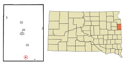 Location in Deuel County and the state of South Dakota | |
| Coordinates: 44°34′20″N 96°38′31″W / 44.57222°N 96.64194°WCoordinates: 44°34′20″N 96°38′31″W / 44.57222°N 96.64194°W | |
| Country | United States |
| State | South Dakota |
| County | Deuel |
| Founded | 1884[1] |
| Area | |
| • Total | 0.31 sq mi (0.80 km2) |
| • Land | 0.31 sq mi (0.80 km2) |
| • Water | 0.00 sq mi (0.00 km2) |
| Elevation | 2,001 ft (610 m) |
| Population | |
| • Total | 212 |
| • Estimate (2019)[6] | 209 |
| • Density | 680.78/sq mi (262.69/km2) |
| Time zone | UTC-6 (Central (CST)) |
| • Summer (DST) | UTC-5 (CDT) |
| ZIP code | 57268 |
| Area code(s) | 605 |
| FIPS code | 46-63740[4] |
| GNIS feature ID | 1258580[5] |
| Website | http://www2.torontosd.com/home |

Toronto is a town in Deuel County, South Dakota, United States. The population was 212 at the 2010 census.
Toronto was laid out in 1884, and named after the capital of Ontario, Canada, the native home of a first settler.[7]
Geography[]
Toronto is located at 44°34′20″N 96°38′31″W / 44.57222°N 96.64194°W (44.572334, -96.641897).[8] nearly the same latitude as its larger Canadian namesake.
According to the United States Census Bureau, the town has a total area of 0.31 square miles (0.80 km2), all land.[9]
Toronto has been assigned the ZIP code 57268 and the FIPS place code 63740.
Demographics[]
| Historical population | |||
|---|---|---|---|
| Census | Pop. | %± | |
| 1890 | 148 | — | |
| 1900 | 447 | 202.0% | |
| 1910 | 424 | −5.1% | |
| 1920 | 380 | −10.4% | |
| 1930 | 341 | −10.3% | |
| 1940 | 362 | 6.2% | |
| 1950 | 322 | −11.0% | |
| 1960 | 268 | −16.8% | |
| 1970 | 216 | −19.4% | |
| 1980 | 236 | 9.3% | |
| 1990 | 201 | −14.8% | |
| 2000 | 202 | 0.5% | |
| 2010 | 212 | 5.0% | |
| 2019 (est.) | 209 | [6] | −1.4% |
| U.S. Decennial Census[10] | |||
2010 census[]
As of the census[3] of 2010, there were 212 people, 100 households, and 53 families residing in the town. The population density was 683.9 inhabitants per square mile (264.1/km2). There were 115 housing units at an average density of 371.0 per square mile (143.2/km2). The racial makeup of the town was 93.4% White, 3.8% Native American, 1.4% from other races, and 1.4% from two or more races. Hispanic or Latino of any race were 4.2% of the population.
There were 100 households, of which 25.0% had children under the age of 18 living with them, 43.0% were married couples living together, 5.0% had a female householder with no husband present, 5.0% had a male householder with no wife present, and 47.0% were non-families. 40.0% of all households were made up of individuals, and 18% had someone living alone who was 65 years of age or older. The average household size was 2.12 and the average family size was 2.94.
The median age in the town was 40.8 years. 23.1% of residents were under the age of 18; 6.2% were between the ages of 18 and 24; 24.5% were from 25 to 44; 27.3% were from 45 to 64; and 18.9% were 65 years of age or older. The gender makeup of the town was 52.4% male and 47.6% female.
2000 census[]
As of the census[4] of 2000, there were 202 people, 94 households, and 56 families residing in the town. The population density was 657.9 people per square mile (251.6/km2). There were 113 housing units at an average density of 368.0 per square mile (140.7/km2). The racial makeup of the town was 98.02% White, 0.50% African American, 1.49% from other races.
There were 94 households, out of which 25.5% had children under the age of 18 living with them, 48.9% were married couples living together, 9.6% had a female householder with no husband present, and 40.4% were non-families. 39.4% of all households were made up of individuals, and 20.2% had someone living alone who was 65 years of age or older. The average household size was 2.15 and the average family size was 2.88.
In the town, the population was spread out, with 26.7% under the age of 18, 4.5% from 18 to 24, 24.8% from 25 to 44, 20.3% from 45 to 64, and 23.8% who were 65 years of age or older. The median age was 41 years. For every 100 females there were 88.8 males. For every 100 females age 18 and over, there were 82.7 males.
The median income for a household in the town was $23,750, and the median income for a family was $34,844. Males had a median income of $26,667 versus $26,250 for females. The per capita income for the town was $14,891. About 8.2% of families and 9.4% of the population were below the poverty line, including none of those under the age of eighteen and 16.7% of those 65 or over.
References[]
- ^ "SD Towns" (PDF). South Dakota State Historical Society. Retrieved 2010-02-16.
- ^ "2019 U.S. Gazetteer Files". United States Census Bureau. Retrieved July 30, 2020.
- ^ Jump up to: a b "U.S. Census website". United States Census Bureau. Retrieved 2012-06-21.
- ^ Jump up to: a b "U.S. Census website". United States Census Bureau. Retrieved 2008-01-31.
- ^ "US Board on Geographic Names". United States Geological Survey. 2007-10-25. Retrieved 2008-01-31.
- ^ Jump up to: a b "Population and Housing Unit Estimates". United States Census Bureau. May 24, 2020. Retrieved May 27, 2020.
- ^ Federal Writers' Project (1940). South Dakota place-names, v.1-3. University of South Dakota. p. 63.
- ^ "US Gazetteer files: 2010, 2000, and 1990". United States Census Bureau. 2011-02-12. Retrieved 2011-04-23.
- ^ "US Gazetteer files 2010". United States Census Bureau. Archived from the original on 2012-01-25. Retrieved 2012-06-21.
- ^ "Census of Population and Housing". Census.gov. Retrieved June 4, 2015.
| show Municipalities and communities of Deuel County, South Dakota, United States |
|---|

| show Authority control |
|---|
- Towns in Deuel County, South Dakota