Transport in the Republic of the Congo
This article needs additional citations for verification. (August 2017) |
This article may require copy editing for grammar, style, cohesion, tone, or spelling. (November 2021) |
Transport in the Republic of Congo include land, air and water transportation. The country's rail system was built by forced labourers in the 1930s with over 1,000 km (620 mi) of paved roads and two major international airports (Maya-Maya Airport and Pointe Noire Airport).
The country also have a large port on the Atlantic Ocean at Pointe-Noire, others along the Congo River at Brazzaville and Impfondo.
Railways[]

total:
510 km - Congo-Ocean Railway connects Brazzaville and Pointe-Noire.
narrow gauge:
510 km 1.067-m gauge[1]
Timeline[]
2003[]
- Concessioning[2]
2006[]
2007[]
- 12 April 2007 According to Engineering News, a South Korean consortium has agreed to build a new 800 km railway in the Congo-Brazzaville Republic in return for timber concessions. They would build a railway from Brazzaville to Ouesso in the Sangha region in the north-west of the country. A two-year feasibility study would take place before signing a final agreement with the government and starting construction work on the railway.[4] See CMKC Group.
Highways[]
total:
23,324 km
paved:
3,111 km
unpaved:
20,213 km[5]
17,000 km of the Congo's railways are classified as national, departmental, and routes of local interest. 6,324 km are non-classified routes.
National Highways Network:
- N1 Brazzaville - Kinkala - Dolisie - Pointe Noire
- N2 Brazzaville - Owando - Ouésso
- N3 Dolisie - Border with Gabon
Waterways[]

The Congo and Ubangi (Oubangui) rivers provide 1,120 km of commercially navigable water transport. Other rivers are used for local traffic only.[1]
Pipelines[]
Crude oil: 982 km
Gas: 232km
Liquid petroleum gas: 4km[1]
Ports and harbours[]

Atlantic Ocean[]
- Pointe-Noire (Major seaport)
Congo River[]
- Brazzaville (River port)
- Impfondo
- Djeno (Oil terminal)
Other rivers[]
- Oyo
Sangha River[]
- Ouesso[1]
Air[]
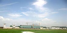
The Republic of the Congo has two international airports: Maya-Maya Airport in Brazzaville and Pointe Noire Airport. As of June 2014, no less than six airlines operated between the two airports and both airports had direct flights to Addis Ababa, Abidjan, Casablanca, Cotonou, Douala, Libreville, Johannesburg, Paris. Maya-Maya Airport was served by a larger number of airlines than Pointe Noire and had direct flights to various other destinations in Africa and the Middle East.[citation needed]
Airports - with paved runways[]
Total:
8
1,524 to 2,437 m:
5
2,438 to 3,047 m: 1
over 3,047 m: 2
Airports - with unpaved runways[]
Total:
10
1,524 to 2,437 m:
8
914 to 1,523 m:
9
under 914 m:
2[1]
See also[]
References[]
- ^ a b c d e "Congo, Republic of the", The World Factbook, Central Intelligence Agency, 2021-10-27, retrieved 2021-11-13
- ^ [1][dead link]
- ^ "Congo: Rail traffic suspended, fuel shortage hits Brazzaville". Reliefweb.int. 25 April 2006. Retrieved 9 August 2017.
- ^ "Archived copy". Archived from the original on 2012-05-30. Retrieved 2008-06-26.CS1 maint: archived copy as title (link)
- ^ "Congo, Republic of the", The World Factbook, Central Intelligence Agency, 2021-10-27, retrieved 2021-11-13
![]() This article incorporates public domain material from the CIA World Factbook website https://www.cia.gov/the-world-factbook/.
This article incorporates public domain material from the CIA World Factbook website https://www.cia.gov/the-world-factbook/.
Currency: Central African CFA franc | |
| Communications | |
| Industries: | |
- Transport in the Republic of the Congo