
Tuamarina
Tuamarina | |
|---|---|
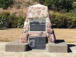 Pioneers' Memorial in Tuamarina | |
 | |
| Coordinates: 41°25′49″S 173°57′44″E / 41.43028°S 173.96222°E | |
| Country | New Zealand |
| Region | Marlborough |
| Ward | Wairau-Awatere Ward |
| Area | |
| • Total | 9.68 km2 (3.74 sq mi) |
| Population (2018)[2] | |
| • Total | 237 |
| • Density | 24/km2 (63/sq mi) |
| Postcode(s) | 7273 |
Tuamarina (often spelled Tua Marina) is a small town in Marlborough, New Zealand. State Highway 1 runs through the area. The Tuamarina River joins the Wairau River just south of the settlement. Picton is about 18 km to the north, and Blenheim is about 10 km to the south.[3][4]
The name is a corruption of the Māori word Tuamarino, which means 'the calm beyond'. Dairy farming is the major economic activity, and the Koromiko cheese factory won a number of awards[5] before it was destroyed by fire in 2004.
The Wairau Affray occurred in the area in 1843, resulting in 26 deaths.[6]
The Wairau Plain is prone to flooding, and river conservation is necessary to keep the river under control. Significant floods have occurred in the Tuamarina area, such as one in December 1939.[7]
Demographics[]
Tuamarina is defined by Statistics New Zealand as a rural settlement and covers 9.68 km2 (3.74 sq mi).[1]
| Year | Pop. | ±% p.a. |
|---|---|---|
| 2006 | 267 | — |
| 2013 | 222 | −2.60% |
| 2018 | 237 | +1.32% |
| Source: [2] | ||
The settlement had a population of 237 at the 2018 New Zealand census, an increase of 15 people (6.8%) since the 2013 census, and a decrease of 30 people (-11.2%) since the 2006 census. There were 87 households. There were 117 males and 120 females, giving a sex ratio of 0.97 males per female. The median age was 45.8 years (compared with 37.4 years nationally), with 48 people (20.3%) aged under 15 years, 30 (12.7%) aged 15 to 29, 123 (51.9%) aged 30 to 64, and 39 (16.5%) aged 65 or older.
Ethnicities were 94.9% European/Pākehā, 12.7% Māori, 2.5% Asian, and 2.5% other ethnicities (totals add to more than 100% since people could identify with multiple ethnicities).
Although some people objected to giving their religion, 63.3% had no religion, 27.8% were Christian and 1.3% had other religions.
Of those at least 15 years old, 30 (15.9%) people had a bachelor or higher degree, and 33 (17.5%) people had no formal qualifications. The median income was $41,200, compared with $31,800 nationally. The employment status of those at least 15 was that 120 (63.5%) people were employed full-time, 24 (12.7%) were part-time, and 0 (0.0%) were unemployed.[2]
Tuamarina statistical area[]
Tuamarina statistical area surrounds the settlement and also includes Rārangi. It covers 167.78 km2 (64.78 sq mi).[1] It had an estimated population of 1,350 as of June 2021,[8] with a population density of 8.0 people per km2.
| Year | Pop. | ±% p.a. |
|---|---|---|
| 2006 | 1,092 | — |
| 2013 | 1,185 | +1.17% |
| 2018 | 1,263 | +1.28% |
| Source: [9] | ||

Tuamarina had a population of 1,263 at the 2018 New Zealand census, an increase of 78 people (6.6%) since the 2013 census, and an increase of 171 people (15.7%) since the 2006 census. There were 477 households. There were 633 males and 633 females, giving a sex ratio of 1.0 males per female. The median age was 46.4 years (compared with 37.4 years nationally), with 249 people (19.7%) aged under 15 years, 162 (12.8%) aged 15 to 29, 648 (51.3%) aged 30 to 64, and 207 (16.4%) aged 65 or older.
Ethnicities were 92.6% European/Pākehā, 13.1% Māori, 1.9% Pacific peoples, 1.2% Asian, and 2.1% other ethnicities (totals add to more than 100% since people could identify with multiple ethnicities).
The proportion of people born overseas was 17.1%, compared with 27.1% nationally.
Although some people objected to giving their religion, 63.4% had no religion, 25.7% were Christian, 0.2% were Hindu, 0.5% were Buddhist and 1.7% had other religions.
Of those at least 15 years old, 186 (18.3%) people had a bachelor or higher degree, and 174 (17.2%) people had no formal qualifications. The median income was $35,100, compared with $31,800 nationally. The employment status of those at least 15 was that 576 (56.8%) people were employed full-time, 150 (14.8%) were part-time, and 21 (2.1%) were unemployed.[9]
Education[]
Tua Marina School is a coeducational full primary (years 1–8) school with a decile rating of 7 and a roll of 86.[10] The school celebrated its 100th anniversary in 1971.[11]
Notable people[]
- Eileen Duggan, 1894–1972, poet.[12]
Notes[]
- ^ a b c "ArcGIS Web Application". statsnz.maps.arcgis.com. Retrieved 19 August 2021.
- ^ a b c "Statistical area 1 dataset for 2018 Census". Statistics New Zealand. March 2020. 7023301 (7023301). 2018 Census place summary: 7023301
- ^ Peter Dowling, ed. (2004). Reed New Zealand Atlas. Reed Books. pp. map 61. ISBN 0-7900-0952-8.
- ^ Roger Smith, GeographX (2005). The Geographic Atlas of New Zealand. Robbie Burton. pp. map 139. ISBN 1-877333-20-4.
- ^ "Tuamarina". Marlborough Online.
- ^ "Wairau Affray". Encyclopedia of New Zealand (1966).
- ^ McIntosh, Alister; Redman, William Edward; Allen, William Raymond, eds. (1940). Marlborough: A Provincial History. Blenheim: Marlborough Provincial Historical Committee. pp. 367f.
- ^ "Population estimate tables - NZ.Stat". Statistics New Zealand. Retrieved 22 October 2021.
- ^ a b "Statistical area 1 dataset for 2018 Census". Statistics New Zealand. March 2020. Tuamarina (306900). 2018 Census place summary: Tuamarina
- ^ "Te Kete Ipurangi – Tua Marina School". Ministry of Education.
- ^ Smith, F.W. (1971). The Tua Marina School 100th anniversary 1871–1971 : with which is incorporated the history of the Waikakaho Schools 1887–1933. Tua Marina Waikakaho School Centennial Committee.
- ^ "Duggan, Eileen May 1894 – 1972". Dictionary of New Zealand Biography.
| Wikimedia Commons has media related to Tuamarina. |
- Populated places in the Marlborough Region