Turners Falls Airport
Turners Falls Airport | |||||||||||
|---|---|---|---|---|---|---|---|---|---|---|---|
| Summary | |||||||||||
| Airport type | Public | ||||||||||
| Owner | Town of Montague | ||||||||||
| Serves | Montague, Massachusetts | ||||||||||
| Elevation AMSL | 359 ft / 109 m | ||||||||||
| Coordinates | 42°35′30″N 072°31′23″W / 42.59167°N 72.52306°WCoordinates: 42°35′30″N 072°31′23″W / 42.59167°N 72.52306°W | ||||||||||
| Website | www.montague.net/... | ||||||||||
| Map | |||||||||||
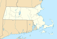 0B5 Location of airport in Massachusetts | |||||||||||
| Runways | |||||||||||
| |||||||||||
| Statistics (2011) | |||||||||||
| |||||||||||

Turners Falls Airport (FAA LID: 0B5) is a town owned, public use airport located three nautical miles (6 km) north of the central business district of Montague, a town in Franklin County, Massachusetts, United States. It is owned by the Town of Montague.[1] It is included in the National Plan of Integrated Airport Systems for 2011–2015, which categorized it as a general aviation facility.[2]
History[]
Although started by a private group, the airport was the site of a large New Deal camp during the Great Depression. Civilian Conservation Corps workers lived in tents on the grounds and labored by day. They were generally out-of-work local men who were grateful for a job. The airport was used by the U.S. Navy for basic aviation training in World War II; students, including famous Red Sox players turned aviators Ted Williams and Johnny Pesky trained there.[3] The field was expanded in the ensuing peacetime and eventually gained the name Turners Falls Municipal Airport. The term 'municipal' was dropped as the airport focused on regional economic development.
The airport complex is situated in a valley between a small mountain and the oxbow of the Connecticut River. This location lends itself to calm weather and provides a guarantee that obstructions will never be placed on the river side. The land side also provides over a mile of flat and virtually uninhabited land, leaving plenty of room for runway expansion if a road was rerouted. A dispute with Native Americans over alleged burial grounds once threatened to shut down the airport but an accord has been reached on the matter.
Today the Airport Industrial Park includes high-tech manufacturers and biotech companies. Turners Falls Airport was formerly known as "Turners Falls Municipal Airport" until a large industrial park sprang up around it. Private jet traffic has increased due to local corporations and students at the Five Colleges, Williams College, Northfield Mount Hermon School (NMH), Deerfield Academy, Eaglebrook School, and .
Turners Falls Airport has been serviced for decades by Pioneer Aviation, the current fixed-base operator. It provides major repair services, inspections, and fuel.
Facilities and aircraft[]
Turners Falls Airport covers an area of 227 acres (92 ha) at an elevation of 359 feet (109 m) above mean sea level. It has one runway designated 16/34 with an asphalt surface measuring 3,200 by 75 feet (975 x 23 m).[1]
For the 12-month period ending November 1, 2011, the airport had 17,600 aircraft operations, an average of 48 per day: 99.4% general aviation and 0.6% air taxi. At that time there were 29 aircraft based at this airport, all 100% single-engine.[1]
References[]
- ^ a b c d FAA Airport Form 5010 for 0B5 PDF. Federal Aviation Administration. Effective May 31, 2012.
- ^
"2011–2015 NPIAS Report, Appendix A" (PDF, 2.03 MB). National Plan of Integrated Airport Systems. Federal Aviation Administration. October 4, 2010.
{{cite web}}: External link in|work= - ^ "Remembering Johnny Pesky - Mr. Red Sox". 14 August 2012.
External links[]
- Airport page at Town of Montague website
- Aerial image as of April 1992 from USGS The National Map
- FAA Terminal Procedures for 0B5, effective December 30, 2021
- Resources for this airport:
- FAA airport information for 0B5
- AirNav airport information for 0B5
- FlightAware airport information and live flight tracker
- SkyVector aeronautical chart for 0B5
- Airports in Massachusetts
- Transportation buildings and structures in Franklin County, Massachusetts
- Civilian Conservation Corps in Massachusetts