U11 (Berlin U-Bahn)
This article needs additional citations for verification. (May 2012) |
| Overview | ||||||||||||||||||||||||||||||||||||||||||||||||||||||||||||||||||||||||||||||||||||||||||||||||||||||||||||||||||||||||||||||||||||||||||||||||||||||||||||||||
|---|---|---|---|---|---|---|---|---|---|---|---|---|---|---|---|---|---|---|---|---|---|---|---|---|---|---|---|---|---|---|---|---|---|---|---|---|---|---|---|---|---|---|---|---|---|---|---|---|---|---|---|---|---|---|---|---|---|---|---|---|---|---|---|---|---|---|---|---|---|---|---|---|---|---|---|---|---|---|---|---|---|---|---|---|---|---|---|---|---|---|---|---|---|---|---|---|---|---|---|---|---|---|---|---|---|---|---|---|---|---|---|---|---|---|---|---|---|---|---|---|---|---|---|---|---|---|---|---|---|---|---|---|---|---|---|---|---|---|---|---|---|---|---|---|---|---|---|---|---|---|---|---|---|---|---|---|---|---|---|---|
| Locale | Berlin | |||||||||||||||||||||||||||||||||||||||||||||||||||||||||||||||||||||||||||||||||||||||||||||||||||||||||||||||||||||||||||||||||||||||||||||||||||||||||||||||
| Service | ||||||||||||||||||||||||||||||||||||||||||||||||||||||||||||||||||||||||||||||||||||||||||||||||||||||||||||||||||||||||||||||||||||||||||||||||||||||||||||||||
| System | Berlin U-Bahn | |||||||||||||||||||||||||||||||||||||||||||||||||||||||||||||||||||||||||||||||||||||||||||||||||||||||||||||||||||||||||||||||||||||||||||||||||||||||||||||||
| Technical | ||||||||||||||||||||||||||||||||||||||||||||||||||||||||||||||||||||||||||||||||||||||||||||||||||||||||||||||||||||||||||||||||||||||||||||||||||||||||||||||||
| Track gauge |
| |||||||||||||||||||||||||||||||||||||||||||||||||||||||||||||||||||||||||||||||||||||||||||||||||||||||||||||||||||||||||||||||||||||||||||||||||||||||||||||||
| ||||||||||||||||||||||||||||||||||||||||||||||||||||||||||||||||||||||||||||||||||||||||||||||||||||||||||||||||||||||||||||||||||||||||||||||||||||||||||||||||
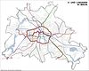
The U11 line is a planned line of the Berlin U-Bahn.
It was featured in the Berlin city transport development plan (StEP) in 1995 and the zoning of 2004 and 2009[1] as a route control system.
Several tram lines are already running to the parallel route (M5, M6, M8, 16) and the plans were cancelled.
The U11 would connect the eastern districts of Berlin to Berlin Hauptbahnhof. It would comprise extend 15.8 kilometers, with 21 stations, which are:
- Berlin Hauptbahnhof (ICE, IC, RB, RE, InterConnex, Harz-Berlin-Express, S5, S7, S75, U55)
- Naturkundemuseum (U6)
- Berlin Nordbahnhof (S1, S2, S25)
- Rosenthaler Platz (U8)
- Rosa-Luxemburg-Platz (U2)
- Landsberger Allee (S41, S42, S8, S85, S9)
- (possible transition to the S-Bahn)
- Marzahn (S7)
- .
References[]
Categories:
- Berlin U-Bahn lines