Unicoi, Tennessee
Unicoi, Tennessee | |
|---|---|
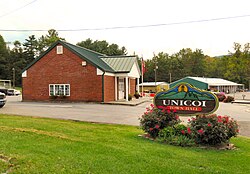 Unicoi Town Hall | |
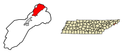 Location of Unicoi in Unicoi County, Tennessee. | |
| Coordinates: 36°13′12″N 82°20′17″W / 36.22000°N 82.33806°WCoordinates: 36°13′12″N 82°20′17″W / 36.22000°N 82.33806°W | |
| Country | United States |
| State | Tennessee |
| County | Unicoi |
| Incorporated | 1994[1] |
| Named for | Unaka, Cherokee for "white"[2] |
| Area | |
| • Total | 16.19 sq mi (41.93 km2) |
| • Land | 16.19 sq mi (41.93 km2) |
| • Water | 0.00 sq mi (0.00 km2) |
| Elevation | 1,923 ft (586 m) |
| Population (2010) | |
| • Total | 3,632 |
| • Estimate (2019)[4] | 3,594 |
| • Density | 221.99/sq mi (85.71/km2) |
| Time zone | UTC-5 (Eastern (EST)) |
| • Summer (DST) | UTC-4 (EDT) |
| ZIP code | 37692 |
| Area code(s) | 423 |
| FIPS code | 47-75820[5] |
| GNIS feature ID | 1304219[6] |
| Website | www |

Unicoi is a town in Unicoi County, Tennessee, United States. The population was 3,519 at the 2000 census and 3,632 at the 2010 census. It is part of the Johnson City Metropolitan Statistical Area, which is a component of the Johnson City–Kingsport–Bristol, TN-VA Combined Statistical Area – commonly known as the "Tri-Cities" region.
History[]
Unicoi was originally known as "Greasy Cove." In 1851, the Swingle brothers opened a post office in the community, and named it "Swingleville." In 1876, Dr. F.H. Hannum obtained control of the post office, and changed its name to "Limonite." When the railroads arrived in the valley in the late 1880s, the name was changed to "Unicoi City," and later shortened to its current form. The town developed in the early 20th century as a shipping point for area mining and logging operations.[7][8]
Geography[]
Unicoi is located at 36°13′12″N 82°20′17″W / 36.22000°N 82.33806°W (36.220028, -82.338138).[9] The town is situated in the North Indian Creek Valley (known locally as "The Valley Beautiful"), at a point where North Indian Creek emerges from the mountains to the southeast and bends to the southwest toward Erwin and its eventual confluence with the Nolichucky River. The northern portions of Unicoi are located in the headwaters of Buffalo Creek, which flows northeastward (in the opposite direction from North Indian Creek) and eventually empties into the Watauga River.

Unicoi is surrounded by the Cherokee National Forest. Buffalo Mountain rises prominently to the west of Unicoi, and a series of rugged hills and ridges that comprise the outer Unaka Mountains rise to the east. Erwin, the county seat, is located further down the valley to the southwest. Johnson City is located opposite Buffalo Mountain to the north.
Interstate 26, which traverses the valley, passes through western Unicoi. Tennessee State Route 107 connects Unicoi with Erwin to the southwest and the rural Limestone Cove area to the east. Tennessee State Route 173 connects the town with U.S. Route 19E.
According to the United States Census Bureau, the town has a total area of 16.3 square miles (42 km2), all of it land.
Demographics[]
| Historical population | |||
|---|---|---|---|
| Census | Pop. | %± | |
| 2000 | 3,519 | — | |
| 2010 | 3,632 | 3.2% | |
| 2019 (est.) | 3,594 | [4] | −1.0% |
| Sources:[10][11] | |||
2020 census[]
| Race | Number | Percentage |
|---|---|---|
| White (non-Hispanic) | 3,377 | 88.1% |
| Black or African American (non-Hispanic) | 7 | 0.18% |
| Native American | 12 | 0.31% |
| Asian | 4 | 0.1% |
| Other/Mixed | 115 | 3.0% |
| Hispanic or Latino | 318 | 8.3% |
As of the 2020 United States census, there were 3,833 people, 1,421 households, and 909 families residing in the town.
2000 census[]
As of the census[5] of 2000, there were 3,519 people, 1,452 households, and 1,052 families residing in the town. The population density was 216.4 people per square mile (83.6/km2). There were 1,562 housing units at an average density of 96.0 per square mile (37.1/km2). The racial makeup of the town was 97.76% White, 0.06% African American, 0.31% Native American, 0.23% Asian, 0.03% Pacific Islander, 1.05% from other races, and 0.57% from two or more races. Hispanic or Latino of any race were 2.22% of the population.
There were 1,452 households, out of which 29.2% had children under the age of 18 living with them, 62.1% were married couples living together, 7.1% had a female householder with no husband present, and 27.5% were non-families. 23.2% of all households were made up of individuals, and 8.8% had someone living alone who was 65 years of age or older. The average household size was 2.42 and the average family size was 2.88.
In the town, the population was spread out, with 22.3% under the age of 18, 8.2% from 18 to 24, 29.7% from 25 to 44, 27.4% from 45 to 64, and 12.5% who were 65 years of age or older. The median age was 39 years. For every 100 females, there were 104.6 males. For every 100 females age 18 and over, there were 99.0 males.
The median income for a household in the town was $29,483, and the median income for a family was $40,208. Males had a median income of $31,299 versus $19,052 for females. The per capita income for the town was $15,870. About 9.7% of families and 13.2% of the population were below the poverty line, including 16.0% of those under age 18 and 19.9% of those age 65 or over.
References[]
- ^ Tennessee Blue Book, 2005-2006, pp. 618-625.
- ^ Nancy Capace, Encyclopedia of Tennessee (North American Book Distributors, 2000), p. 226.
- ^ "2019 U.S. Gazetteer Files". United States Census Bureau. Retrieved July 30, 2020.
- ^ a b "Population and Housing Unit Estimates". United States Census Bureau. May 24, 2020. Retrieved May 27, 2020.
- ^ a b "U.S. Census website". United States Census Bureau. Retrieved 2008-01-31.
- ^ "US Board on Geographic Names". United States Geological Survey. 2007-10-25. Retrieved 2008-01-31.
- ^ Pat Alderman, "Unicoi," Greasy Cove in Unicoi County: Authentic Folklore (Overmountain Press, 1975), p. 12.
- ^ "Tennessee Place Names and Post Offices," Tennessee state website (TN.gov). Accessed: 30 September 2015.
- ^ "US Gazetteer files: 2010, 2000, and 1990". United States Census Bureau. 2011-02-12. Retrieved 2011-04-23.
- ^ "Census of Population and Housing: Decennial Censuses". United States Census Bureau. Retrieved 2012-03-04.
- ^ "Incorporated Places and Minor Civil Divisions Datasets: Subcounty Resident Population Estimates: April 1, 2010 to July 1, 2012". Population Estimates. U.S. Census Bureau. Archived from the original on 11 June 2013. Retrieved 11 December 2013.
- ^ "Explore Census Data". data.census.gov. Retrieved 2021-12-26.
External links[]
| Wikimedia Commons has media related to Unicoi, Tennessee. |
- Official site
- Municipal Technical Advisory Service entry for Unicoi — information on local government, elections, and link to charter
Municipalities and communities of Unicoi County, Tennessee, United States | ||
|---|---|---|
| Towns | ||
| CDP | ||
| Unincorporated communities | ||
| Footnotes | ‡This populated place also has portions in an adjacent county or counties | |
| ||
- Towns in Unicoi County, Tennessee
- Towns in Tennessee
- Johnson City metropolitan area, Tennessee