Union Township, Elkhart County, Indiana
Union Township | |
|---|---|
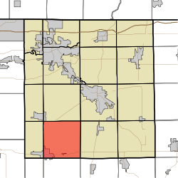 Location of Union Township in Elkhart County | |
| Coordinates: 41°28′33″N 85°56′20″W / 41.47583°N 85.93889°WCoordinates: 41°28′33″N 85°56′20″W / 41.47583°N 85.93889°W | |
| Country | United States |
| State | Indiana |
| County | Elkhart |
| Government | |
| • Type | Indiana township |
| Area | |
| • Total | 35.92 sq mi (93.0 km2) |
| • Land | 35.92 sq mi (93.0 km2) |
| • Water | 0 sq mi (0 km2) |
| Elevation | 863 ft (263 m) |
| Population (2010) | |
| • Total | 6,134 |
| • Density | 170.7/sq mi (65.9/km2) |
| FIPS code | 18-77264[2] |
| GNIS feature ID | 453914 |

Union Township is one of sixteen townships in Elkhart County, Indiana. As of the 2010 census, its population was 6,134.[3]
History[]
Union Township was organized in 1837.[4]
Geography[]
According to the 2010 census, the township has a total area of 35.92 square miles (93.0 km2), all land.[3]
Cities and towns[]
- Nappanee (east half)
Unincorporated towns[]
(This list is based on USGS data and may include former settlements.)
Adjacent townships[]
- Harrison Township (north)
- Elkhart Township (northeast)
- Jackson Township (east)
- Van Buren Township, Kosciusko County (southeast)
- Jefferson Township, Kosciusko County (south)
- Scott Township, Kosciusko County (southwest)
- Locke Township (west)
- Olive Township (northwest)
Major highways[]
Cemeteries[]
The township contains one cemetery, Bull.
References[]
- ^ "US Board on Geographic Names". United States Geological Survey. 2007-10-25. Retrieved 2008-01-31.
- ^ "U.S. Census website". United States Census Bureau. Retrieved 2008-01-31.
- ^ a b "Population, Housing Units, Area, and Density: 2010 - County -- County Subdivision and Place -- 2010 Census Summary File 1". United States Census. Archived from the original on 2020-02-12. Retrieved 2013-05-10.
- ^ History of Elkhart County, Indiana. Chas. C. Chapman Co. 1881. pp. 1131.
External links[]
Municipalities and communities of Elkhart County, Indiana, United States | ||
|---|---|---|
| Cities | ||
| Towns | ||
| Townships | ||
| CDPs | ||
| Unincorporated communities | ||
| Footnotes | ‡This populated place also has portions in an adjacent county or counties | |
| ||
This Elkhart County, Indiana location article is a stub. You can help Wikipedia by . |
Categories:
- Townships in Elkhart County, Indiana
- Townships in Indiana
- Michiana Region, Indiana geography stubs