Union Township, Montgomery County, Indiana
Union Township | |
|---|---|
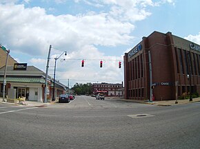 Downtown Crawfordsville, in Union Township | |
 Location in Montgomery County | |
| Coordinates: 40°02′15″N 86°53′51″W / 40.03750°N 86.89750°WCoordinates: 40°02′15″N 86°53′51″W / 40.03750°N 86.89750°W | |
| Country | |
| State | |
| County | Montgomery |
| Government | |
| • Type | Indiana township |
| Area | |
| • Total | 111.88 sq mi (289.8 km2) |
| • Land | 111.58 sq mi (289.0 km2) |
| • Water | 0.3 sq mi (0.8 km2) 0.27% |
| Elevation | 781 ft (238 m) |
| Population (2010) | |
| • Total | 24,587 |
| • Density | 220.4/sq mi (85.1/km2) |
| Time zone | UTC-5 (Eastern (EST)) |
| • Summer (DST) | UTC-4 (EDT) |
| ZIP codes | 47933, 47965, 47968 |
| Area code(s) | 765 |
| GNIS feature ID | 453926 |

Union Township is one of eleven townships in Montgomery County, Indiana, United States. As of the 2010 census, its population was 24,587 and it contained 10,723 housing units.[2] Wabash College is located in Crawfordsville in this township.
Geography[]
According to the 2010 census, the township has a total area of 111.88 square miles (289.8 km2), of which 111.58 square miles (289.0 km2) (or 99.73%) is land and 0.3 square miles (0.78 km2) (or 0.27%) is water.[2]
Cities, towns, villages[]
- Crawfordsville
- New Market (north half)
Unincorporated towns[]
- Ames at 40°02′00″N 86°53′13″W / 40.033376°N 86.886952°W
- Fiskville at 40°02′55″N 86°53′41″W / 40.048654°N 86.89473°W
- Garfield at 40°04′59″N 86°49′26″W / 40.083097°N 86.823896°W
- Lake Holiday
- Manchester at 40°05′52″N 86°54′15″W / 40.097819°N 86.904174°W
- North Union at 39°57′56″N 86°54′12″W / 39.9656°N 86.903341°W
- Smartsburg at 40°02′49″N 86°49′43″W / 40.046987°N 86.828618°W
- Whitesville at 39°57′55″N 86°50′01″W / 39.965322°N 86.833618°W
(This list is based on USGS data and may include former settlements.)
Cemeteries[]
The township contains these nineteen cemeteries: Ben Hur, Breaks, Calvary, Coons, Finley Chapel, Galey, Harshbarger, Hutton, Independent Order of Odd Fellows, Lutheran, Michael, Nutt, Oak Hill, Oldtown, Sidener, Stover, Weir, Wilhite and Wilson.
Major highways[]
Airports and landing strips[]
- Crawfordsville Municipal Airport
School districts[]
- Crawfordsville Community Schools
- North Montgomery Community School Corporation
- South Montgomery Community School Corporation
Political districts[]
- Indiana's 4th congressional district
- State House District 41
- State Senate District 23
References[]
- "Union Township, Montgomery County, Indiana". Geographic Names Information System. United States Geological Survey. Retrieved 2009-09-27.
- United States Census Bureau 2008 TIGER/Line Shapefiles
- IndianaMap
- ^ "US Board on Geographic Names". United States Geological Survey. October 25, 2007. Retrieved 2017-05-09.
- ^ a b "Population, Housing Units, Area, and Density: 2010 - County -- County Subdivision and Place -- 2010 Census Summary File 1". United States Census. Archived from the original on 2020-02-12. Retrieved 2013-05-10.
External links[]
- Indiana Township Association
- United Township Association of Indiana
- City-Data.com page for Union Township
Places adjacent to Union Township, Montgomery County, Indiana | |
|---|---|
Municipalities and communities of Montgomery County, Indiana, United States | ||
|---|---|---|
| City | ||
| Towns | ||
| Townships | ||
| CDP | ||
| Other unincorporated communities | ||
| Footnotes | ‡This populated place also has portions in an adjacent county or counties | |
| ||
- Townships in Montgomery County, Indiana
- Townships in Indiana