Upsala, Minnesota
Upsala | |
|---|---|
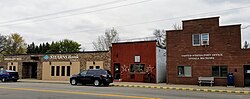 Upsala city hall and post office | |
| Motto(s): Where life is always looking up! | |
 Location of Upsala, Minnesota | |
| Coordinates: 45°48′29″N 94°34′9″W / 45.80806°N 94.56917°W | |
| Country | United States |
| State | Minnesota |
| County | Morrison |
| Area | |
| • Total | 3.24 sq mi (8.39 km2) |
| • Land | 3.24 sq mi (8.39 km2) |
| • Water | 0.00 sq mi (0.00 km2) |
| Elevation | 1,198 ft (365 m) |
| Population | |
| • Total | 427 |
| • Estimate (2019)[5] | 424 |
| • Density | 130.90/sq mi (50.55/km2) |
| Time zone | UTC-6 (Central (CST)) |
| • Summer (DST) | UTC-5 (CDT) |
| ZIP code | 56384 |
| Area code(s) | 320 |
| FIPS code | 27-66334[3] |
| GNIS feature ID | 0653575[4] |
| Website | www.cityofupsala.com |

Upsala is a city in Morrison County, Minnesota, United States. The population was 427 at the 2010 census.[6]

History[]
A post office called Upsala was established in 1883.[7] The city is named after Uppsala, Sweden by Swedish settlers.[8]

Geography[]
According to the United States Census Bureau, the city has a total area of 3.24 square miles (8.39 km2), all land.[9]
Minnesota State Highway 238 serves as one of the main routes in the community.
Demographics[]
| Historical population | |||
|---|---|---|---|
| Census | Pop. | %± | |
| 1920 | 316 | — | |
| 1930 | 345 | 9.2% | |
| 1940 | 347 | 0.6% | |
| 1950 | 366 | 5.5% | |
| 1960 | 356 | −2.7% | |
| 1970 | 312 | −12.4% | |
| 1980 | 400 | 28.2% | |
| 1990 | 371 | −7.2% | |
| 2000 | 424 | 14.3% | |
| 2010 | 427 | 0.7% | |
| 2019 (est.) | 424 | [5] | −0.7% |
| U.S. Decennial Census[10] | |||
2010 census[]
As of the census[2] of 2010, there were 427 people, 188 households, and 115 families living in the city. The population density was 131.8 inhabitants per square mile (50.9/km2). There were 211 housing units at an average density of 65.1 per square mile (25.1/km2). The racial makeup of the city was 95.6% White, 0.9% African American, 0.7% Native American, 0.5% Asian, 0.2% Pacific Islander, 1.4% from other races, and 0.7% from two or more races. Hispanic or Latino of any race were 4.0% of the population.
There were 188 households, of which 31.4% had children under the age of 18 living with them, 46.8% were married couples living together, 10.1% had a female householder with no husband present, 4.3% had a male householder with no wife present, and 38.8% were non-families. 33.5% of all households were made up of individuals, and 18.1% had someone living alone who was 65 years of age or older. The average household size was 2.27 and the average family size was 2.86.
The median age in the city was 40.6 years. 24.1% of residents were under the age of 18; 5.9% were between the ages of 18 and 24; 26.7% were from 25 to 44; 22.1% were from 45 to 64; and 21.3% were 65 years of age or older. The gender makeup of the city was 47.1% male and 52.9% female.
2000 census[]
As of the census[3] of 2000, there were 424 people, 188 households, and 103 families living in the city. The population density was 130.6 people per square mile (50.4/km2). There were 196 housing units at an average density of 60.4 per square mile (23.3/km2). The racial makeup of the city was 99.06% White, 0.47% Asian, and 0.47% from two or more races. Hispanic or Latino of any race were 0.94% of the population.
There were 188 households, out of which 25.0% had children under the age of 18 living with them, 47.3% were married couples living together, 5.9% had a female householder with no husband present, and 44.7% were non-families. 40.4% of all households were made up of individuals, and 25.5% had someone living alone who was 65 years of age or older. The average household size was 2.26 and the average family size was 3.14.
In the city, the population was spread out, with 25.9% under the age of 18, 6.8% from 18 to 24, 25.0% from 25 to 44, 16.5% from 45 to 64, and 25.7% who were 65 years of age or older. The median age was 40 years. For every 100 females, there were 93.6 males. For every 100 females age 18 and over, there were 91.5 males.
The median income for a household in the city was $30,000, and the median income for a family was $48,333. Males had a median income of $31,731 versus $19,821 for females. The per capita income for the city was $16,382. About 9.4% of families and 13.7% of the population were below the poverty line, including 15.3% of those under age 18 and 20.9% of those age 65 or over.
Politics[]
The Upsala City Council consists of five members. Councilors are elected to a four-year term while the mayor is elected to a two-year term. Council members and the mayor must reside within the city. The Mayor is currently Rollie Johnson. City Council consists of Robert Maciej, Joan Olson, Dennis Olson, and Brian Lange. Upsala's fire chief is Jay Baggenstoss.
Education[]
Upsala Area Schools[]
http://www.upsala.k12.mn.us/ This central Minnesota school is host to about 400 students K-12. The school brought country schools together in 1922. The original 1922 building was torn down in 2004 and the new school building was built to serve the Upsala Community. There is an elementary section, and a middle and high school section all in the one school. The school is the home of the Cardinals. In Football, Baseball, and Track & Field Upsala combines with Swanville Area Schools and are nicknamed the Upsala Swanville Area (USA) Patriots. The Upsala Cardinal Boy's Basketball team competed at the state level in 2011 and 2013. The Upsala Girl's Basketball team also made it to the state tournament in 2013. The USA Patriot Football Team competed at the state level in 2012 and 2013. Other clubs the High School offers include FFA, Team 4480 UC-Robotics, Drama Club, and Knowledge Bowl.
Events[]
Upsala Heritage Days[]
UHD is held annually in the second week of August. There are many events included in the weekend long celebration including a Medallion Hunt, collector car show, a 5K, concerts in the park, and a parade.
References[]
- ^ "2019 U.S. Gazetteer Files". United States Census Bureau. Retrieved July 26, 2020.
- ^ Jump up to: a b "U.S. Census website". United States Census Bureau. Retrieved 2012-11-13.
- ^ Jump up to: a b "U.S. Census website". United States Census Bureau. Retrieved 2008-01-31.
- ^ "US Board on Geographic Names". United States Geological Survey. 2007-10-25. Retrieved 2008-01-31.
- ^ Jump up to: a b "Population and Housing Unit Estimates". United States Census Bureau. May 24, 2020. Retrieved May 27, 2020.
- ^ "2010 Census Redistricting Data (Public Law 94-171) Summary File". American FactFinder. U.S. Census Bureau, 2010 Census. Retrieved 23 April 2011.[dead link]
- ^ "Morrison County". Jim Forte Postal History. Retrieved 21 July 2015.
- ^ Upham, Warren (1920). Minnesota Geographic Names: Their Origin and Historic Significance. Minnesota Historical Society. p. 356.
- ^ "US Gazetteer files 2010". United States Census Bureau. Archived from the original on 2012-01-25. Retrieved 2012-11-13.
- ^ "Census of Population and Housing". Census.gov. Retrieved June 4, 2015.
| show Municipalities and communities of Morrison County, Minnesota, United States |
|---|

Coordinates: 45°48′39″N 94°34′17″W / 45.81083°N 94.57139°W
| show Authority control |
|---|
- Cities in Morrison County, Minnesota
- Cities in Minnesota