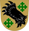
Vörå
Vörå
Vörå – Vöyri | |
|---|---|
Municipality | |
| Vörå kommun Vöyrin kunta | |
 | |
 Coat of arms | |
 Location of Vörå in Finland | |
| Coordinates: 63°08′N 022°15′E / 63.133°N 22.250°ECoordinates: 63°08′N 022°15′E / 63.133°N 22.250°E | |
| Country | |
| Region | Ostrobothnia |
| Sub-region | Vaasa sub-region |
| Charter | 1868 (Vörå) |
| Re-established | 2007 (Vörå-Maxmo) |
| Re-established | 2011 (Vörå) |
| Government | |
| • Municipal manager | Mikko Ollikainen |
| Area (2018-01-01)[1] | |
| • Total | 1,499.91 km2 (579.12 sq mi) |
| • Land | 781.31 km2 (301.67 sq mi) |
| • Water | 718.6 km2 (277.5 sq mi) |
| Area rank | 107th largest in Finland |
| • Density | 0/km2 (0/sq mi) |
| Population by native language | |
| • Swedish | 84.6% (official) |
| • Finnish | 13.6% |
| • Others | 1.8% |
| Time zone | UTC+02:00 (EET) |
| • Summer (DST) | UTC+03:00 (EEST) |
| Municipal tax rate[5] | 21.5% |
| Website | www.vora.fi |
Vörå (Finland Swedish: [ˈvœːro]; Finnish: Vöyri) is a municipality of Finland. In 2011, it was created from the municipalities of Vörå-Maxmo and Oravais.[6] Vörå-Maxmo was created in 2007 from the municipalities of (old) Vörå and Maxmo. It is located in the province of Western Finland and is part of the Ostrobothnia region.
The municipality is bilingual, with the majority (85%) speaking Swedish and the minority (14%) Finnish.[7]
As of 2014, primary industries in Vörå employ "15.5 per cent of the population, 32.9 per cent of people work in the industrial sector, and 50.3 per cent of people work in the service sector."[7]
The Battle of Oravais during the Finnish War (1808-1809) took place in Vörå.[7]
Old Vörå[]

The former municipality had a population of 3,524 (2003) and covered an area of 427.50 km2 of which 2.38 km2 is water. The population density was 8.3 inhabitants per km2. The majority were speakers of Swedish (85%) and the minority speakers of Finnish (14%).[7]
References[]
- ^ "Area of Finnish Municipalities 1.1.2018" (PDF). National Land Survey of Finland. Retrieved 30 January 2018.
- ^ Jump up to: a b c d "Preliminary population structure by area, 2021M01*-2021M03*". StatFin (in Finnish). Statistics Finland. Retrieved 2 May 2021.
- ^ "Population according to language and the number of foreigners and land area km2 by area as of 31 December 2008". Statistics Finland's PX-Web databases. Statistics Finland. Retrieved 29 March 2009.
- ^ Jump up to: a b c d e "Population according to age (1-year) and sex by area and the regional division of each statistical reference year, 2003-2020". StatFin. Statistics Finland. Retrieved 2 May 2021.
- ^ "List of municipal and parish tax rates in 2021" (PDF). Tax Administration of Finland. 1 December 2020. Retrieved 10 April 2021.
- ^ "1.1.2011 yhdistyvien kuntien uudet nimet". Kunnat.net (in Finnish). Helsinki: Suomen Kuntaliitto. 2 July 2010. Archived from the original on 15 April 2007. Retrieved 1 January 2011.
- ^ Jump up to: a b c d "Discovering Swedish-speaking municipalities: Vörå". www.helsinkitimes.fi. Retrieved 12 July 2021.
External links[]
![]() Media related to Vörå at Wikimedia Commons
Media related to Vörå at Wikimedia Commons
- Municipality of Vörå – Official website (in Swedish and Finnish)
- Vörå
- Populated places established in 2011
- Western Finland Province geography stubs

