Veenendaal
Veenendaal | |
|---|---|
Municipality | |
 Church in Veenendaal | |
 Flag Coat of arms | |
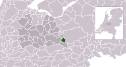 Location in Utrecht | |
| Coordinates: 52°1′N 5°33′E / 52.017°N 5.550°ECoordinates: 52°1′N 5°33′E / 52.017°N 5.550°E | |
| Country | Netherlands |
| Province | Utrecht |
| Government | |
| • Body | Municipal council |
| • Mayor | |
| Area | |
| • Total | 19.72 km2 (7.61 sq mi) |
| • Land | 19.46 km2 (7.51 sq mi) |
| • Water | 0.26 km2 (0.10 sq mi) |
| Elevation | 6 m (20 ft) |
| Population (January 2019)[4] | |
| • Total | 65,589 |
| • Density | 3,370/km2 (8,700/sq mi) |
| Demonym(s) | Veenendaler |
| Time zone | UTC+1 (CET) |
| • Summer (DST) | UTC+2 (CEST) |
| Postcode | 3900–3907 |
| Area code | 0318 |
| Website | www |


Veenendaal (Dutch pronunciation: [ˈveːnə(n)ˌdaːl] (![]() listen)) is a municipality and a town in central Netherlands, located in the province of Utrecht. Veenendaal is the only population centre within its administrative borders. The municipality had a population of 65,589 in 2019 and covers an area of 19.72 km2 (7.61 sq mi).
listen)) is a municipality and a town in central Netherlands, located in the province of Utrecht. Veenendaal is the only population centre within its administrative borders. The municipality had a population of 65,589 in 2019 and covers an area of 19.72 km2 (7.61 sq mi).
History[]
The original village was founded in the 16th century as a peat colony from which it got its name. Veen is the Dutch word for peat and daal for valley, so literally the name means "peat valley". In 1855 Veenendaal was hit by a flood. After that wool and tobacco industry became Veenendaal's largest source of income, roughly until World War II. Until just after World War II, Veenendaal remained a small community with only a few thousand residents. In the last fifty years, the town grew rapidly to the city with 64,000+ inhabitants of today.
Until the second half of the 20th century, Veenendaal was divided into two parts, a 'Gelders' and an 'Utrechts' part ('Gelders' comes from Gelderland and 'Utrechts' from Utrecht, both Dutch provinces). This is because in the first few centuries of the town's existence it was too small to be its own municipality. The southern half eventually became independent from Rhenen and Renswoude in 1795. The northern half separated from Ede in 1960.
In 1997 it was elected the greenest city in Europe and in 2004 of the Netherlands.
Like most Dutch cities, Veenendaal is well adapted to the high number of cyclists. A large network of bike paths make it convenient to cycle to various destinations and within the town, the bike is the most popular mean of transportation. In 2000 and 2020, Veenendaal was chosen as Fietsstad of the year, recognised as being the top city for cycling in the Netherlands.[5]
Religion[]
The city is known for being one of the bigger cities within the Dutch Bible Belt (together with Ede and Kampen), as it is inhabited by a considerable number (though not a majority) of conservative Protestants.
Notable residents[]

- Antonie Aris van de Loosdrecht (1885-1917) a Dutch missionary to the Dutch East Indies
- Kees Stip (1913-2001) a Dutch epigram poet [6]
- Bram van Ojik (born 1954) a Dutch politician, diplomat and activist
- Roelof Bisschop (born 1956) a Dutch historian and politician, Veenendaal municipal councillor 1986 to 2007
- Stef Bos (born 1961) a Dutch singer who lives in Cape Town, South Africa
- Frits Wester (born 1962) a Dutch journalist, political analyst on Dutch TV
- Jan Engelaar (born 1968) stage name DJ Jean, a Dutch disc jockey
- Carla Dik-Faber (born 1971) a Dutch art historian and politician, Veenendaal municipal councillor 2003 to 2010
- Yuri Landman (born 1973) experimental musical instrument builder
- Bas Oskam (born 1980) stage name Noisecontrollers, a Dutch DJ and hardstyle music producer
- Joram Metekohy (born 1983) stage name Wildstylez, a Dutch hardstyle DJ and record producer
- Willem Rebergen (born 1985) stage name Headhunterz, a Dutch DJ and record producer
- Nicky Romero (born 1989) a Dutch musician, DJ, record producer and remixer
Sport[]
- Linda Faber (born 1960) a former freestyle swimmer, competed at the 1976 Summer Olympics
- Marco van den Berg (born 1965) a Dutch retired basketball player and current coach
- Harry van der Meer (born 1973) a former water polo forward who participated in three Summer Olympics
- Barry Ditewig (born 1977) a Dutch football goalkeeper with over 400 club caps
Gallery[]
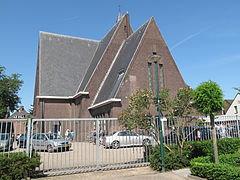
Veenendaal, reformed church

Veenendaal, tower in the street

Veenendaal, windmill: stellingmolen de Vriendschap

Veenendaal, 'towngate': de Bernard van Kreelpoort


References[]
- ^ "Burgemeester Gert-Jan Kats" (in Dutch). Gemeente Veenendaal.
- ^ "Kerncijfers wijken en buurten 2020" [Key figures for neighbourhoods 2020]. StatLine (in Dutch). CBS. 24 July 2020. Retrieved 19 September 2020.
- ^ "Postcodetool for 3901GA". Actueel Hoogtebestand Nederland (in Dutch). Het Waterschapshuis. Retrieved 10 April 2014.
- ^ "Bevolkingsontwikkeling; regio per maand" [Population growth; regions per month]. CBS Statline (in Dutch). CBS. 1 January 2019. Retrieved 1 January 2019.
- ^ "Veenendaal is de beste Fietsstad van Nederland". De Gelderlander (in Dutch). Retrieved 2020-05-29.
- ^ "Kees Stip". dbnl.org (in Dutch). DBNL (Digital Library for Dutch Literature). Retrieved 5 September 2015.
External links[]
| Wikimedia Commons has media related to Veenendaal. |
| show Places adjacent to Veenendaal |
|---|

| show Authority control |
|---|
- Veenendaal
- Municipalities of Utrecht (province)
- Populated places in Utrecht (province)