Victory Gardens, New Jersey
Victory Gardens, New Jersey | |
|---|---|
| Borough of Victory Gardens | |
 Location in Morris County and the state of New Jersey. | |
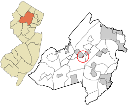
 Census Bureau map of Victory Gardens, New Jersey | |
| Coordinates: 40°52′34″N 74°32′37″W / 40.87613°N 74.54353°WCoordinates: 40°52′34″N 74°32′37″W / 40.87613°N 74.54353°W[1][2] | |
| Country | |
| State | |
| County | |
| Incorporated | September 18, 1951 |
| Government | |
| • Type | Borough |
| • Body | Borough Council |
| • Mayor | David Holeman Jr. (D, term ends December 31, 2020)[3][4] |
| • Administrator / Municipal clerk | Deborah Evans[5][6] |
| Area | |
| • Total | 0.15 sq mi (0.38 km2) |
| • Land | 0.15 sq mi (0.38 km2) |
| • Water | 0.00 sq mi (0.00 km2) 0.00% |
| Area rank | 562nd of 565 in state 39th of 39 in county[1] |
| Elevation | 646 ft (197 m) |
| Population | |
| • Total | 1,520 |
| • Estimate (2019)[12] | 1,470 |
| • Rank | 513th of 566 in state 39th of 39 in county[13] |
| • Density | 10,419.2/sq mi (4,022.9/km2) |
| • Density rank | 35th of 566 in state 1st of 39 in county[13] |
| Time zone | UTC−05:00 (Eastern (EST)) |
| • Summer (DST) | UTC−04:00 (Eastern (EDT)) |
| ZIP Code | |
| Area code(s) | 862/973 and 908[15] |
| FIPS code | 3402775890[1][16][17] |
| GNIS feature ID | 0885427[1][18] |
| Website | www |

Victory Gardens is a borough in Morris County, New Jersey, United States. As of the 2010 United States Census, the borough's population was 1,520,[9][10][11] reflecting a decline of 26 (-1.7%) from the 1,546 counted in the 2000 Census, which had in turn increased by 232 (+17.7%) from the 1,314 counted in the 1990 Census.[19] The borough is the fourth-smallest municipality by area in the state.[20]
Victory Gardens is Morris County's smallest municipality, measured both by size and population, and its most densely populated.[21]
History[]
The origins of the borough began in 1941, when the federal government acquired 91 acres (370,000 m2) in Randolph Township as the site of a 300-unit housing project for war industry employees. The borough's name is derived from the victory gardens planted at homes and parks during World War II to provide additional supplies of fruits and vegetables.[22][23] The federal government paid for all infrastructure. Streets are named for U.S. Presidents.[24]
Randolph Township residents approved a referendum as part of a September 1951 special election in which voters were asked if the township's Victory Gardens neighborhood should be removed from the township and created as an independent municipality for its 1,300 residents covering 92 acres (37 ha).[25] Residents of other areas of Randolph Township argued that the compensation paid by the federal government for the more than 250 students attending the Randolph Township Schools did not adequately cover the cost of their public education, that the housing and other structures in Victory Gardens was out of compliance with the Township's building and zoning ordinances and that the overwhelming Democratic Party political leanings of residents of Victory Gardens were out of sync with the largely Republican Party township.[26]
Victory Gardens was incorporated as a borough by an act of the New Jersey Legislature on June 20, 1951, from portions of Randolph Township, based on the results of the referendum passed on September 18, 1951.[27][28]
A project approved in 1973 brought the construction of 184 units of garden apartments on a site covering 12.4 acres (5.0 ha), providing additional rateables and offering permanent housing for an estimated 400 people, that would contrast with the temporary original structures built in the 1940s that had long passed their expected lifespan.[29]
Geography[]
According to the United States Census Bureau, the borough had a total area of 0.15 square miles (0.38 km2), all of which was land.[1][2]
The borough borders the Morris County municipalities of Dover and Randolph.[30][31][32]
Demographics[]
| Historical population | |||
|---|---|---|---|
| Census | Pop. | %± | |
| 1960 | 1,085 | — | |
| 1970 | 1,027 | −5.3% | |
| 1980 | 1,043 | 1.6% | |
| 1990 | 1,314 | 26.0% | |
| 2000 | 1,546 | 17.7% | |
| 2010 | 1,649 | 6.7% | |
| 2019 (est.) | 1,470 | [12][33] | −10.9% |
| Population sources:1960-1990[34] 2000[35][36] 2010[9][10][11] | |||
Census 2010[]
The 2010 United States census counted 1,520 people, 533 households, and 398 families in the borough. The population density was 10,419.2 per square mile (4,022.9/km2). There were 566 housing units at an average density of 3,879.8 per square mile (1,498.0/km2). The racial makeup was 58.49% (889) White, 16.25% (247) Black or African American, 0.66% (10) Native American, 2.43% (37) Asian, 0.00% (0) Pacific Islander, 17.43% (265) from other races, and 4.74% (72) from two or more races. Hispanic or Latino of any race were 62.96% (957) of the population.[9]
Of the 533 households, 41.7% had children under the age of 18; 43.0% were married couples living together; 21.8% had a female householder with no husband present and 25.3% were non-families. Of all households, 20.3% were made up of individuals and 3.2% had someone living alone who was 65 years of age or older. The average household size was 2.85 and the average family size was 3.16.[9]
26.4% of the population were under the age of 18, 9.1% from 18 to 24, 34.2% from 25 to 44, 24.0% from 45 to 64, and 6.3% who were 65 years of age or older. The median age was 33.3 years. For every 100 females, the population had 92.4 males. For every 100 females ages 18 and older there were 90.8 males.[9]
The Census Bureau's 2006-2010 American Community Survey showed that (in 2010 inflation-adjusted dollars) median household income was $53,269 (with a margin of error of +/- $3,599) and the median family income was $52,500 (+/- $6,885). Males had a median income of $34,063 (+/- $5,135) versus $33,750 (+/- $9,755) for females. The per capita income for the borough was $18,340 (+/- $1,640). About 11.9% of families and 16.3% of the population were below the poverty line, including 26.6% of those under age 18 and none of those age 65 or over.[37]
Census 2000[]
As of the 2000 United States Census[16] there were 1,546 people, 564 households, and 381 families residing in the borough. The population density was 10,582.6 people per square mile (3,979.4/km2). There were 588 housing units at an average density of 4,025.0 per square mile (1,513.5/km2). The racial makeup of the borough was 51.36% White, 21.41% African American, 0.06% Native American, 5.43% Asian, 15.27% from other races, and 6.47% from two or more races. Hispanic or Latino of any race were 50.65% of the population.[35][36]
15.27% of Victory Gardens residents identified themselves as being of Colombian ancestry in the 2000 Census, the highest percentage of the population of any municipality in the United States.[38]
There were 564 households, out of which 39.7% had children under the age of 18 living with them, 43.3% were married couples living together, 17.9% had a female householder with no husband present, and 32.3% were non-families. 25.2% of all households were made up of individuals, and 2.7% had someone living alone who was 65 years of age or older. The average household size was 2.74 and the average family size was 3.21.[35][36]
In the borough the population was spread out, with 26.5% under the age of 18, 9.6% from 18 to 24, 39.3% from 25 to 44, 19.2% from 45 to 64, and 5.4% who were 65 years of age or older. The median age was 32 years. For every 100 females, there were 92.5 males. For every 100 females age 18 and over, there were 87.3 males.[35][36]
The median income for a household in the borough was $44,375, and the median income for a family was $43,594. Males had a median income of $32,841 versus $24,875 for females. The per capita income for the borough was $20,616. About 8.9% of families and 8.4% of the population were below the poverty line, including 10.4% of those under age 18 and 10.5% of those age 65 or over.[35][36]
Government[]
Local government[]
Victory Gardens is governed under the Borough form of New Jersey municipal government, which is used in 218 municipalities (of the 565) statewide, making it the most common form of government in New Jersey.[39] The governing body is comprised of the Mayor and the Borough Council, with all positions elected at-large on a partisan basis as part of the November general election. The Mayor is elected directly by the voters to a four-year term of office. The Borough Council is comprised of six members elected to serve three-year terms on a staggered basis, with two seats coming up for election each year in a three-year cycle.[7] The Borough form of government used by Victory Gardens is a "weak mayor / strong council" government in which council members act as the legislative body with the mayor presiding at meetings and voting only in the event of a tie. The mayor can veto ordinances subject to an override by a two-thirds majority vote of the council. The mayor makes committee and liaison assignments for council members, and most appointments are made by the mayor with the advice and consent of the council.[40][41][3]
As of 2020, the Mayor of Victory Gardens is Democrat David L. Holeman Jr., whose term of office ends December 31, 2020. Members of the Borough Council are Vera C. Cheatham (D, 2022), Ondria Garcia-Montes (D, 2021), James R. Glass (D, 2022), Kendyll Hedgepath (D, 2021; elected to serve an unexpired term), Ismael Lorenzo Sr. (D, 2020), Tara White (D, 2020).[3][42]<[43][44][45][46][47][48]
Joan Cegelka won election in November 2013 to serve the balance of the term expiring in 2014 that had been held by David Holeman before he took office as mayor, with Vera Cheatham winning re-election to a full three-year term and Independent Hector Lorenzo Jr. knocking off incumbent Sonia Hall for terms starting January 1, 2014.[49]
In December 2010, Councilmember Ondria Garcia-Montes was placed on probation for 12 months after an incident in which she falsely told police that a criminal suspect who was the subject of a search warrant was not in her apartment.[50]
Dover serves as the lead agency operating a joint municipal court that include Victory Gardens and the neighboring municipalities of Mine Hill Township, Mount Arlington and Wharton.[51] Established in 2009, the joint municipal court was forecast to offer annual savings in excess of $250,000 over the 10-year life of the agreement.[52]
In 2018, the borough had an average property tax bill of $4,417, the lowest in the county, compared to an average bill of $10,480 in Morris County and $8,767 statewide.[53][54]
Federal, state and county representation[]
Victory Gardens is located in the 11th Congressional District[55] and is part of New Jersey's 25th state legislative district.[10][56][57]
For the 117th United States Congress, New Jersey's Eleventh Congressional District is represented by Mikie Sherrill (D, Montclair).[58] New Jersey is represented in the United States Senate by Democrats Cory Booker (Newark, term ends 2027)[59] and Bob Menendez (Harrison, term ends 2025).[60][61]
For the 2020–2021 session (Senate, General Assembly), the 25th Legislative District of the New Jersey Legislature is represented in the State Senate by Tony Bucco (R, Boonton Township) and in the General Assembly by Brian Bergen (R, Denville) and Aura K. Dunn (R, Mendham Borough).[62][63]
Morris County is governed by a seven-member Board of County Commissioners, who are elected at-large in partisan elections, to three-year terms on a staggered basis, with either one or three seats up for election each year as part of the November general election. The Commissioner Board sets policies for the operation of six super-departments, more than 30 divisions plus authorities, commissions, boards and study committees.[64] Actual day-to-day operation of departments is supervised by County Administrator, John Bonanni.[65] As of 2021, Morris County's Commissioners are Commissioner Director Stephen H. Shaw (R, Mountain Lakes, 2021),[66] Commissioner Deputy Director Deborah Smith (R, Denville, 2021),[67] John Krickus (R, Washington Township, 2021),[68] Douglas Cabana (R, Boonton Township, 2022),[69] Kathryn A. DeFillippo (R, Roxbury, 2022),[70] Thomas J. Mastrangelo (R, Montville, 2022),[71] and Tayfun Selen (R, Chatham Township, 2023).[72] [73]
Tayfun Selen was elected by a county Republican convention to the vacant seat of Heather Darling, who was elected Morris County Surrogate in 2019.[74] He served the remainder of her term which ended in 2020 and was elected to a full three-year term in the November general election that year.[75]
Pursuant to Article VII Section II of the New Jersey State Constitution, each county in New Jersey is required to have three elected administrative officials known as "constitutional officers." These officers are the County Clerk and County Surrogate (both elected for five-year terms of office) and the County Sheriff (elected for a three-year term).[76] As of 2021, they are County Clerk Ann F. Grossi (R, Parsippany, 2023),[77] Sheriff James M. Gannon (R, Boonton Township, 2022)[78] and Surrogate Heather Darling (R, Roxbury, 2024).[79]
Politics[]
As of March 23, 2011, there were a total of 523 registered voters in Victory Gardens, of which 234 (44.7%) were registered as Democrats, 58 (11.1%) were registered as Republicans and 231 (44.2%) were registered as Unaffiliated. There were no voters registered to other parties.[80]
In the 2012 presidential election, Democrat Barack Obama received 81.8% of the vote (301 cast), ahead of Republican Mitt Romney with 17.7% (65 votes), and other candidates with 0.5% (2 votes), among the 372 ballots cast by the borough's 565 registered voters (4 ballots were spoiled), for a turnout of 65.8%.[81][82] In the 2008 presidential election, Democrat Barack Obama received 77.4% of the vote (302 cast), ahead of Republican John McCain with 21.0% (82 votes) and other candidates with 0.5% (2 votes), among the 390 ballots cast by the borough's 575 registered voters, for a turnout of 67.8%.[83] In the 2004 presidential election, Democrat John Kerry received 63.7% of the vote (209 ballots cast), outpolling Republican George W. Bush with 32.9% (108 votes) and other candidates with 0.4% (2 votes), among the 328 ballots cast by the borough's 515 registered voters, for a turnout percentage of 63.7.[84]
In the 2013 gubernatorial election, Republican Chris Christie and Democrat Barbara Buono each received 48.4% of the vote (90 cast), ahead of other candidates with 3.2% (6 votes), among the 224 ballots cast by the borough's 556 registered voters (38 ballots were spoiled), for a turnout of 40.3%.[85][86] In the 2009 gubernatorial election, Democrat Jon Corzine received 58.4% of the vote (118 ballots cast), ahead of Republican Chris Christie with 27.2% (55 votes), Independent Chris Daggett with 8.4% (17 votes) and other candidates with 0.5% (1 votes), among the 202 ballots cast by the borough's 544 registered voters, yielding a 37.1% turnout.[87]
Education[]
Victory Gardens is a non-operating school district, with all public school students in kindergarten through twelfth grade in Victory Gardens attending the schools of the Dover School District in Dover, which has been consolidated between the two municipalities since 2010.[88][89][90] As of the 2018–19 school year, the district, comprised of five schools, had an enrollment of 3,262 students and 211.9 classroom teachers (on an FTE basis), for a student–teacher ratio of 15.4:1.[91] Schools in the district (with 2018–19 enrollment from the National Center for Education Statistics[92]) are Academy Street Elementary School[93] with 547 students in grades K-6, East Dover Elementary School[94] with 468 students in grades K-6, North Dover Elementary School[95] with 673 students in grades PreK-6, Dover Middle School[96] with 511 students in grades 7-8 and Dover High School[97] with 983 students in grades 9-12.[98] Public school students in grades 7-12 from Mine Hill Township attend Dover Middle School and Dover High School as part of a sending/receiving relationship with the Mine Hill School District.[99] The high school was recognized with the National Blue Ribbon School Award in 2013.[100]
Transportation[]

Roads and highways[]
As of May 2010, the borough had a total of 2.89 miles (4.65 km) of roadways, of which 2.78 miles (4.47 km) were maintained by the municipality and 0.11 miles (0.18 km) by Morris County.[101]
County Route 665 (South Salem Street) runs through the northwest corner of the borough, connecting Randolph on both sides.[102]
Public transportation[]
NJ Transit offers local bus service on the 875 route.[103][104] NJ Transit had previously offered service in the borough on the MCM2 and MCM7 routes.[105][106]
References[]
- ^ Jump up to: a b c d e f 2019 Census Gazetteer Files: New Jersey Places, United States Census Bureau. Accessed July 1, 2020.
- ^ Jump up to: a b US Gazetteer files: 2010, 2000, and 1990, United States Census Bureau. Accessed September 4, 2014.
- ^ Jump up to: a b c Borough Government, Borough of Victory Gardens. Accessed March 12, 2020. "The Borough form remains the single most popular form of local government in New Jersey. This form dates back to the Borough Act of 1878 and was revised in 1897 and by the Borough Act of 1987. The Borough mayor is elected at-large to a four-year term. Six council members are elected at-large to staggered three-year terms. The Borough form is often referred to as a 'weak mayor-strong council' form." Note that as of date accessed, members are all listed with term-end dates that are years out of date.
- ^ 2020 New Jersey Mayors Directory, New Jersey Department of Community Affairs. Accessed February 1, 2020.
- ^ Office of the Clerk, Borough of Victory Gardens. Accessed March 12, 2020.
- ^ Telephone Directory, Borough of Victory Gardens. Accessed March 12, 2020.
- ^ Jump up to: a b 2012 New Jersey Legislative District Data Book, Rutgers University Edward J. Bloustein School of Planning and Public Policy, March 2013, p. 116.
- ^ U.S. Geological Survey Geographic Names Information System: Borough of Victory Gardens, Geographic Names Information System. Accessed March 14, 2013.
- ^ Jump up to: a b c d e f DP-1 - Profile of General Population and Housing Characteristics: 2010 for Victory Gardens borough, Morris County, New Jersey Archived February 12, 2020, at archive.today, United States Census Bureau. Accessed July 19, 2012.
- ^ Jump up to: a b c d Municipalities Sorted by 2011-2020 Legislative District, New Jersey Department of State. Accessed February 1, 2020.
- ^ Jump up to: a b c Profile of General Demographic Characteristics: 2010 for Victory Gardens borough[permanent dead link], New Jersey Department of Labor and Workforce Development. Accessed July 19, 2012.
- ^ Jump up to: a b Annual Estimates of the Resident Population for Minor Civil Divisions in New Jersey: April 1, 2010 to July 1, 2019, United States Census Bureau. Accessed May 21, 2020.
- ^ Jump up to: a b GCT-PH1 Population, Housing Units, Area, and Density: 2010 - State -- County Subdivision from the 2010 Census Summary File 1 for New Jersey Archived February 12, 2020, at archive.today, United States Census Bureau. Accessed December 23, 2012.
- ^ Look Up a ZIP Code for Victory Gardens, NJ, United States Postal Service. Accessed July 19, 2012.
- ^ Area Code Lookup - NPA NXX for Victory Gardens, NJ, Area-Codes.com. Accessed August 31, 2013.
- ^ Jump up to: a b U.S. Census website , United States Census Bureau. Accessed September 4, 2014.
- ^ Geographic codes for New Jersey, Missouri Census Data Center. Accessed September 1, 2019.
- ^ US Board on Geographic Names, United States Geological Survey. Accessed September 4, 2014.
- ^ Table 7. Population for the Counties and Municipalities in New Jersey: 1990, 2000 and 2010, New Jersey Department of Labor and Workforce Development, February 2011. Accessed July 19, 2012.
- ^ Astudillo, Carla. "The 10 tiniest towns in New Jersey (they're really small)", NJ Advance Media for NJ.com, November 1, 2016, updated May 16, 2019. Accessed March 5, 2020. "We used square mile data from the New Jersey Department of Environmental Protection to rank the ten municipalities with the smallest area size.... 4. Victory Gardens This tiny borough in the middle of Morris County has over 1,500 residents spread across only 0.14 square miles. It started out as a 300-unit World War II housing project built in the town of Randolph for workers at the nearby Picatinny Arsenal."
- ^ GCT-PH1: Population, Housing Units, Area, and Density: 2010 - County -- County Subdivision and Place from 2010 Census Summary File 1 for Morris County, New Jersey Archived February 12, 2020, at archive.today, United States Census Bureau. Accessed July 19, 2012.
- ^ History, Borough of Victory Gardens. Accessed October 18, 2015. "The borough was named for the victory gardens planted at private residences during World War II."
- ^ "Victory Gardens: a tiny town with an interesting past", Hidden New Jersey, March 28, 2013. Accessed October 18, 2015. "As you might have guessed from the name, Victory Gardens was born during World War II as housing for workers who were employed at nearby Picatinny Arsenal and other private defense contractors manufacturing war goods."
- ^ Victory Gardens profile, Morris County, New Jersey, backed up by the Internet Archive as of September 28, 2007. Accessed August 29, 2011.
- ^ Staff. "Community Separates; Federal Housing Project Is Split From Jersey Township", The New York Times, September 19, 1951. Accessed November 10, 2013. "Randolph Township voters decided tonight by a margin of twenty-four ballots to discontinue a Federal housing development as part of the township."
- ^ "Township To Vote On Excluding Area; Randolph, N.J., to Decide by Ballot Tomorrow Fate of Victory Gardens Section", The New York Times, September 17, 1951. Accessed November 10, 2013. "Citizens in near-by Randolph Township will ballot Tuesday to decide whether the Victory Gardens section should be excluded from the township and ordered to form a municipality of its own."
- ^ Snyder, John P. The Story of New Jersey's Civil Boundaries: 1606-1968, Bureau of Geology and Topography; Trenton, New Jersey; 1969. p. 197. Accessed July 19, 2012.
- ^ Historical Timeline of Morris County Boundaries, Morris County Library. Accessed December 24, 2016. "1951, September. Victory Gardens is established from Randolph. Victory Gardens had been a temporary community of defense industry workers during World War II whose municipal services were provided by Randolph Township. From PL 1951, c. 259."
- ^ Staff. "Victory Gardens Expanding", The New York Times, March 11, 1973. Accessed November 10, 2013. "Victory Gardens-This tiny community, which faces an uncertain future, is engaged in its biggest expansion ever, the development of Carmel Gardens, a 184-unit garden-apartment complex on 12.4 acres of land."
- ^ Areas touching Victory Gardens, MapIt. Accessed March 12, 2020.
- ^ Morris County Municipalities Map, Morris County, New Jersey Department of Planning and Preservation. Accessed March 12, 2020.
- ^ New Jersey Municipal Boundaries, New Jersey Department of Transportation. Accessed November 15, 2019.
- ^ Census Estimates for New Jersey April 1, 2010 to July 1, 2019, United States Census Bureau. Accessed May 21, 2020.
- ^ Table 6. New Jersey Resident Population by Municipality: 1930 - 1990, New Jersey Department of Labor and Workforce Development. Accessed June 28, 2015.
- ^ Jump up to: a b c d e Census 2000 Profiles of Demographic / Social / Economic / Housing Characteristics for Victory Gardens borough, New Jersey[permanent dead link], United States Census Bureau. Accessed July 19, 2012.
- ^ Jump up to: a b c d e DP-1: Profile of General Demographic Characteristics: 2000 - Census 2000 Summary File 1 (SF 1) 100-Percent Data for Victory Gardens borough, Morris County, New Jersey Archived February 12, 2020, at archive.today, United States Census Bureau. Accessed July 19, 2012.
- ^ DP03: Selected Economic Characteristics from the 2006-2010 American Community Survey 5-Year Estimates for Victory Gardens borough, Morris County, New Jersey Archived February 12, 2020, at archive.today, United States Census Bureau. Accessed June 21, 2012.
- ^ Colombian Communities, EPodunk. Accessed August 23, 2006.
- ^ Inventory of Municipal Forms of Government in New Jersey, Rutgers University Center for Government Studies, July 1, 2011. Accessed November 18, 2019.
- ^ Cerra, Michael F. "Forms of Government: Everything You've Always Wanted to Know, But Were Afraid to Ask" Archived 2014-09-24 at the Wayback Machine, New Jersey State League of Municipalities. Accessed November 30, 2014.
- ^ "Forms of Municipal Government in New Jersey", p. 6. Rutgers University Center for Government Studies. Accessed June 3, 2015.
- ^ 2019 Municipal Data Sheet, Borough of Victory Gardens. Accessed March 12, 2020.
- ^ Morris County Manual 2020, Morris County, New Jersey Clerk. Accessed June 3, 2020.
- ^ Morris County Municipal Elected Officials For The Year 2020, Morris County, New Jersey Clerk, updated March 17, 2020. Accessed June 3, 2020.
- ^ General Election November 5, 2019, Official Results, Morris County, New Jersey, updated November 15, 2019. Accessed January 31, 2020.
- ^ General Election Winners List For November 6, 2018, Morris County, New Jersey Clerk. Accessed January 1, 2019.
- ^ General Election November 7, 2017 Official Results, Morris County, New Jersey Clerk, updated November 17, 2017. Accessed January 1, 2018.
- ^ Official General Election Winners List For November 8, 2016, Morris County, New Jersey Clerk. Accessed January 1, 2017.
- ^ Staff. "Morris County election results 2013: Local, county, school races", The Star-Ledger, November 5, 2013. Accessed November 10, 2013.
- ^ Horowitz, Ben. "N.J. councilwoman is placed on probation, pre-trial program for allegedly hiding suspect", The Star-Ledger, December 15, 2010. Accessed August 29, 2011.
- ^ Mayor and Board of Aldermen, Town of Dover Minutes of the Reorganization Meeting for January 1, 2015, Town of Dover. Accessed July 29, 2015.
- ^ Forrest, Cindy. "Victory Gardens Council judges proposal for joint municipal court", The Record, May 18, 2012. Accessed July 29, 2015. "With Dover as the lead agency, four other area towns - Rockaway Borough, Wharton, Mine Hill, and Mt. Arlington - entered into a landmark municipal court shared-services agreement in 2009 anticipating an estimated $2.65 million savings over the 10-year life of the contract."
- ^ 2018 Property Tax Information, New Jersey Department of Community Affairs, updated January 16, 2019. Accessed November 7, 2019.
- ^ Marcus, Samantha. "These are the towns with the lowest property taxes in each of N.J.’s 21 counties", NJ Advance Media for NJ.com, April 30, 2019. Accessed November 7, 2019. "New Jersey’s average property tax bill may have hit $8,767 last year — a new record — but taxpayers in some parts of the state pay just a fraction of that.... The average property tax bill in Victory Gardens Borough was $4,417 in 2018, the lowest in Morris County."
- ^ Plan Components Report, New Jersey Redistricting Commission, December 23, 2011. Accessed February 1, 2020.
- ^ 2019 New Jersey Citizen's Guide to Government, New Jersey League of Women Voters. Accessed October 30, 2019.
- ^ Districts by Number for 2011-2020, New Jersey Legislature. Accessed January 6, 2013.
- ^ Directory of Representatives: New Jersey, United States House of Representatives. Accessed January 3, 2019.
- ^ [1], United States Senate. Accessed April 30, 2021. "He now owns a home and lives in Newark's Central Ward community."
- ^ Biography of Bob Menendez, United States Senate, January 26, 2015. "Menendez, who started his political career in Union City, moved in September from Paramus to one of Harrison's new apartment buildings near the town's PATH station.."
- ^ [2]. United States Senate. Accessed April 30, 2021. "Booker, Cory A. - (D - NJ) Class II; Menendez, Robert - (D - NJ) Class I"
- ^ Legislative Roster 2020-2021 Session, New Jersey Legislature. Accessed February 28, 2020.
- ^ District 25 Legislators, New Jersey Legislature. Accessed February 28, 2020.
- ^ [3], Morris County, New Jersey. Accessed January 15, 2021.
- ^ Morris County Manual 2019, Morris County Clerk. Accessed April 16, 2019.
- ^ Stephen H. Shaw, Morris County, New Jersey. Accessed January 15, 2021.
- ^ Deborah Smith, Morris County, New Jersey. Accessed January 15, 2021.
- ^ John Krickus, Morris County, New Jersey. Accessed January 15, 2021.
- ^ Douglas R. Cabana, Morris County, New Jersey. Accessed January 15, 2021).
- ^ Kathryn A. DeFillippo, Morris County, New Jersey. Accessed January 15, 2021.
- ^ Thomas J. Mastrangelo, Morris County, New Jersey. Accessed January 15, 2021.
- ^ Tayfun Selen, Morris County, New Jersey. Accessed January 15, 2021.
- ^ Commissioners, Morris County, New Jersey. Accessed January 15, 2021.
- ^ Filler, Marion. "Morris County's next freeholder is…Tayfun Selen". Morristown Green. Retrieved May 12, 2020.
- ^ "2020 General Election Summary Report" (PDF). Morris County Clerk. Office of the Morris County Clerk. Retrieved January 15, 2021.
- ^ New Jersey State Constitution (1947), Article VII, Section II, Paragraph 2, New Jersey Department of State. Accessed October 26, 2017.
- ^ Ann F. Grossi, Esq., Office of the Morris County Clerk. Accessed April 16, 2019.
- ^ About Us: Sheriff James M. Gannon, Morris County Sheriff's Office. Accessed April 16, 2019.
- ^ Morris County Surrogate Court, Morris County, New Jersey. Accessed May 12, 2020.
- ^ Voter Registration Summary - Morris, New Jersey Department of State Division of Elections, March 23, 2011. Accessed December 23, 2012.
- ^ "Presidential General Election Results - November 6, 2012 - Morris County" (PDF). New Jersey Department of Elections. March 15, 2013. Retrieved December 24, 2014.
- ^ "Number of Registered Voters and Ballots Cast - November 6, 2012 - General Election Results - Morris County" (PDF). New Jersey Department of Elections. March 15, 2013. Retrieved December 24, 2014.
- ^ 2008 Presidential General Election Results: Morris County, New Jersey Department of State Division of Elections, December 23, 2008. Accessed December 23, 2012.
- ^ 2004 Presidential Election: Morris County, New Jersey Department of State Division of Elections, December 13, 2004. Accessed December 23, 2012.
- ^ "Governor - Morris County" (PDF). New Jersey Department of Elections. January 29, 2014. Retrieved December 24, 2014.
- ^ "Number of Registered Voters and Ballots Cast - November 5, 2013 - General Election Results - Morris County" (PDF). New Jersey Department of Elections. January 29, 2014. Retrieved December 24, 2014.
- ^ 2009 Governor: Morris County Archived October 17, 2012, at the Wayback Machine, New Jersey Department of State Division of Elections, December 31, 2009. Accessed December 23, 2012.
- ^ Martin, Liz. "Voters have their say on the budgets", Neighbor News, April 28, 2010. Accessed July 11, 2016. "The school board goes from 11 members to 10 after this election as the temporary Board seat assigned to the Victory Gardens representative Danielle Press expired permanently on April 20. Now that Victory Gardens has merged with the Dover school district, there will no longer be a dedicated Victory Gardens seat on the Board. Any resident from either Dover or Victory Gardens will be eligible to run for any available Board seat."
- ^ 13 Non-Operating School Districts Eliminated, New Jersey Department of Education press release dated July 1, 2009. Accessed July 11, 2016.
- ^ Dover Public Schools District Policy 0110 - Identification, Dover School District. Accessed May 20, 2020. "Purpose The Board of Education exists for providing a thorough and efficient system of free public education in grades PK through 12 in the Dover School District. Composition The Dover School District is comprised of all the area within the municipal boundaries of Dover in County of Morris."
- ^ District information for Dover Public School District, National Center for Education Statistics. Accessed April 1, 2020.
- ^ School Data for the Dover School District, National Center for Education Statistics. Accessed April 1, 2020.
- ^ Academy Street Elementary School, Dover School District. Accessed May 20, 2020.
- ^ East Dover Elementary School, Dover School District. Accessed May 20, 2020.
- ^ North Dover Elementary School, Dover School District. Accessed May 20, 2020.
- ^ Dover Middle School, Dover School District. Accessed May 20, 2020.
- ^ Dover High School, Dover School District. Accessed May 20, 2020.
- ^ New Jersey School Directory for the Dover School District, New Jersey Department of Education. Accessed December 29, 2016.
- ^ Dover High School 2015 Report Card Narrative, New Jersey Department of Education. Accessed July 11, 2016. "Dover High School, located 40 miles from New York City, services approximately 900 high school students from the Town of Dover, the Borough of Victory Gardens, and the Township of Mine Hill."
- ^ 2013 National Blue Ribbon Schools; All Public and Private, United States Department of Education. Accessed March 2, 2015.
- ^ Morris County Mileage by Municipality and Jurisdiction, New Jersey Department of Transportation, May 2010. Accessed November 10, 2013.
- ^ Morris County Route 665 Straight Line Diagram, New Jersey Department of Transportation, October 2000. Accessed November 10, 2013.
- ^ Riding the Bus, Morris County Department of Transportation. Accessed October 29, 2014.
- ^ Morris County System Map, NJ Transit. Accessed August 5, 2015.
- ^ Morris County Bus / Rail Connections, NJ Transit, backed up by the Internet Archive as of May 22, 2009. Accessed December 23, 2012.
- ^ Private Carrier Bus Service reductions, NJ Transit. Accessed August 3, 2015.
External links[]
| Wikimedia Commons has media related to Victory Gardens, New Jersey. |
- Victory Gardens Borough website
- Dover School District
- Dover School District's 2015–16 School Report Card from the New Jersey Department of Education
- School Data for the Dover School District, National Center for Education Statistics
- Daily Record regional area newspaper
| show Municipalities and communities of Morris County, New Jersey, United States |
|---|

| show Authority control |
|---|
- Colombian-American culture
- Victory Gardens, New Jersey
- 1951 establishments in New Jersey
- Borough form of New Jersey government
- Boroughs in Morris County, New Jersey
- New Jersey District Factor Group none
- Populated places established in 1951