Vila Nova de Poiares
Vila Nova de Poiares | |
|---|---|
 Flag  Coat of arms | |
 | |
| Coordinates: 40°12′39″N 8°15′27″W / 40.21083°N 8.25750°WCoordinates: 40°12′39″N 8°15′27″W / 40.21083°N 8.25750°W | |
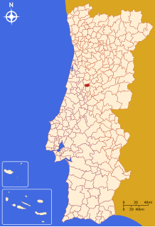
| Country | |
| Region | Centro |
| Intermunic. comm. | Região de Coimbra |
| District | Coimbra |
| Parishes | 4 |
| Area | |
| • Total | 84.45 km2 (32.61 sq mi) |
| Population (2011) | |
| • Total | 7,281 |
| • Density | 86/km2 (220/sq mi) |
| Time zone | UTC±00:00 (WET) |
| • Summer (DST) | UTC+01:00 (WEST) |
| Website | web |

Vila Nova de Poiares (Portuguese pronunciation: [ˈvilɐ ˈnɔvɐ ðɨ poˈjaɾɨʃ] (![]() listen)) is a municipality in the Coimbra district, in Portugal. The population in 2011 was 7,281,[1] in an area of 84.45 km².[2]
listen)) is a municipality in the Coimbra district, in Portugal. The population in 2011 was 7,281,[1] in an area of 84.45 km².[2]
Parishes[]
Administratively, the municipality is divided into 4 civil parishes (freguesias):[3]
- Arrifana
- Lavegadas
- Santo André de Poiares
- São Miguel de Poiares
International relations[]
Vila Nova de Poiares is twinned with:
References[]
- ^ Instituto Nacional de Estatística
- ^ Áreas das freguesias, concelhos, distritos e país
- ^ Diário da República. "Law nr. 11-A/2013, page 552 136" (pdf) (in Portuguese). Retrieved 5 August 2014.
- ^ "Mielec- Miasta Partnerskie" [Mielec - Partnership Cities]. Oficjalny serwis Urzędu Miejskiego w Mielcu [Mielec City Council]
 (in Polish). Archived from the original on 2013-08-21. Retrieved 2013-08-25.
External links[]
| Wikimedia Commons has media related to Vila Nova de Poiares. |
| Authority control |
|
|---|
This Coimbra location article is a stub. You can help Wikipedia by . |
Categories:
- Wikipedia articles with VIAF identifiers
- Wikipedia articles with WorldCat-VIAF identifiers
- Towns in Portugal
- Municipalities of Coimbra District
- Coimbra geography stubs