Villoruela
show This article may be expanded with text translated from the corresponding article in Spanish. (November 2014) Click [show] for important translation instructions. |
Villoruela | |
|---|---|
 | |
 Flag  Seal | |
 Location in Salamanca | |
| Coordinates: 41°0′29″N 5°23′40″W / 41.00806°N 5.39444°WCoordinates: 41°0′29″N 5°23′40″W / 41.00806°N 5.39444°W | |
| Country | Spain |
| Autonomous community | Castile and León |
| Province | Salamanca |
| Comarca | Las Villas |
| Government | |
| • Mayor | Florentino Hernández García (PSOE) |
| Area | |
| • Total | 17.27 km2 (6.67 sq mi) |
| Elevation | 824 m (2,703 ft) |
| Population (2018)[2] | |
| • Total | 780 |
| • Density | 45/km2 (120/sq mi) |
| Time zone | UTC+1 (CET) |
| • Summer (DST) | UTC+2 (CEST) |
| Postal code | 37338 |

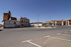
Villoruela is a municipality located in the province of Salamanca, Castile and León, Spain.
References[]
- ^ Jump up to: a b "Municipio:Villoruela". www.lasalina.es. Retrieved 2017-11-02.
- ^ Municipal Register of Spain 2018. National Statistics Institute.
| show Municipalities in the province of Salamanca |
|---|
| Authority control |
|
|---|
This article about a location in the province of Salamanca, Spain, is a stub. You can help Wikipedia by . |
Categories:
- Municipalities in the Province of Salamanca
- Province of Salamanca geography stubs