Vione
show This article may be expanded with text translated from the corresponding article in Italian. (October 2009) Click [show] for important translation instructions. |
Vione
Viù (Lombard) | |
|---|---|
| Comune di Vione | |
 Town hall | |
show Location of Vione | |
 Vione Location of Vione in Italy | |
| Coordinates: 46°14′57″N 10°26′53″E / 46.24917°N 10.44806°ECoordinates: 46°14′57″N 10°26′53″E / 46.24917°N 10.44806°E | |
| Country | Italy |
| Region | Lombardy |
| Province | Brescia (BS) |
| Frazioni | Canè, Stadolina |
| Area | |
| • Total | 36.6 km2 (14.1 sq mi) |
| Elevation | 1,250 m (4,100 ft) |
| Population (2011)[3] | |
| • Total | 723 |
| • Density | 20/km2 (51/sq mi) |
| Demonym(s) | vionesi |
| Time zone | UTC+1 (CET) |
| • Summer (DST) | UTC+2 (CEST) |
| Postal code | 25050 |
| Dialing code | 0364 |
| Patron saint | San Remigio |
| Saint day | 24 August |
| Website | Official website |


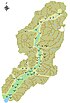
Location of Vione in Val Camonica

Parish church
Vione (Camunian: Viù) is a comune in the province of Brescia, in Lombardy. It is situated above the right bank of the river Oglio, in upper Val Camonica. Neighbouring communes are Edolo, Ponte di Legno, Temù and Vezza d'Oglio. Its coat of arms shows a castle with an eagle over it.[4]
References[]
- ^ "Superficie di Comuni Province e Regioni italiane al 9 ottobre 2011". Istat. Retrieved 16 March 2019.
- ^ "Popolazione Residente al 1° Gennaio 2018". Istat. Retrieved 16 March 2019.
- ^ ISTAT
- ^ araldicacivica.it
This article on a location in the Province of Brescia is a stub. You can help Wikipedia by . |
Categories:
- Cities and towns in Lombardy
- Municipalities of the Province of Brescia
- Province of Brescia geography stubs