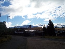
Walkerville, Montana
Walkerville, Montana | |
|---|---|
 Lexington Mine in Walkerville | |
 Location of Walkerville in Silver Bow County, Montana | |
 Walkerville Location of Walkerville in Silver Bow County, Montana | |
| Coordinates: 46°1′48″N 112°32′18″W / 46.03000°N 112.53833°WCoordinates: 46°1′48″N 112°32′18″W / 46.03000°N 112.53833°W | |
| Country | |
| State | |
| County | Silver Bow |
| Area | |
| • Total | 2.23 sq mi (5.77 km2) |
| • Land | 2.23 sq mi (5.77 km2) |
| • Water | 0.00 sq mi (0.00 km2) |
| Elevation | 6,309 ft (1,923 m) |
| Population | |
| • Total | 675 |
| • Estimate (2019)[2] | 708 |
| • Density | 317.92/sq mi (122.77/km2) |
| Time zone | UTC-7 (Mountain (MST)) |
| • Summer (DST) | UTC-6 (MDT) |
| ZIP code | 59701 |
| Area code(s) | 406 |
| FIPS code | 30-77650 |
| GNIS feature ID | 0792762 |


Walkerville is a town in Silver Bow County, Montana, United States. The population was 675 at the 2010 census. Walkerville is a suburb of Butte.
Part of Walkerville is included in the Butte-Anaconda Historic District. Walkerville represents some of the earliest mines in the district and preserves the early mining camp flavor present in the 1890s to 1910s.
Geography[]
Walkerville is located at 46°1′48″N 112°32′18″W / 46.03000°N 112.53833°W (46.029963, -112.538348).[4]
According to the United States Census Bureau, the town has a total area of 2.23 square miles (5.78 km2), all land.[5]
Neighborhoods[]
- Corktown[6]
- Sun View Terrace [6]
- Seldom Seen [6]
- Dewey's Point [6]
- Chicken Flat [6]
- Butchertown [6][7]
- the Corra [6]
Butchertown was named for Rollo Butcher, Walkerville's first permanent resident.[8]
Demographics[]
| Historical population | |||
|---|---|---|---|
| Census | Pop. | %± | |
| 1880 | 444 | — | |
| 1890 | 1,743 | 292.6% | |
| 1900 | 2,621 | 50.4% | |
| 1910 | 2,491 | −5.0% | |
| 1920 | 2,391 | −4.0% | |
| 1930 | 2,052 | −14.2% | |
| 1940 | 1,880 | −8.4% | |
| 1950 | 1,631 | −13.2% | |
| 1960 | 1,453 | −10.9% | |
| 1970 | 1,097 | −24.5% | |
| 1980 | 887 | −19.1% | |
| 1990 | 605 | −31.8% | |
| 2000 | 714 | 18.0% | |
| 2010 | 675 | −5.5% | |
| 2019 (est.) | 708 | [2] | 4.9% |
| U.S. Decennial Census[9] | |||
2010 census[]
As of the census[3] of 2010, there were 675 people, 304 households, and 175 families residing in the town. The population density was 302.7 inhabitants per square mile (116.9/km2). There were 344 housing units at an average density of 154.3 per square mile (59.6/km2). The racial makeup of the town was 93.2% White, 0.1% African American, 3.3% Native American, 0.6% Asian, 0.3% Pacific Islander, 0.3% from other races, and 2.2% from two or more races. Hispanic or Latino of any race were 3.9% of the population.
There were 304 households, of which 27.6% had children under the age of 18 living with them, 41.4% were married couples living together, 10.2% had a female householder with no husband present, 5.9% had a male householder with no wife present, and 42.4% were non-families. 35.2% of all households were made up of individuals, and 13.2% had someone living alone who was 65 years of age or older. The average household size was 2.22 and the average family size was 2.90.
The median age in the town was 44.2 years. 22.4% of residents were under the age of 18; 8.6% were between the ages of 18 and 24; 20.3% were from 25 to 44; 33.8% were from 45 to 64; and 15% were 65 years of age or older. The gender makeup of the town was 48.6% male and 51.4% female.
2000 census[]
As of the census of 2000, there were 714 people, 297 households, and 195 families residing in the town. The population density was 325.1 people per square mile (125.3/km2). There were 343 housing units at an average density of 156.2 per square mile (60.2/km2). The racial makeup of the town was 94.26% White, 0.14% African American, 4.06% Native American, 0.28% Asian, 0.70% from other races, and 0.56% from two or more races. Hispanic or Latino of any race were 3.22% of the population.
There were 297 households, out of which 31.3% had children under the age of 18 living with them, 49.5% were married couples living together, 11.1% had a female householder with no husband present, and 34.3% were non-families. 30.6% of all households were made up of individuals, and 11.4% had someone living alone who was 65 years of age or older. The average household size was 2.40 and the average family size was 3.00.
In the town, the population was spread out, with 25.5% under the age of 18, 8.7% from 18 to 24, 27.3% from 25 to 44, 25.5% from 45 to 64, and 13.0% who were 65 years of age or older. The median age was 37 years. For every 100 females there were 97.8 males. For every 100 females age 18 and over, there were 102.3 males.
The median income for a household in the town was $28,009, and the median income for a family was $29,861. Males had a median income of $27,404 versus $19,063 for females. The per capita income for the town was $14,156. About 9.9% of families and 12.1% of the population were below the poverty line, including 18.8% of those under age 18 and 5.0% of those age 65 or over.
History[]
Walkerville is a suburb of Butte, Montana and is home to some of the earliest mining sites in the area. These sites attracted many investors to Walkerville in the late 1800s. Walkerville is named for four of those investors: brothers Joseph, Samuel, Matthew and David Walker of Salt Lake City;[8] they had purchased the lucrative Alice mine upon recommendation by their agent (and later Copper King) Marcus Daly.[10]:46
There were many different types of materials mined depending on the location of a given site. Copper and silver were two of the most commonly mined materials. In 1893, silver prices dropped, but the town's economy continued to thrive due to its copper production.[11] Walkerville's economic success continued until 1918 when the end of World War I caused copper prices to drop as well. In 2015, nearly all of the town's many mines are abandoned. Some of these sites have become very dangerous and plans are being made to restore or remove them.[12]
References[]
| Wikimedia Commons has media related to Walkerville, Montana. |
- ^ "2019 U.S. Gazetteer Files". United States Census Bureau. Retrieved July 26, 2020.
- ^ Jump up to: a b "Population and Housing Unit Estimates". United States Census Bureau. May 24, 2020. Retrieved May 27, 2020.
- ^ Jump up to: a b "U.S. Census website". United States Census Bureau. Retrieved 2012-12-18.
- ^ "US Gazetteer files: 2010, 2000, and 1990". United States Census Bureau. 2011-02-12. Retrieved 2011-04-23.
- ^ "US Gazetteer files 2010". United States Census Bureau. Retrieved 2012-12-18.
- ^ Jump up to: a b c d e f g "Butte in 75, No. 47: Walkerville City Hall". The Montana Standard. Lee Enterprises. Retrieved 25 April 2020.
- ^ Google (25 April 2020). "Butchertown, Walkerville" (Map). Google Maps. Google. Retrieved 25 April 2020.
- ^ Jump up to: a b The Montana National Register Sign Program. "Walkerville, Butte". Historic Montana. Montana Historical Society. Retrieved 25 April 2020.
- ^ United States Census Bureau. "Census of Population and Housing". Retrieved May 31, 2014.
- ^ Glasscock, C.B. (2002). The War of the Copper Kings. Riverbend Publishing. ISBN 1-931832-21-8.
- ^ http://southwestmt.com/communities/walkerville.htm
- ^ http://epa.gov/aml/tech/silverbow-case.pdf
External links[]
| show Municipalities and communities of Silver Bow County, Montana, United States |
|---|

| show Authority control |
|---|
- Towns in Silver Bow County, Montana